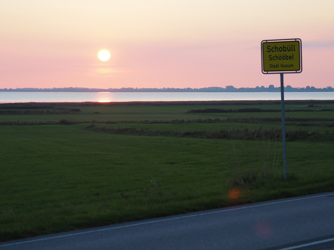
For our 2021 holiday, we're once more exploring a part of Germany we don't know well – this time it's North Frisia, the area on the North Sea coast in northern Schleswig-Holstein. This is notable for its various islands and Halligen as well as the protected tidal flats which are of great natural beauty and importance. We're based in a holiday flat in the village of Schobüll, which is a suburb of Husum.
Click on any picture for an enlarged view.
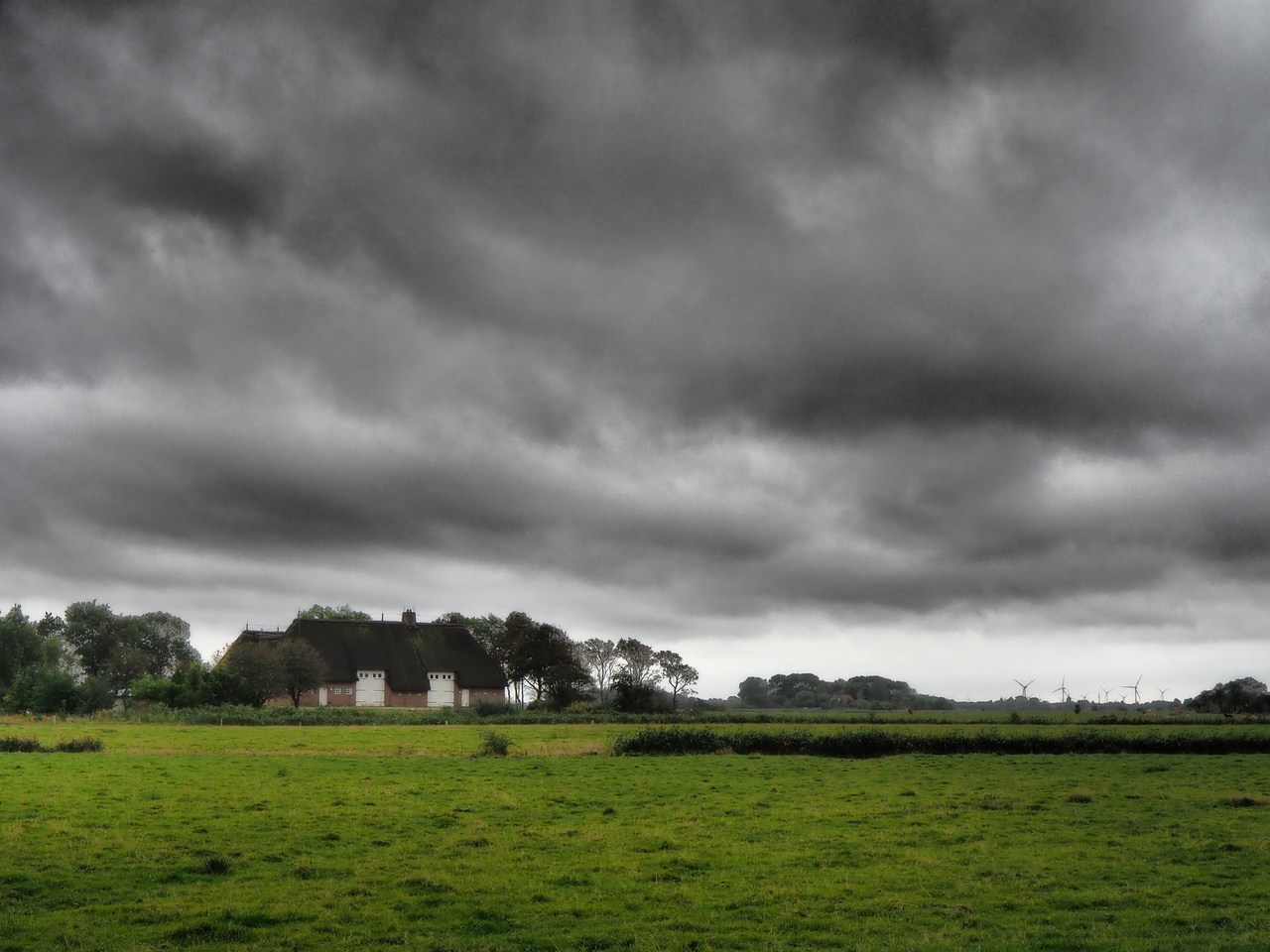
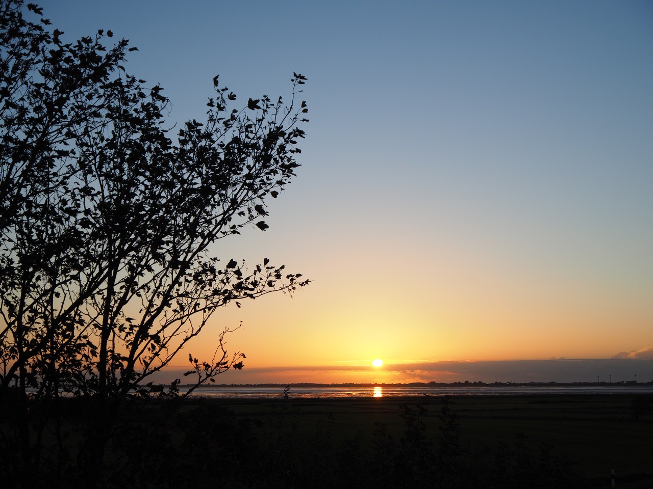
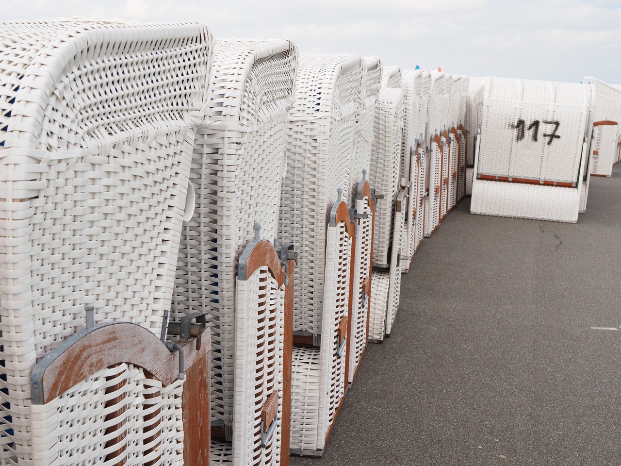
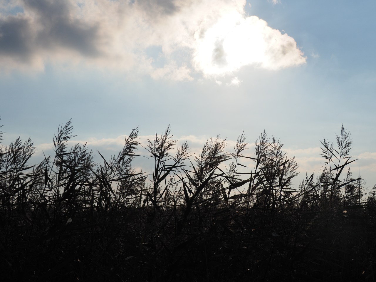
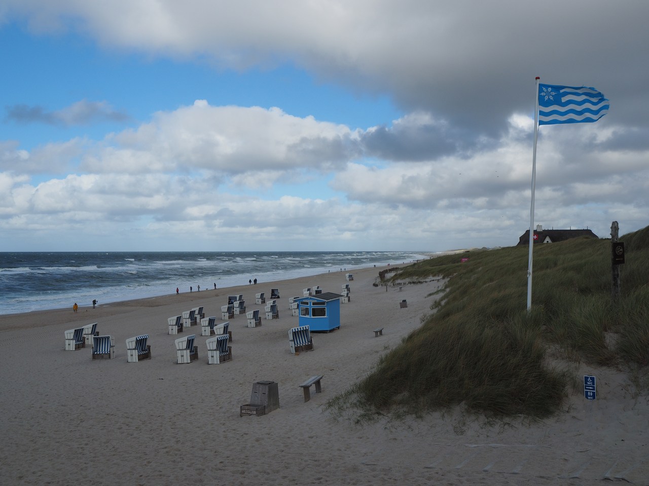
1st October – Grey Town on the Sea
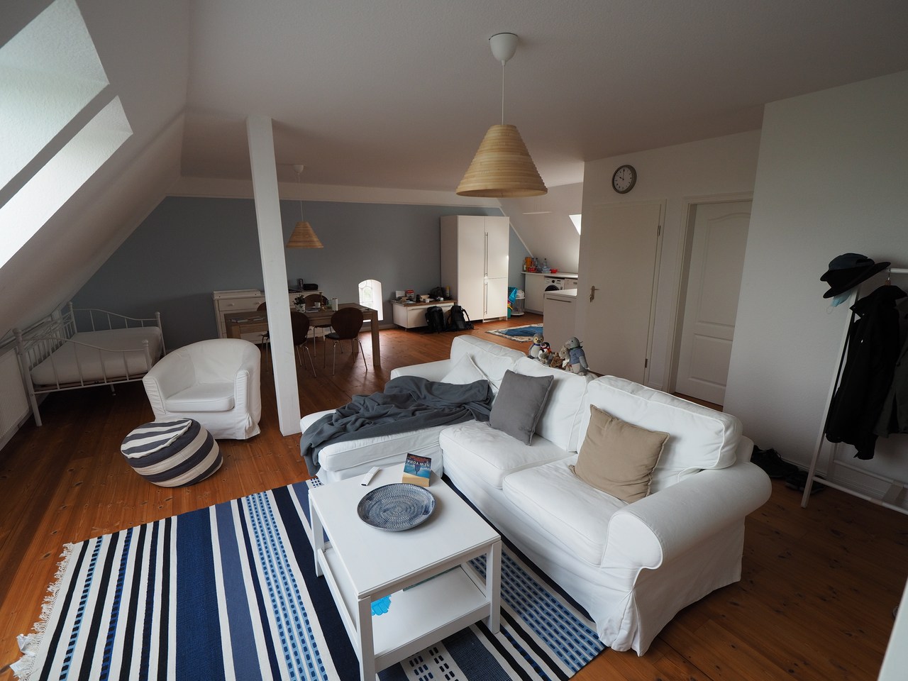
Having arrived fairly late yesterday we're taking the opportunity of looking out at the area surrounding our holiday flat by daylight (and taking a few pictures of the inside before all of our stuff is distributed evenly throughout the flat).
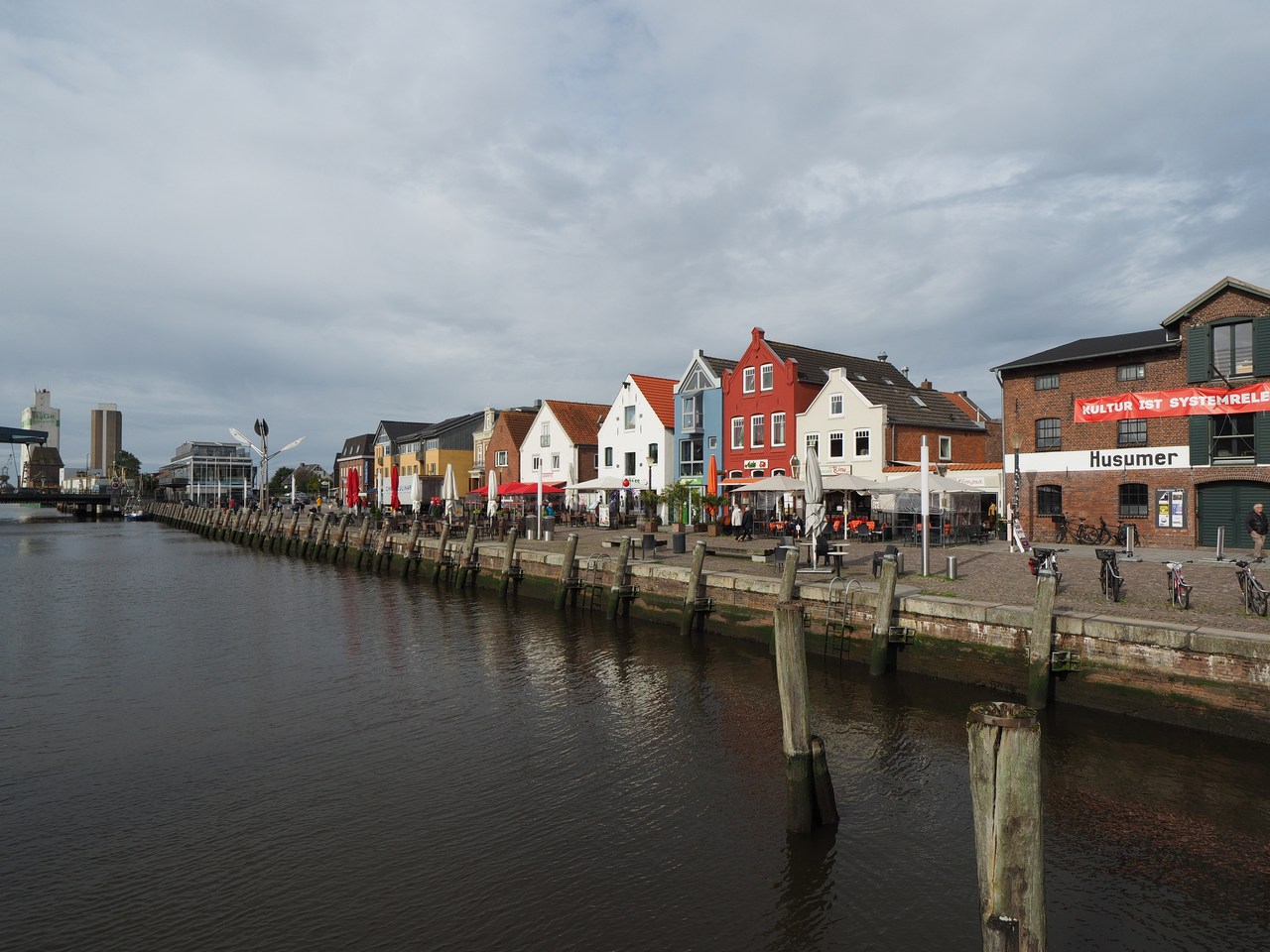
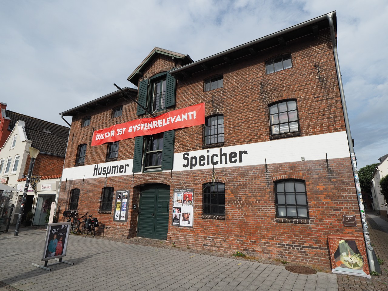
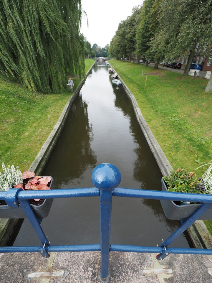
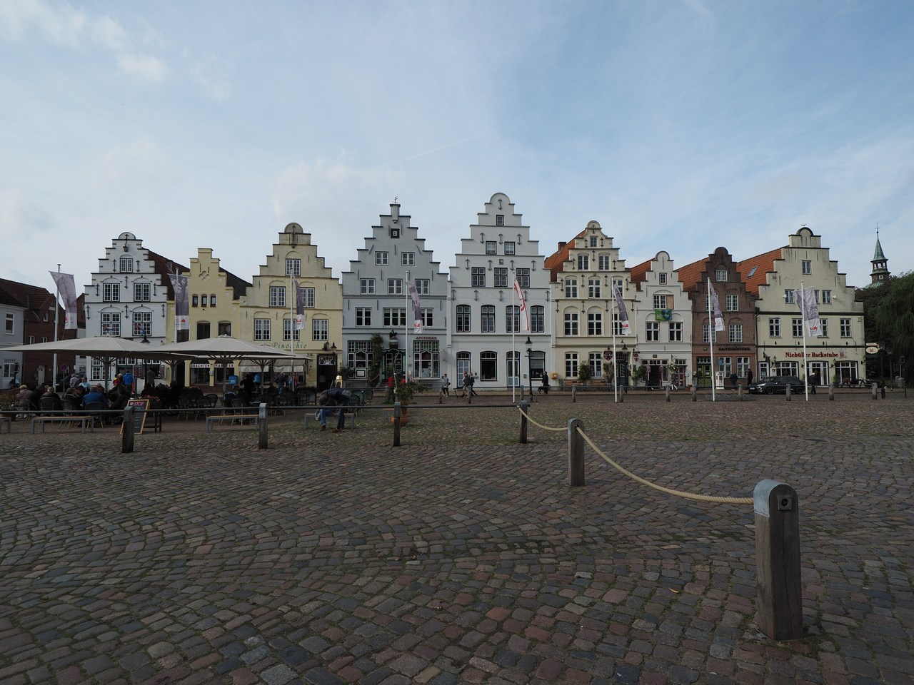
We're having breakfast (mostly consisting of remainders of yesterday's en-route victuals) and then drive back to Husum to explore. Having left the car in the municipal car park we walk across a pedestrian bascule bridge to reach the picturesque inner-harbour area (read “tourist trap”). This has various shops, cafés, and restaurants, and we inspect the different selections of “name” mugs (the invention of the mug doesn't yet seem to have reached the owners of our holiday flat, and we're contemplating providing our own – we did, however, bring a couple of large thermos “travel mugs” from home so the issue isn't exactly urgent). As usual there is no problem getting ones emblazoned with “Marie” but nobody seems to have heard of people called “Anselm”. Apparently if you're a Detlef or Wilfried you're fine; I would have settled for a mug saying Klugschieter (“Know-it-all”) but, inexplicably, they seem to be out of those.
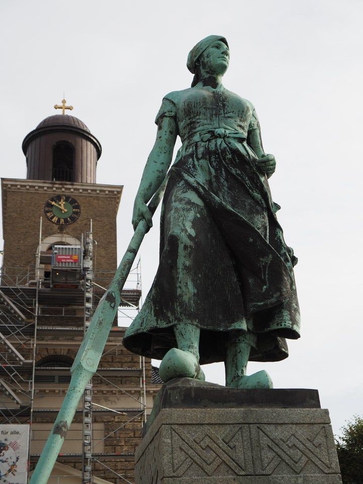
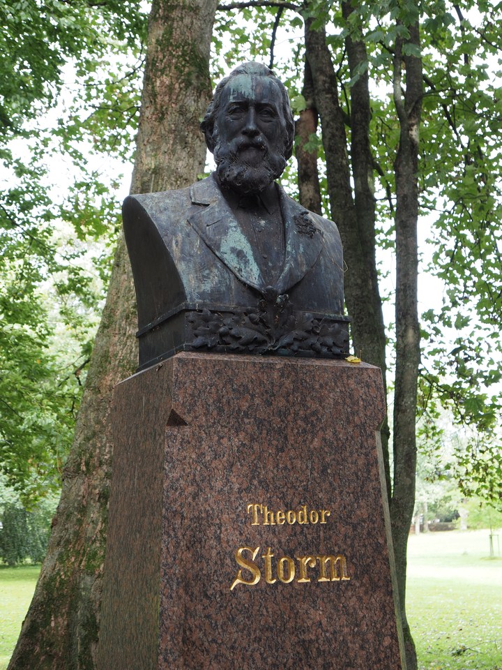
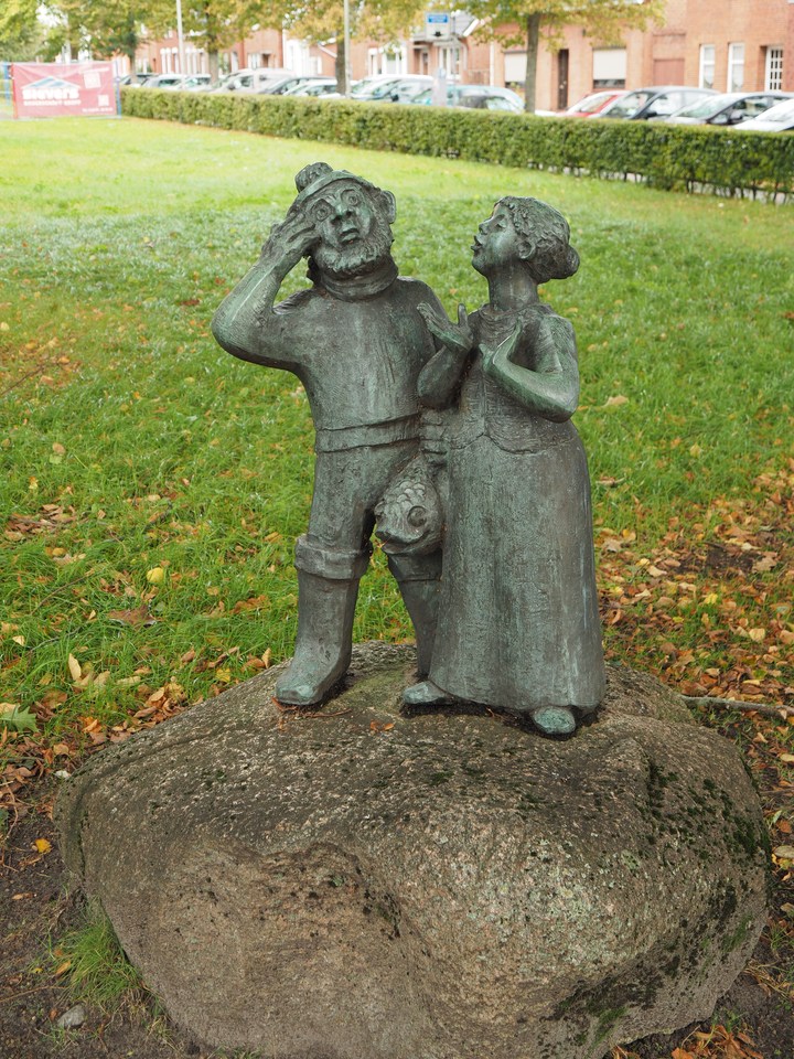
From the harbour area we proceed to the market square, which is notable for the statue of “Tine”, a fisherwoman wearing wooden sabots and brandishing an oar while she is looking out to sea waiting for her husband to arrive with the day's catch, and then to the red-brick “palace”. An ancillary residence of the dukes of Schleswig-Holstein-Gottorf, this is technically called Schloss vor Husum (palace before Husum) because it used to be located outside the town, but today in spite of its name it has ended up right in the middle of it, a few minutes' walk from the market square. We eschew visiting the puppet museum and instead have a quick stroll through the palace grounds, which feature the obligatory monument to Theodor Storm, the famous Husum-born writer familiar to many German school children mainly through his novella, Der Schimmelreiter (The Rider on the White Horse). This is one that I missed (AFAIR we read Annette von Droste-Hülshoff's Die Judenbuche instead), and I did intend to remedy that before coming here! But there's still time.
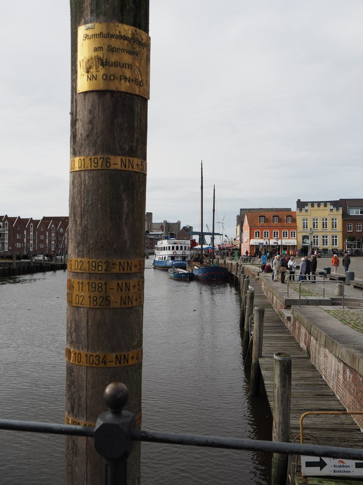
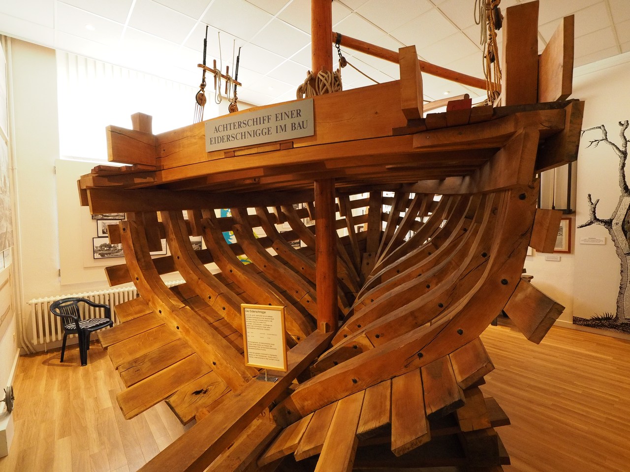
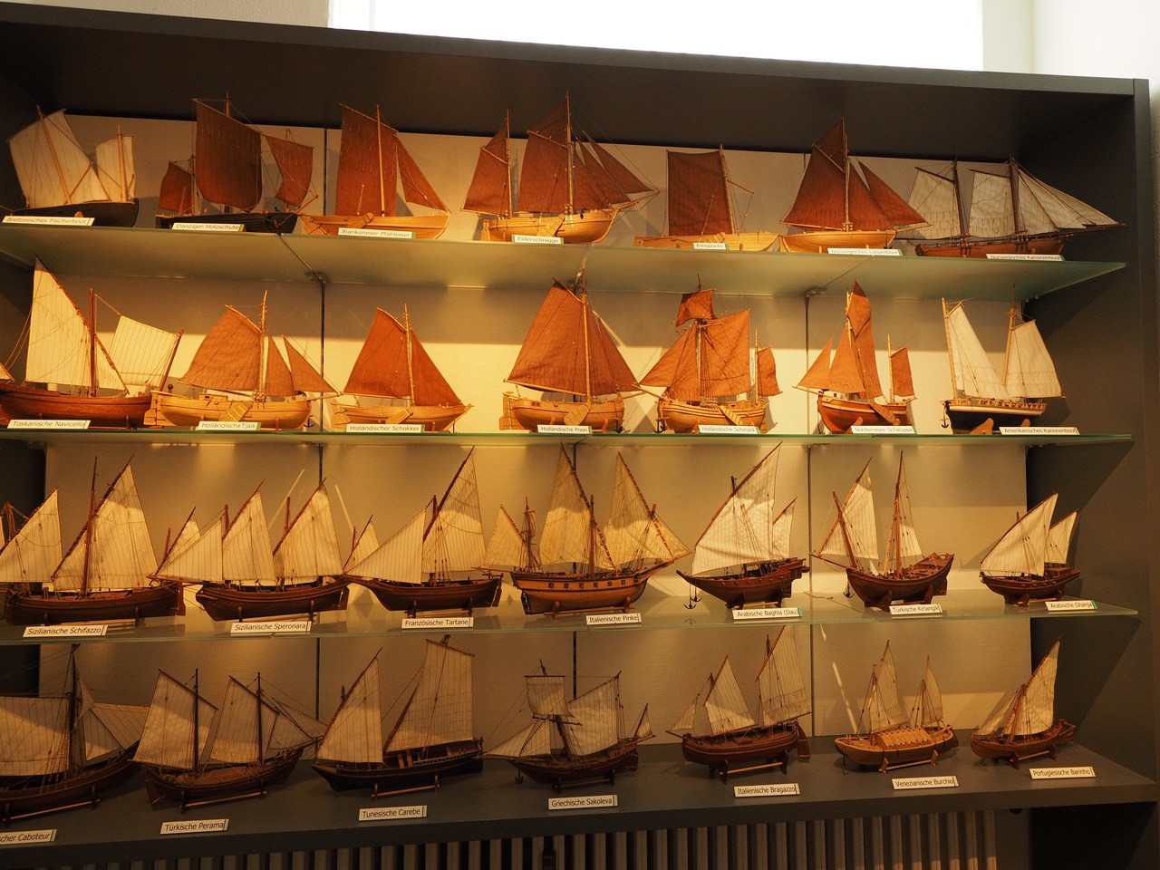
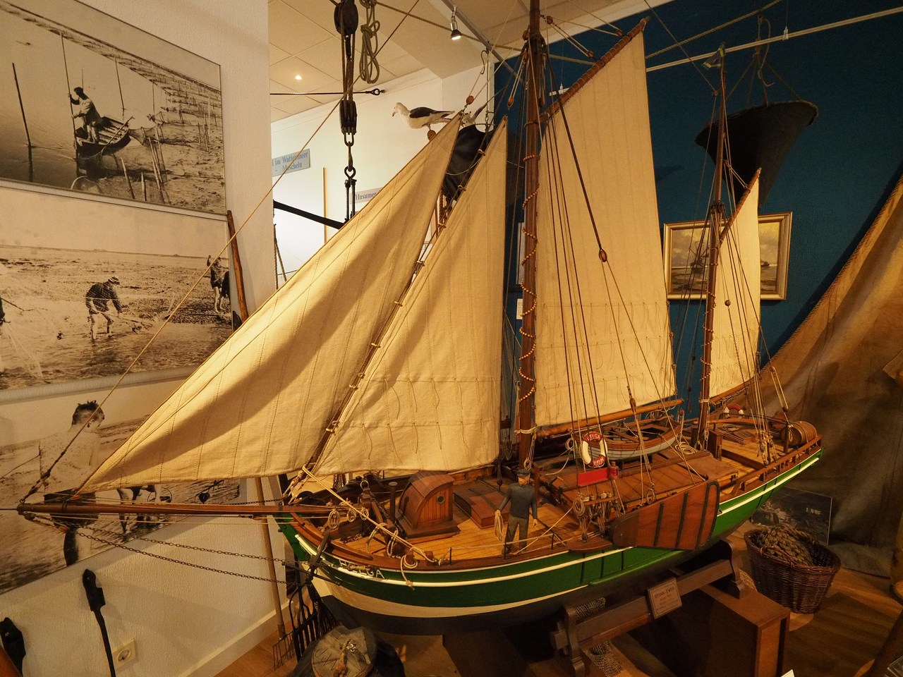
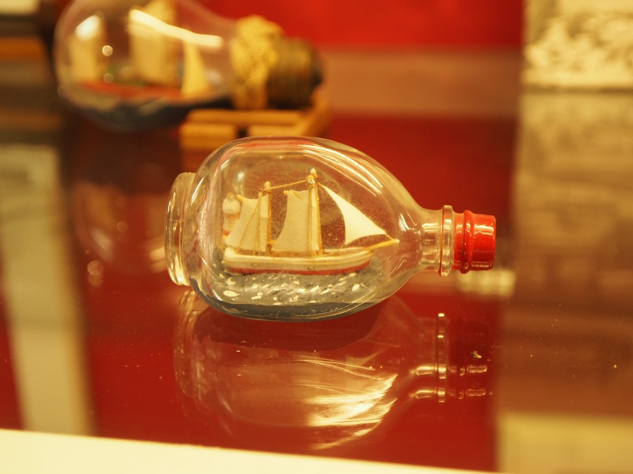
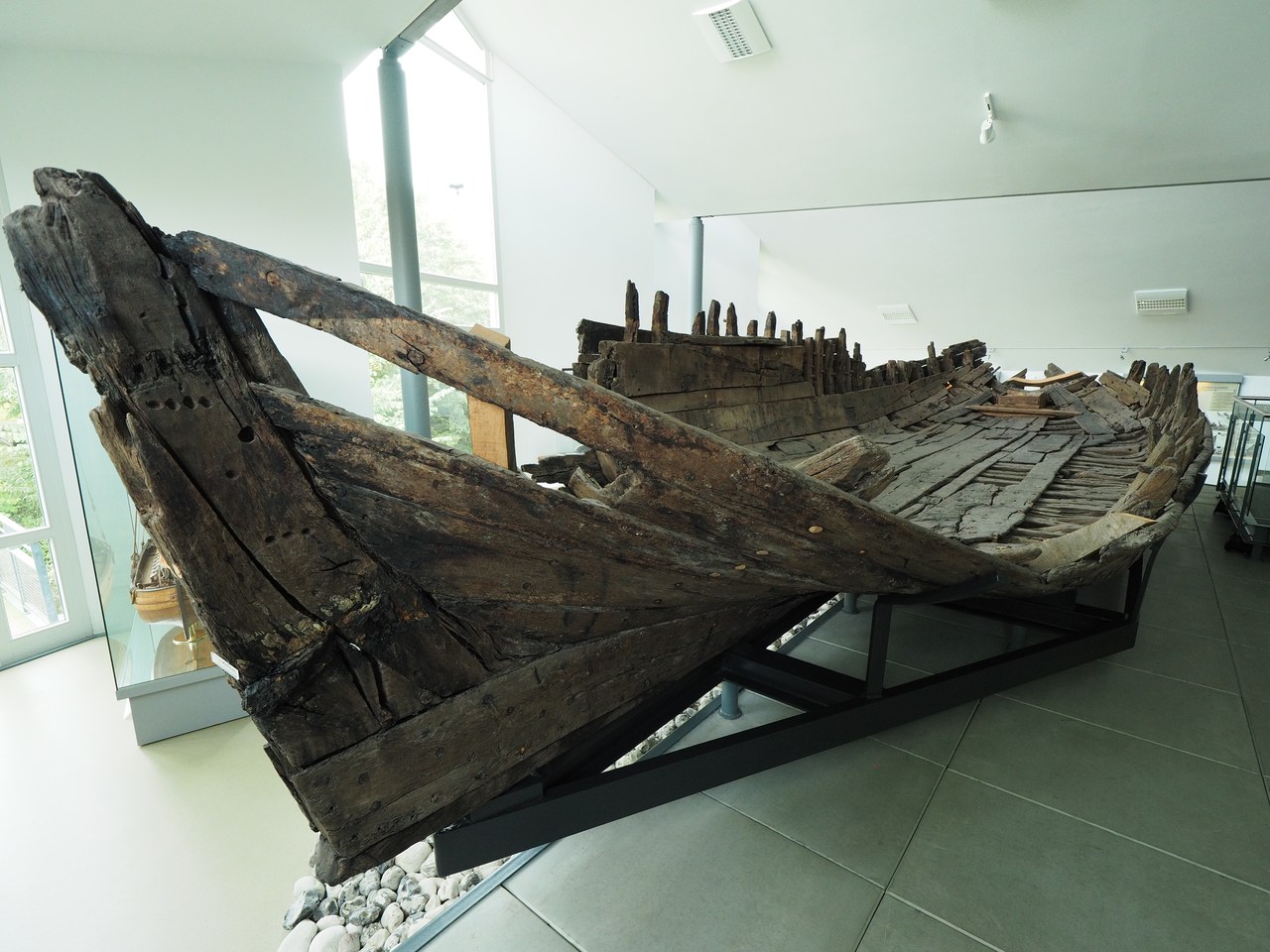
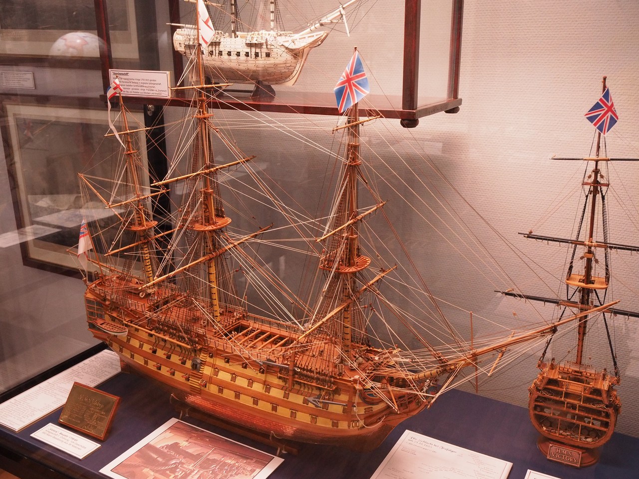
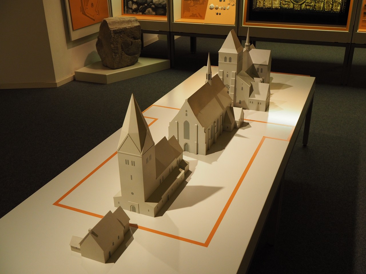
Going back into town we find that St. Mary's Church on the market square is closed for renovations, so we continue to the Nordfriesisches Schiffahrtsmuseum (North Frisian Maritime Museum). This houses, spread across four stories and an inside courtyard, a huge and eclectic collection of ship models, shipping/fishing/whaling paraphernalia, paintings, posters, et cetera – and, most notably, the “Uelvesbüll shipwreck”, a small 16th-century cargo ship which foundered near the coastal village of Uelvesbüll, was discovered during dike works in 1994, and carefully preserved in a sugar solution to prevent the wood from drying out and warping (100 tons of finest refined sugar were used in the process).
After the museum we're treating ourselves to a couple of shrimp-meat rolls for lunch, which we consume on a bench near the harbour being scrutinised by a flock of seagulls that probably wouldn't mind a taste of the shrimp. But at 50 cents a bite, we're not offering to share; if they want shrimp meat they will have to catch their own shrimp!
From there we're off to the supermarket in order to fill the fridge and larder. Practically the very minute we've pulled the flat door closed behind us it starts raining, so we're very satisfied to have made it in time. We're having tea and licorice cookies (which are apparently a thing now) and relaxing for the rest of the afternoon before preparing a chili-con-carne casserole and salad for dinner, which is washed down with one bottle each of Landgang brewery's IPA and pilsener beers (these are very small bottles). Dessert is the Traum von Eiderstedt (Dream of Eiderstedt), a yoghurt/cream concoction which is available from the dairy department at REWE (among, presumably, other places) and comes highly recommended by Staub/Lang, who spent some time in the area last year. It does taste quite delicious together with Rote Grütze (red-berry compote); we could get used to this if it wasn't for the calories!
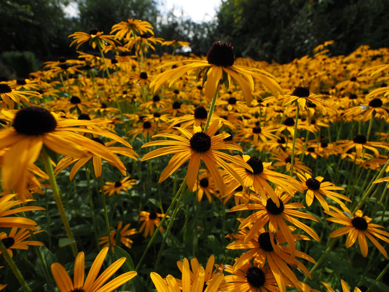
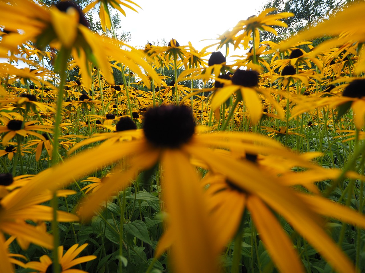
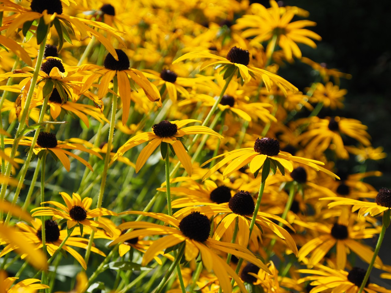
Today's photographs have mostly been taken with the Olympus E-M5 II and the very new 8-25mm/4 PRO lens, which I've taken delivery of only two weeks ago (having ordered it in July). This is an interesting lens for visiting towns or museums because it ranges from an ultra-wide-angle lens (8mm on Micro-4/3 is roughly equivalent to 16mm on a “full frame” sensor) to a “normal” lens at 25mm (50mm). Before this, my widest non-fisheye lens was the short end of the 12-100mm/4 IS PRO, and even though it doesn't sound like much, the 4mm difference between the 8-25mm/4 PRO and the 12-100mm/4 IS PRO lenses is quite noticeable. Ultra-wide-angle photography takes a little getting used to because the depth of field ranges from a few metres (or centimetres, even) from the front of the lens to infinity and you need to get really close to objects that you want to have appear big in the foreground, but so far it seems like fun!


2nd October – Little Amsterdam, and the Tidal-Flats Forum
The complete absence of cereal bowls in our holiday flat and the fact that the two bowls we bought yesterday haven't yet had a turn in the dishwasher mean that I'm having my breakfast muesli from a teacup, but that doesn't discourage us – and nor does the weather which isn't looking too great. But eventually the sun shows up and we decide to venture forth for a look at the picturesque town of Friedrichstadt.
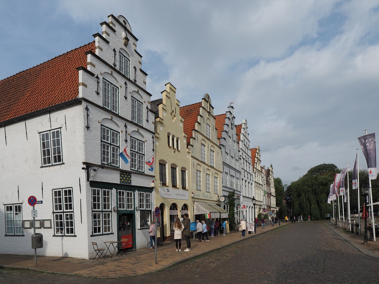
Friedrichstadt is approximately 15 kilometres south-east of Husum, where the river Treene joins the Eider. It was established in 1621 and mainly settled by Remonstrant emigrants from the Netherlands. Remonstrants are a Dutch sect whose members, in the early 17th century, renounced Calvinist ideas such as predestination, and unsurprisingly became unpopular with the established Protestant church. The architecture and general outlook of the town (which came to be called “Little Amsterdam”) was greatly influenced by these early Dutch settlers, who made themselves useful through their knowledge of land reclamation and agriculture. There are still Remonstrants in Friedrichstadt and their (smallish) church – the only one of its kind outside the Netherlands – is worth visiting; according to the guidebook they form part of five religious communities that live peacefully alongside one another: In addition to the Remonstrants there are German and Danish Lutherans, Roman Catholics, and a few Mennonites. (One would suspect from the existence of various Döner restaurants that there might be at least some Muslims, too, but they don't seem to count as far as the guidebook is concerned. There used to be a Jewish community as well but the Nazi era put paid to that, although the former synagogue is still there and now serves as a cultural centre.)
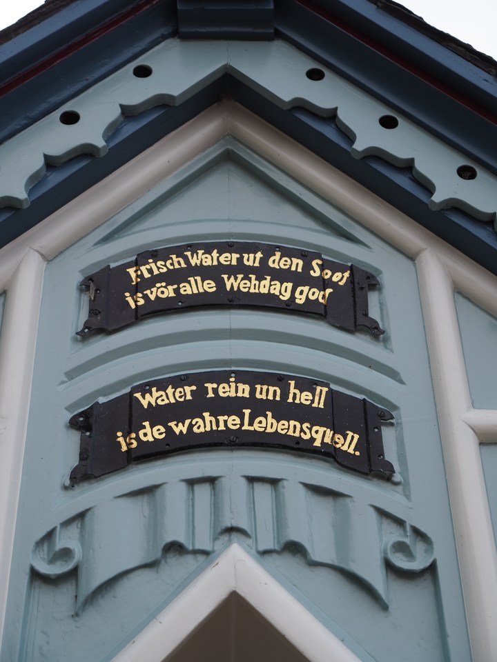
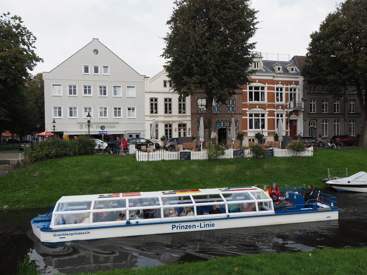
Adding to the Dutch appeal are various canals that criss-cross the town (complete with tourist ships offering guided round trips). Its center is the market square with an impressive set of nine step-gabled town houses on its west side, most of which now feature shops, cafés, or restaurants. Also in the market square is a water pump with an ornate roof whose four sides quote verses by the local poet, Klaus Groth (1819-99), extolling the virtue of water as a drink as opposed to stronger beverages.
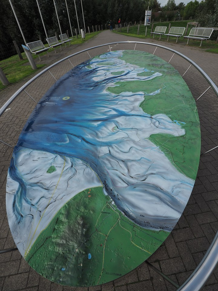
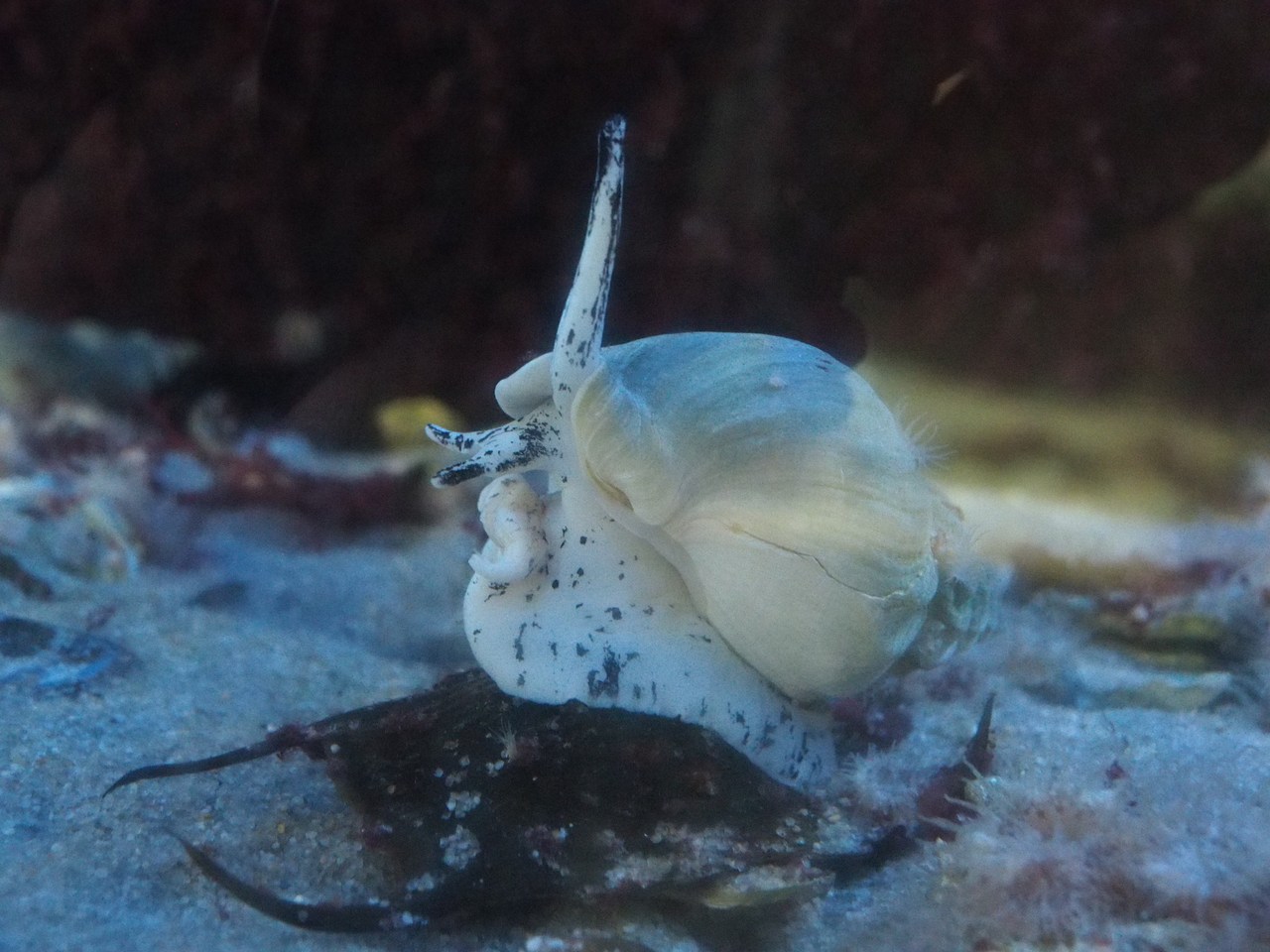
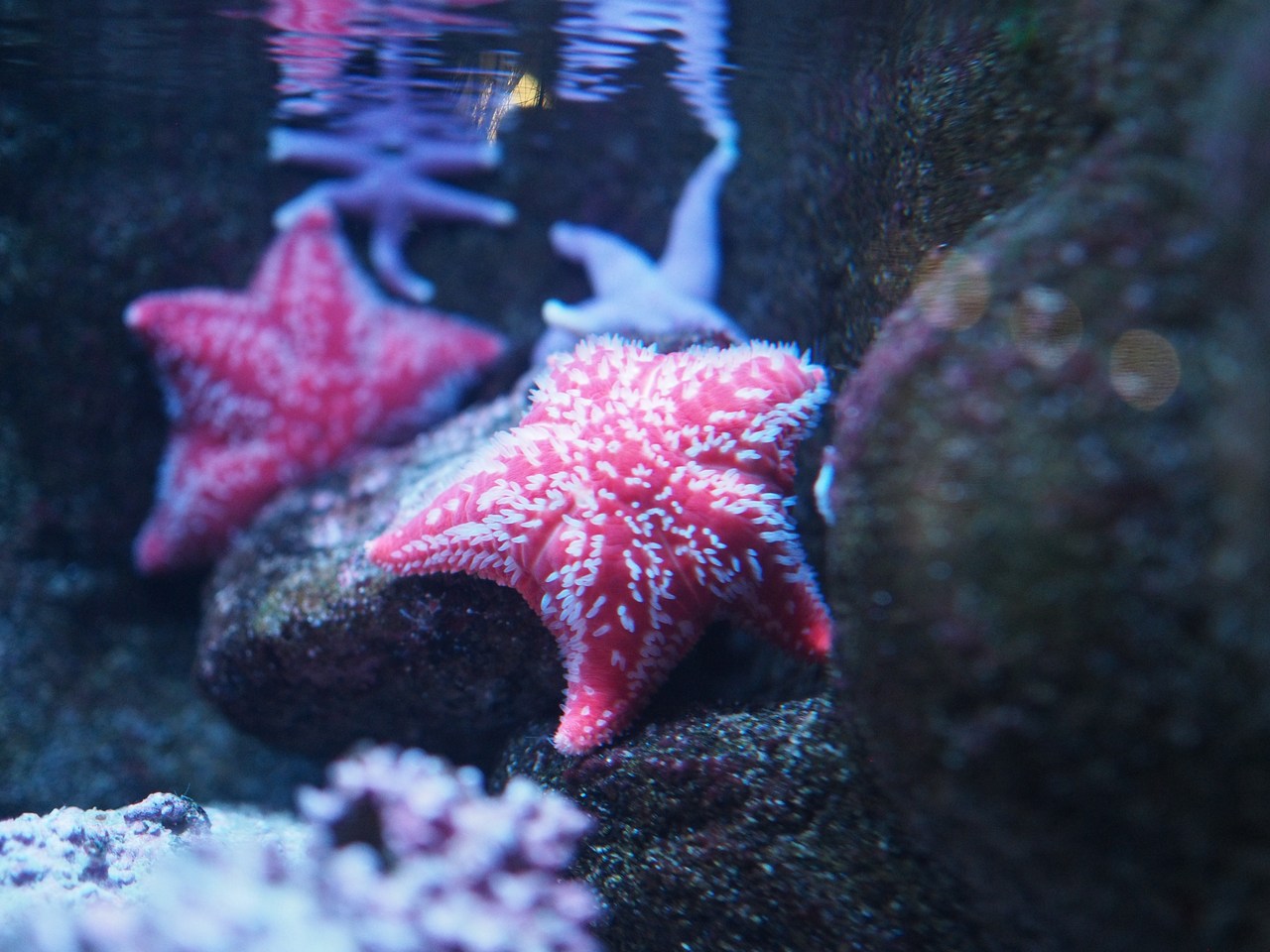
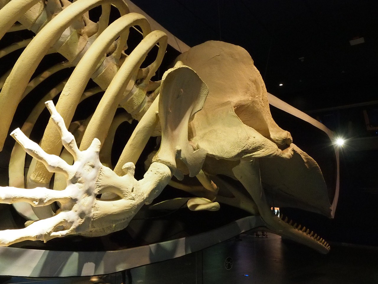
From Friedrichstadt we continue to the Watt-Forum (tidal-flat forum) on the outskirts of Tönning, which is a hands-on type museum/aquarium that attempts to teach visitors all there is to know about the Wadden Sea, its inhabitants, commercial use, and conservation efforts. It is quite busy on a Saturday afternoon but we still manage to get a close look at most of the 37 fish tanks and sundry other exhibits, including the skeleton of a 17.5-m sperm whale which stranded in Denmark some time ago. Half of it has been covered by a plastic reproduction of the whale's body, which illustrates the animal's ginormous size. There's also a very large tank holding different kinds of open-sea fish, although this is no real comparison to other aquaria we have visited, such as the Oceanarium in Lisbon or the Monterey Aquarium. No penguins, either! (We know they don't live in the Wadden Sea, but who cares – neither do sperm whales, and penguins are way cuter.)
Back home we enjoy mugs of tea and the remainder of the licorice cookies (which do tend to grow on one) and put up our feet reading. Dinner is gyros-style pork from the REWE meat counter, together with tsatsiki, bread, and a Greek-style cabbage salad that we fortify with sweetcorn left over from yesterday's chili, a bell pepper, and some tomatoes and cucumber. Very nice. We round off the evening with a round of Paartie, a game that Marie obtained some considerable time ago and which is supposed to get couples to know each other better (to our great relief we realise that after 11 years together, we do apparently know each other fairly well already) and some reading aloud from a new book by Dan Carlin, The End is Always Near. By the author and presenter of the Hardcore History podcast, which we enjoy on long drives in the car, this is an examination of various near-misses and events that did not quite result in the destruction of human civilisation and as such serves as light, uplifting entertainment for the history-minded.


3rd October – North Frisia Museum, and a Restaurant Ship
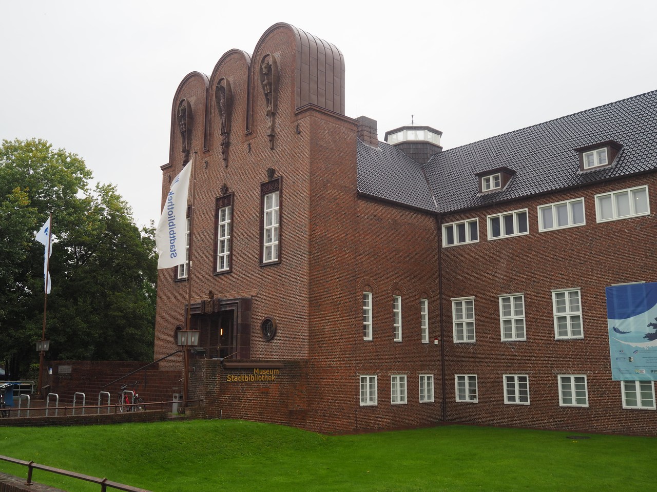
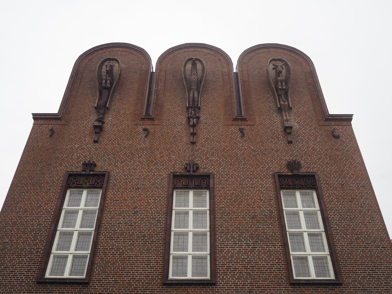
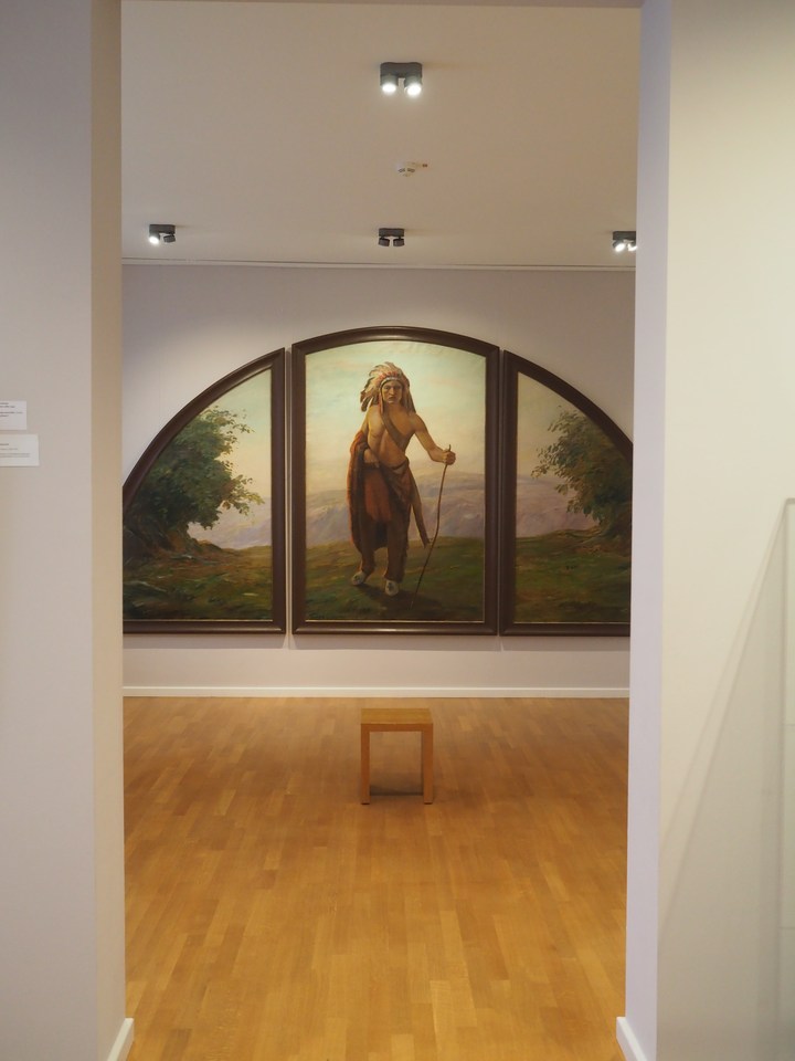
It's a rainy day today, and we're taking it easy until the early afternoon, when we decide to go into town and see the North Frisia Museum. This was built in the 1930s from the very considerable estate of Ludwig Nissen (1855–1924), a Husum-born entrepreneur who emigrated to New York and made it big (as in, BIG) as a jeweller and dealer in diamonds and precious stones. He didn't have any children and decreed that his money would go to the town of Husum for the purpose of building a museum and public library. There was an architectural competition for the building while Nissen was still alive, and the winning design was eventually realised, in somewhat adapted form, between 1934 and 1937 by the Eiderstedt architect Georg Rieve (1888-1966). The main change was to replace the original triangular gable by a set of three semi-circular arches containing expressionist ceramics by Alwin Blaue (1896-1958) – the sea horse, eagle, and triton bull symbolising the North Frisian landscape.
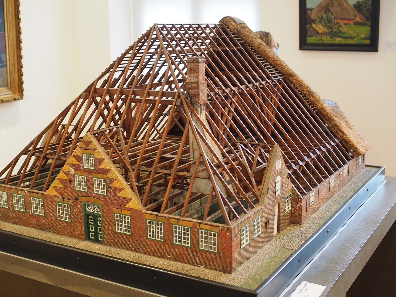
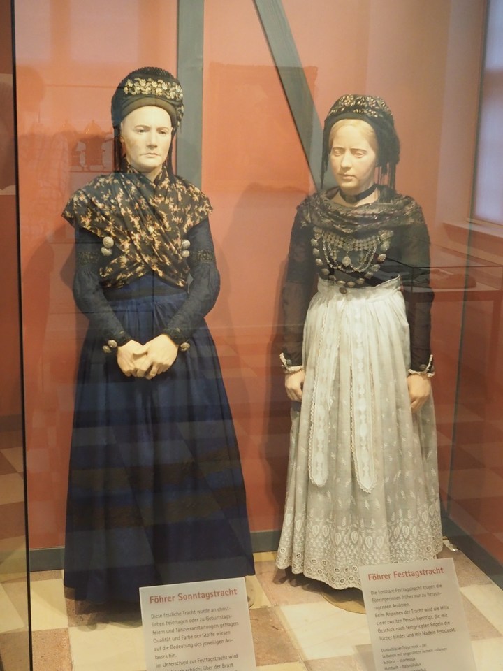
The museum itself houses exhibits on life on the North Sea – based on the history of the town of Rungholt, which was destroyed in a flood in 1362 –, coastal protection, housing, traditional dress, natural history, the town of Husum, and paintings and objects from the collections of Ludwig Nissen himself. Right now there is also a special exhibition on disasters (mostly floods) on the North Sea, in particular the 1962 storm flood which devastated the city of Hamburg (along with lots of other places on the German North Sea coast).
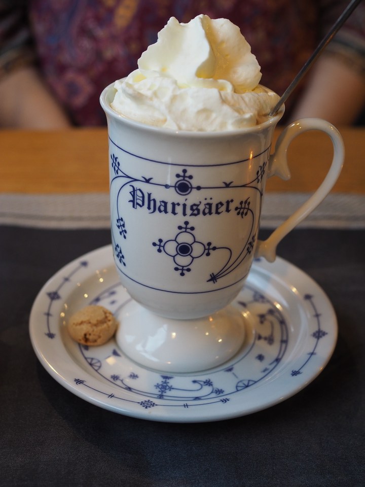
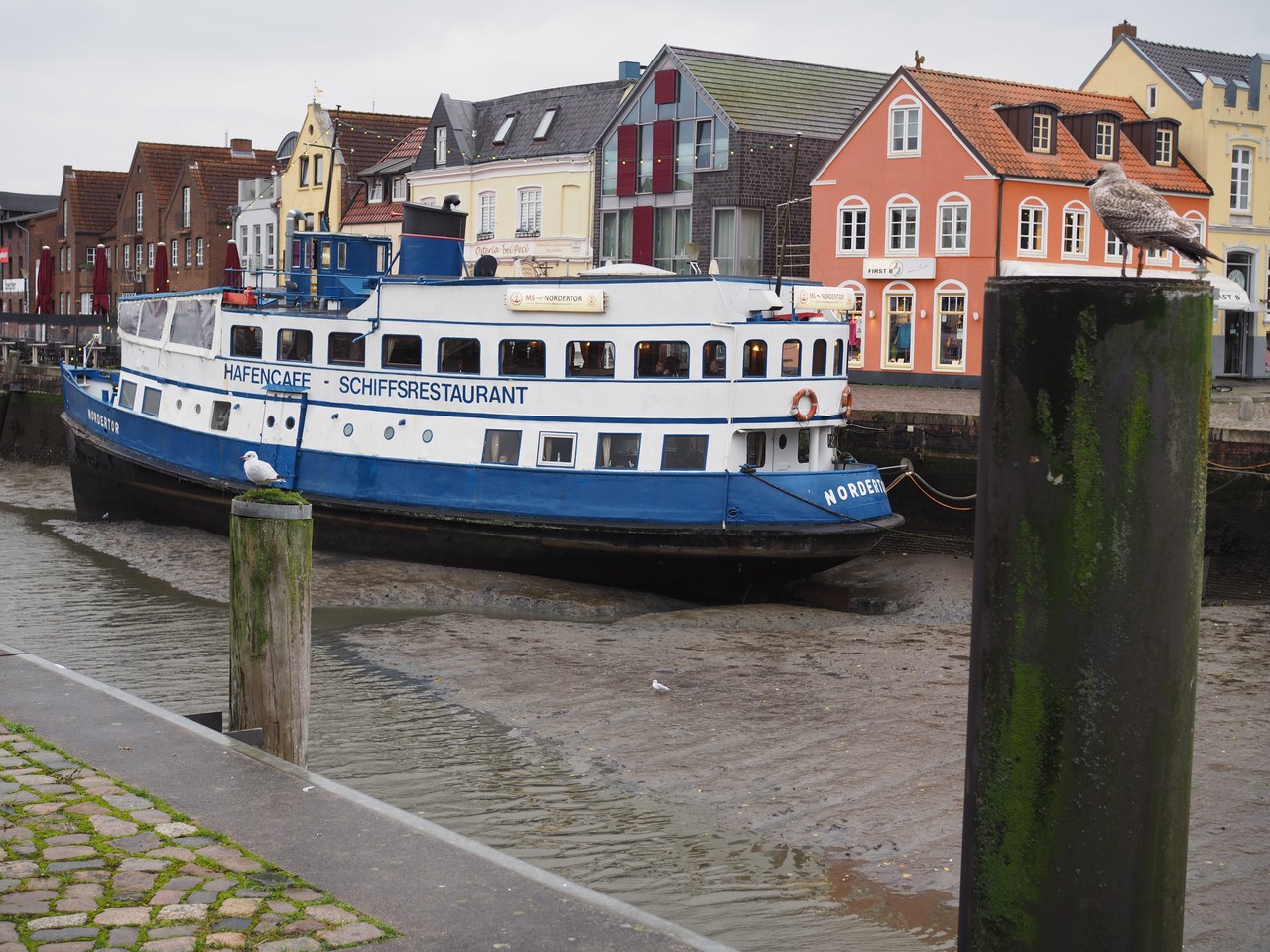
After this deep dive into the history and culture of the area we go for an early dinner (or late lunch?) at the MS Nordertor, a restaurant in an old ship in Husum's inner harbour. The rain has stopped for the short walk from our parking space on the other side of the harbour basin, and with considerable luck, we manage to snag one of the very rare tables for two that have not been pre-reserved, even though we're 20 minutes early for dinner service. While we're waiting we're having tea or, in Marie's case, a Pharisäer, which is sweetened coffee liberally laced with rum and covered with cream. (The story goes that this famous beverage was invented in the 19th century on the island of Nordstrand – not at all far from here – which at the time had a particularly austere and teetotal pastor, Georg Bleyer, who objected to people drinking alcohol in his presence. When celebrating the christening of the seventh (or sixth – the sources disagree) child of farmer Peter Johannsen in 1872, the locals invented the Pharisäer as a ruse; the cream on top of the coffee prevented the alcohol from evaporating and creating an odour, and of course the pastor himself would always get just plain coffee topped with cream and no rum. Eventually Bleyer did figure out what was going on – some sources say because he was mistakenly served a cup of the rum-laced coffee, others because he'd surreptitiously sampled another guest's – and shouted “O you pharisees!”, meaning “hypocrites”, and that gave the beverage its name.) The food arrives very promptly after 5pm – I'm having Labskaus (see last year's blog for a more detailed discussion of this delicacy) and Marie a plate of North Frisian “tapas” including goat's cheese, smoked salmon, deep-fried shrimp, and lamb sausages (plus bread, mustard, and tartar sauce), all of which are very nice.
We get back to our flat fairly early (once more it starts raining hard only minutes after we arrive) and make ourselves comfortable for the rest of the day. After the television news we finish the Traum von Eiderstedt and watch a few more episodes of the ultra-orthodox Jewish soap opera, Shtisel – we've added the flat's “smart TV” to my Netflix account, and must only make a note to log ourselves out again when we leave so the next visitors don't get to watch Netflix on my dime. We're looking forward to the weather improving tomorrow and making plans for the next outing!
Photographically it's a “PEN-F” day today – I think the more compact, lightweight camera with the fast prime lenses is better for an indoor museum visit on a cloudy day and won't give the staff fits. So far the museums have welcomed no-flash photography and since my cameras don't even have a built-in flash this is a restriction I'm happy to comply with.

4th October – Funny Borders, Emil Nolde, and Inland Dunes
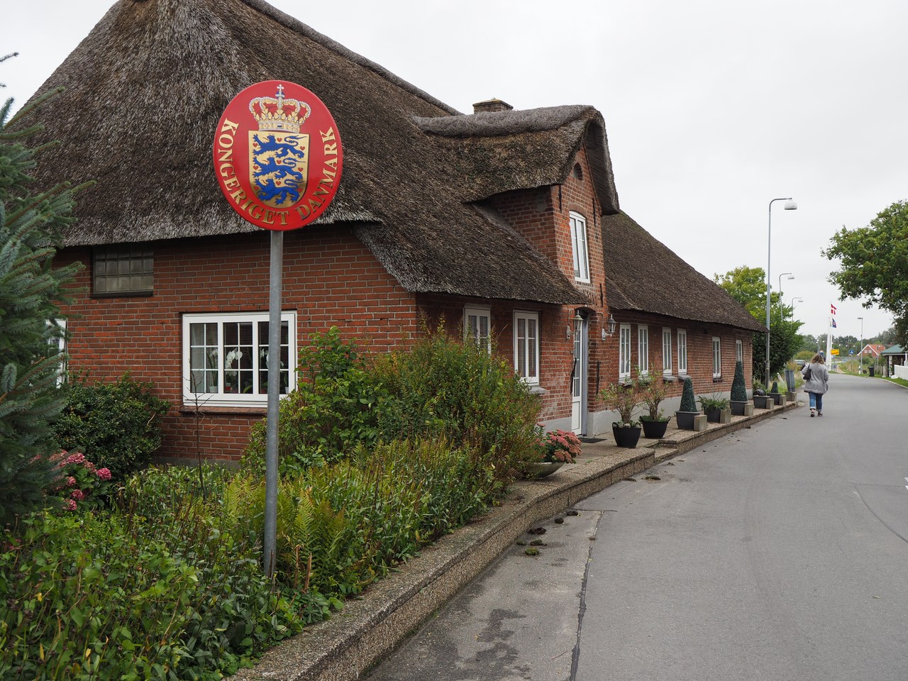
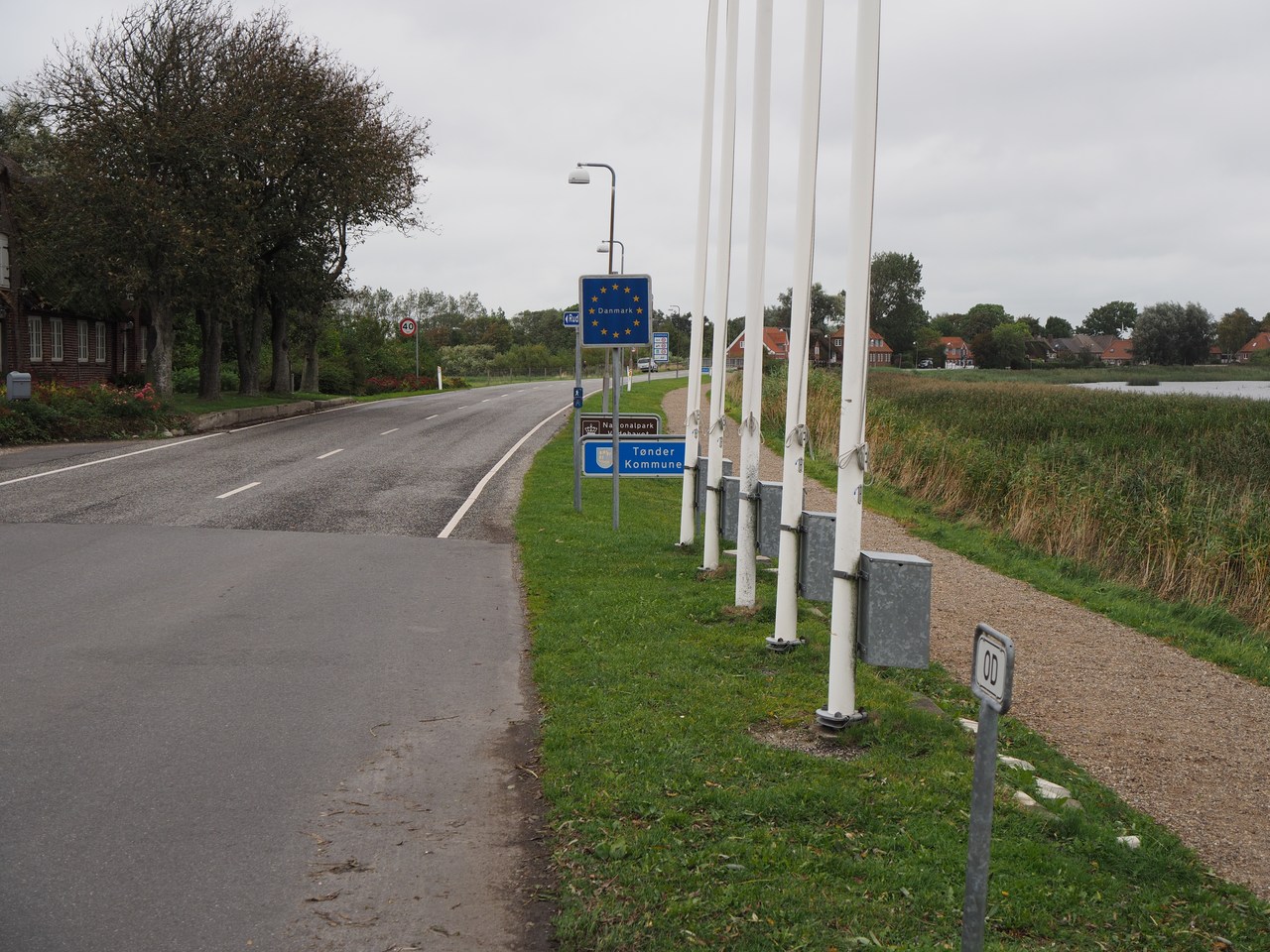
It looks grey today and we're venturing north, near the Danish border. Our first stop is the small village of Rosenkranz, where the border runs along a street such that the houses on one side are in Denmark and the ones on the other side in Germany. There are border markers in the middle of the road just so people can find out exactly what is what.
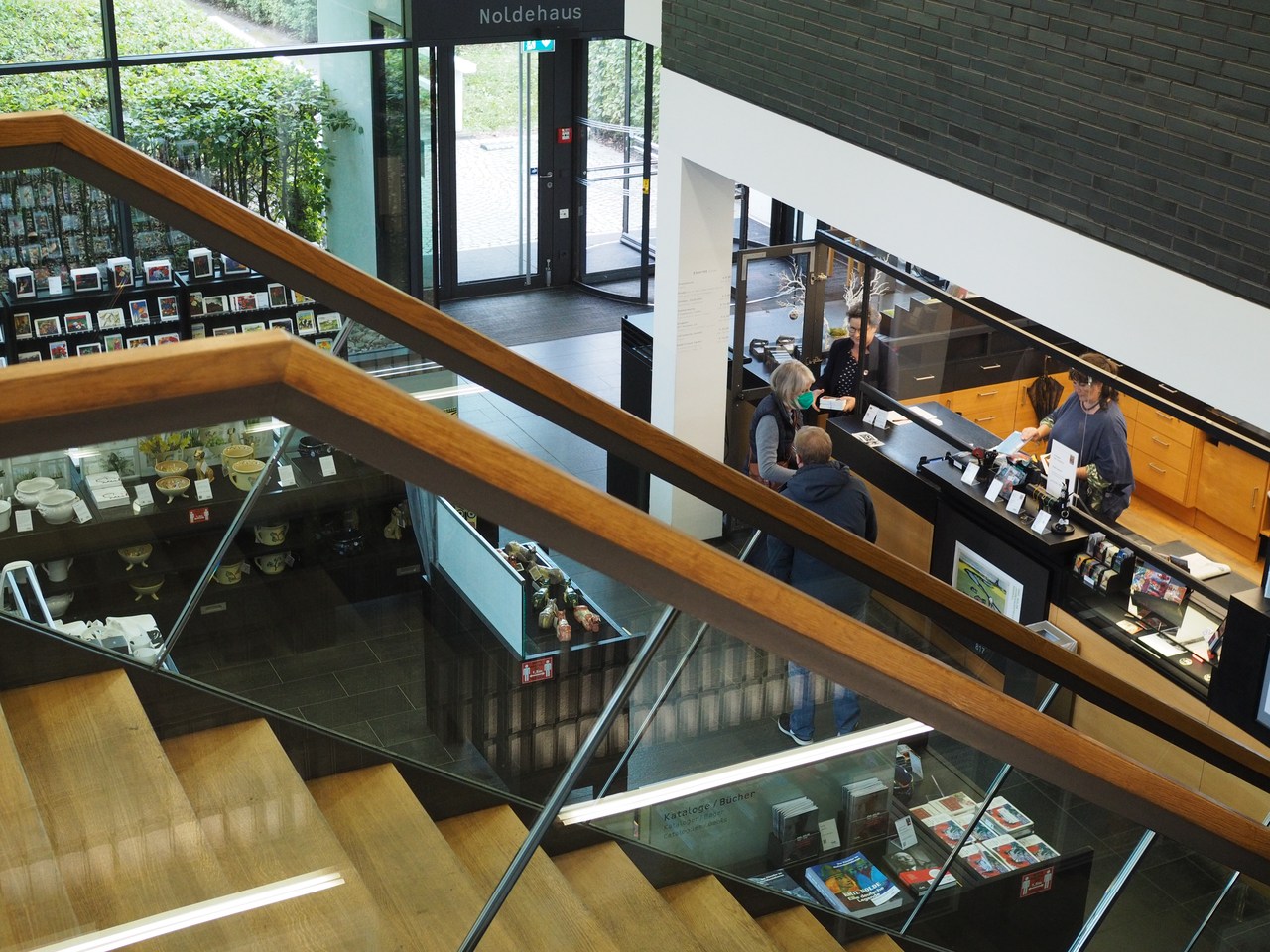
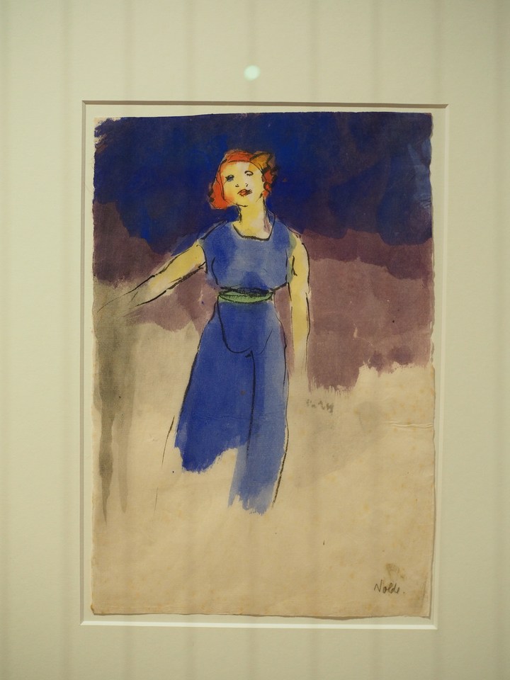
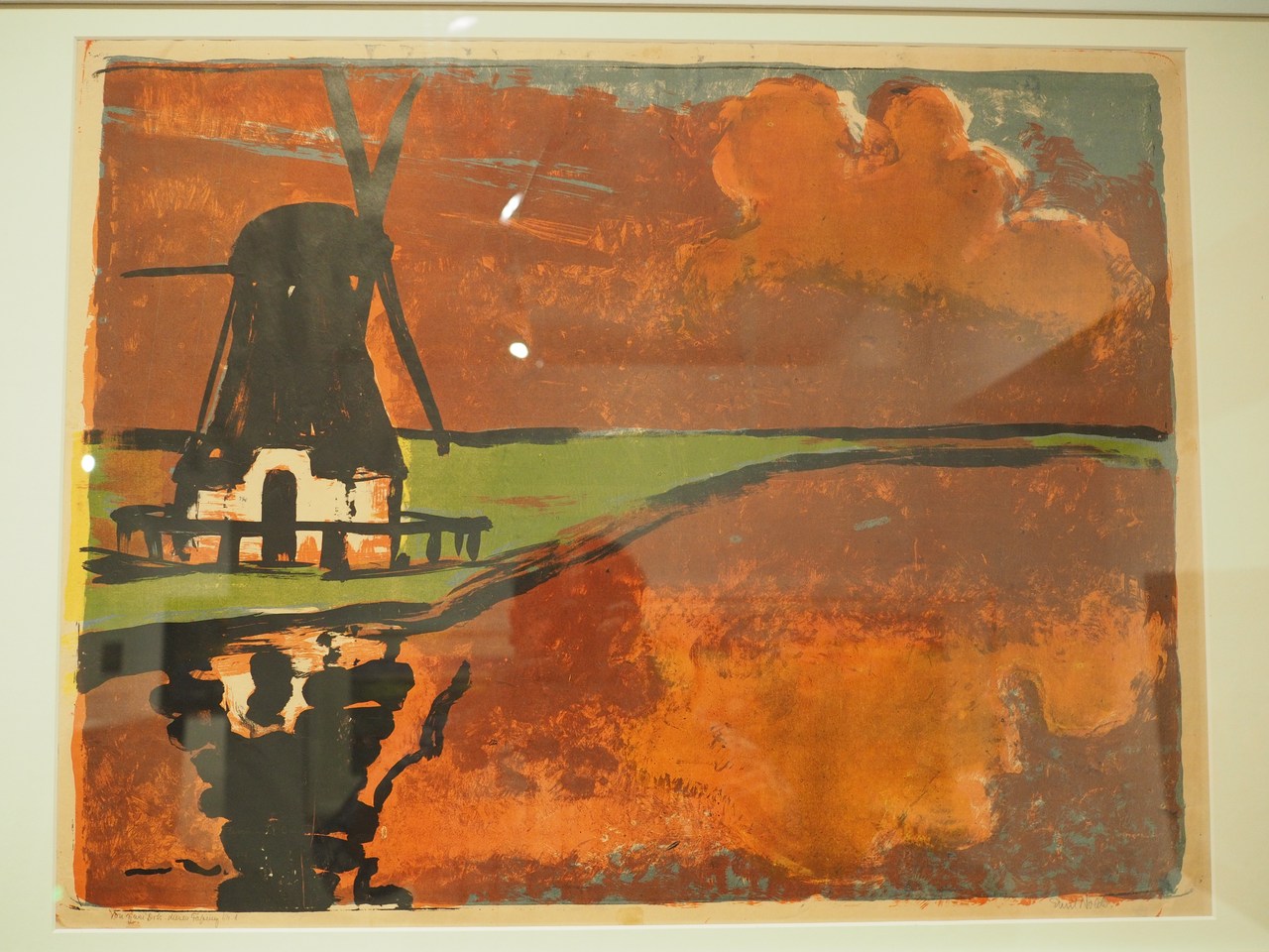
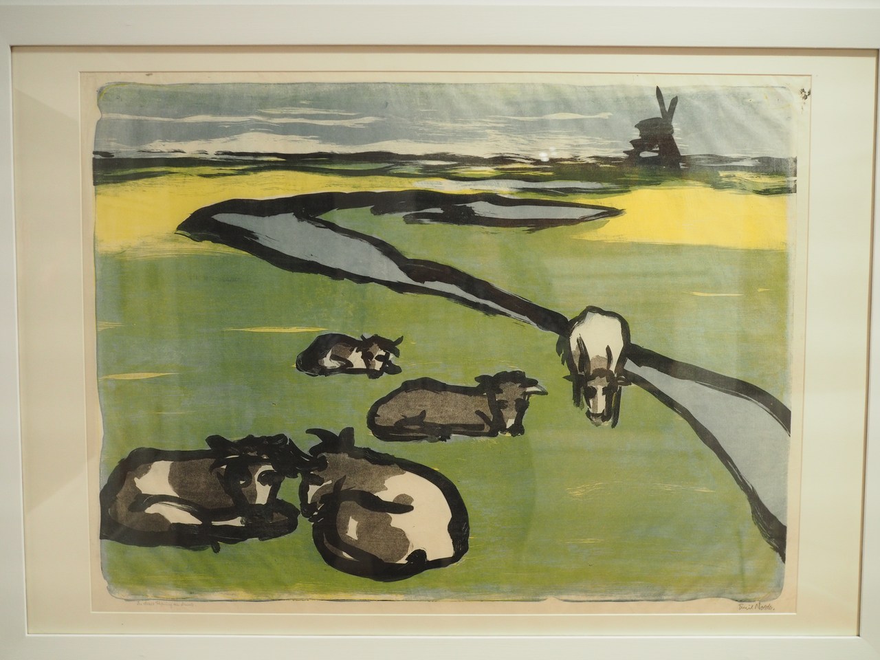
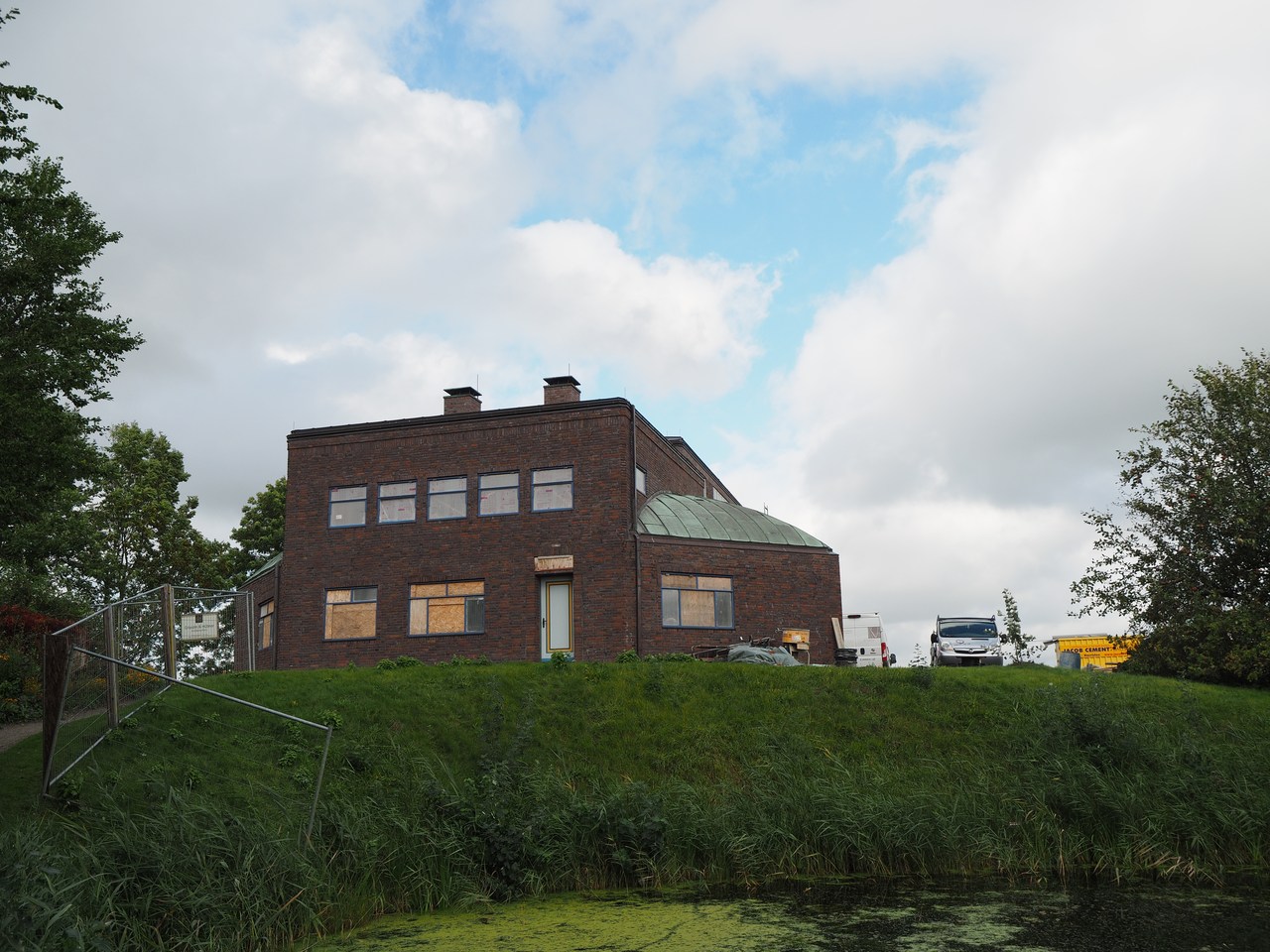
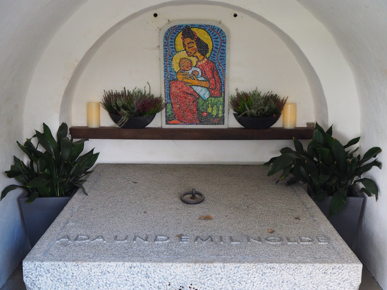
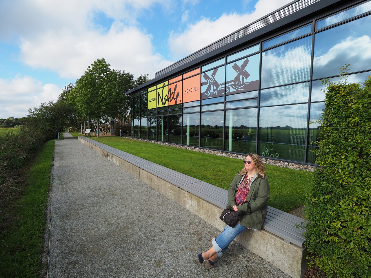
From there it's not at all far to “Seebüll”, the purpose-built estate of German-Danish expressionist painter Emil Nolde (1867-1956) and his wife Ada (1879-1946). The place now belongs to a foundation whose job it is to make Nolde's works, the buildings and grounds accessible to the public. The actual building that Nolde lived and worked in is currently undergoing renovations which will revert it to its original state (there had been extensive alterations made in the late 1950s to render it fit for visitors), but there is an exhibition of a small selection of Nolde's art in the entrance building to the grounds, and one can visit the gardens.
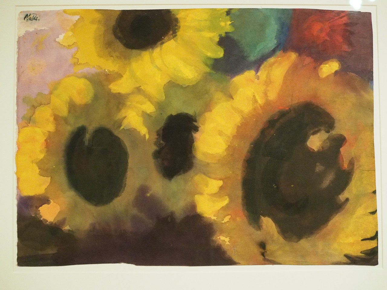
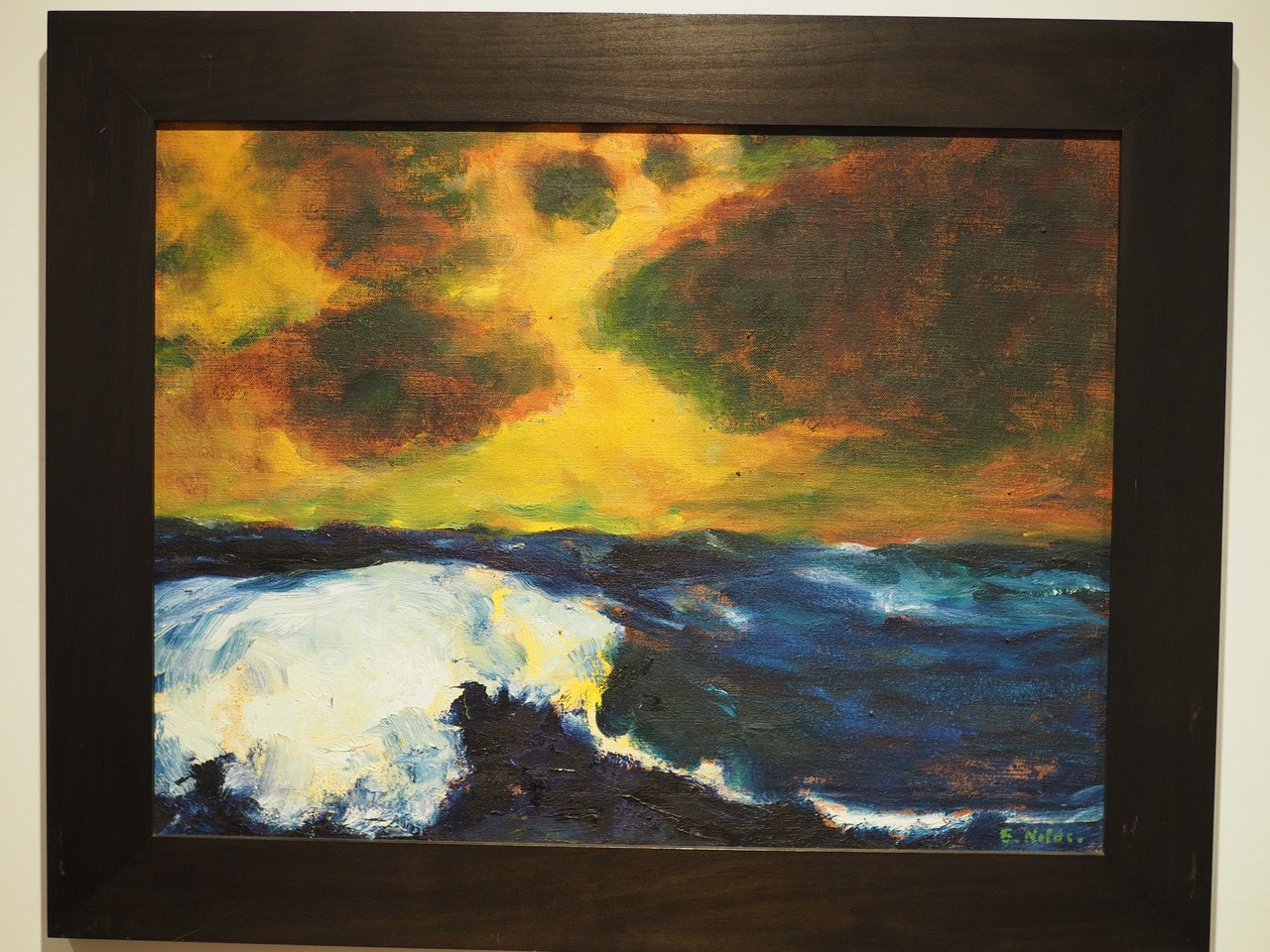
Emil Nolde is one of the most well-known 20th century “German” painters. He was born Emil Hansen in the village of Nolde in the north of Schleswig-Holstein. Even though he considered himself German, he took Danish citizenship in 1920 when the area reverted to Denmark, mostly because his wife was Danish already, and also started calling himself “Nolde” after his place of birth, since there were entirely too many Hansens around. Nolde was quite famous – and eventually high-earning – even in his lifetime. He was also a strident anti-Semite and supporter of the Nazi party, which is extra pathetic because this was not reciprocated by the Nazis, who classified his works as “degenerate art” and eventually, in 1941, banned him from obtaining artist materials and selling pictures. Nolde, who had held high hopes of becoming officially the most important and celebrated German painter when the Nazis came to power, tried to get the Nazi bigwigs to realise that he was, in fact, a pioneer of “true German art” but didn't get anywhere (Hitler in particular – a failed painter himself, after all – detested Nolde's work). After the war, Nolde managed to spin his “painting ban” into the appearance of having been a victim of Nazism rather than a passionate supporter, and since he remained such a well-known and popular artist that actually worked out quite well for him. Only quite recently has the Nolde foundation started to acknowledge the facts, instead of the myth, behind Nolde and the Nazis.
Anyway, the guy may have been an amiable fascist asshole but boy could he paint (and etch, and print, …), and his art is well worth checking out – the pieces on display get changed every year during the months of November and December when the museum is closed. There's also a 1-hour biographical film being shown on an endless loop.
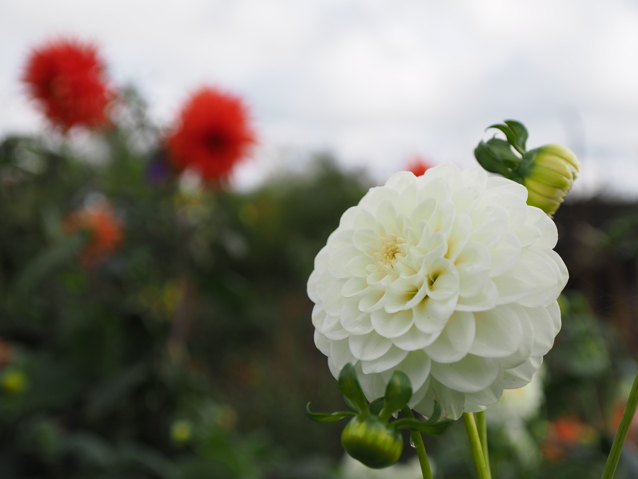
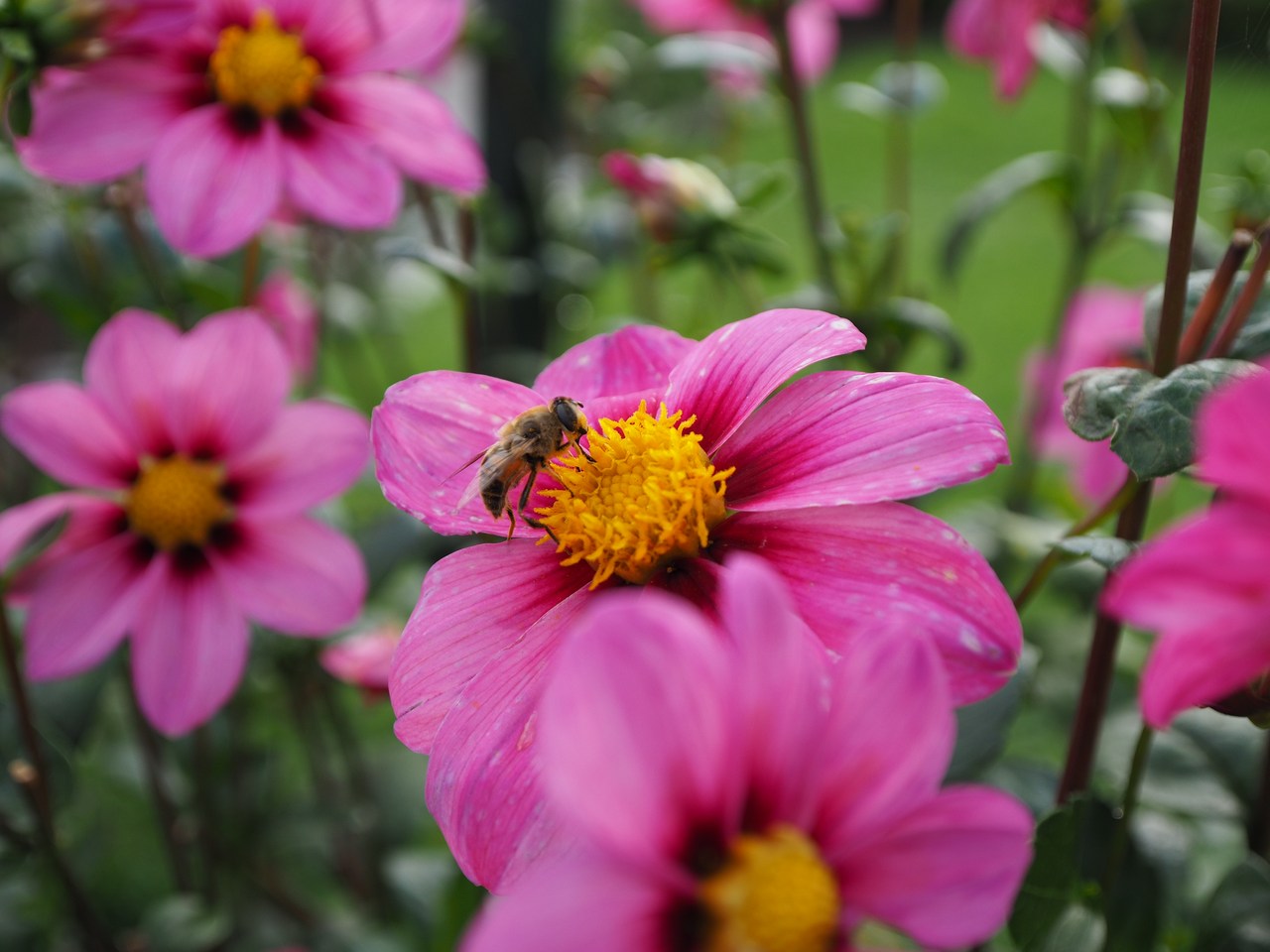
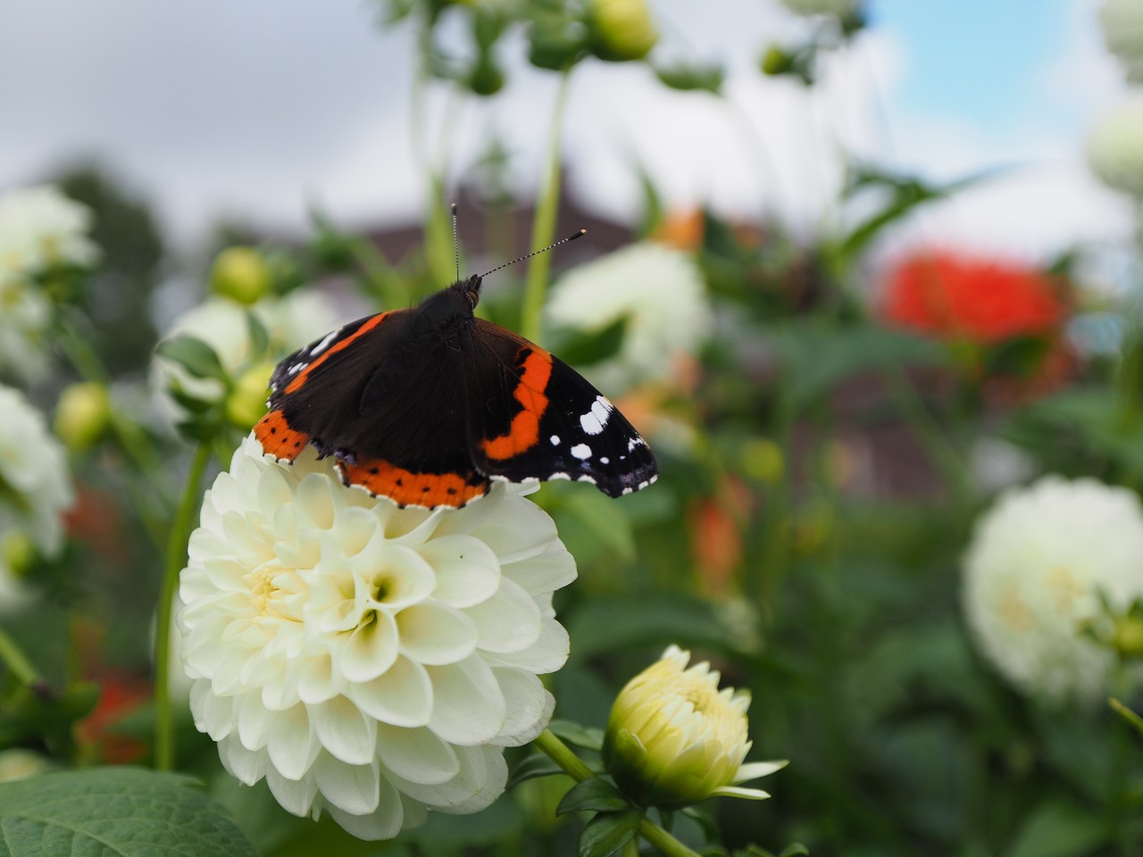
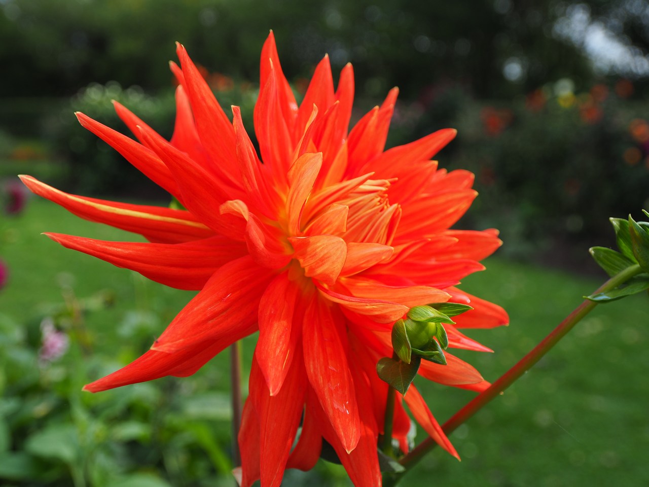
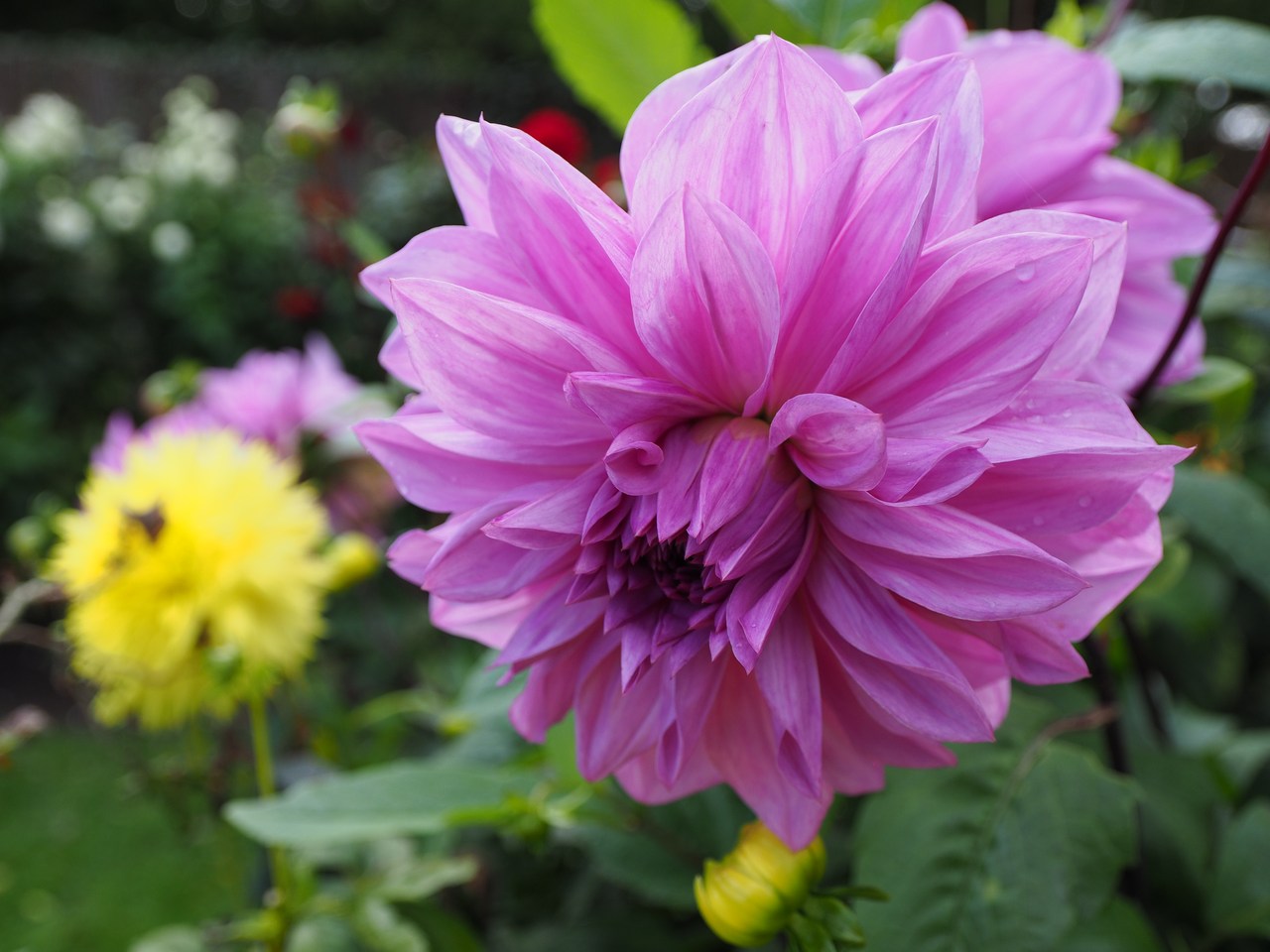
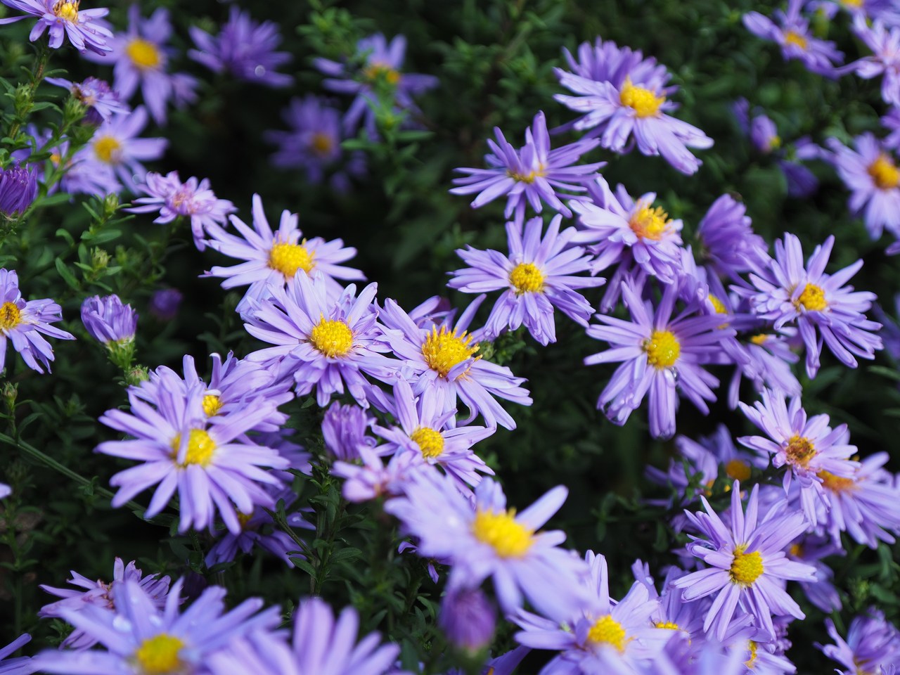
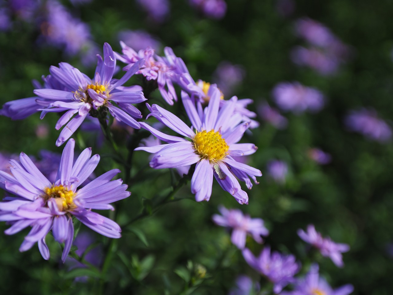
After we've looked at the art on display and watched the film, the weather has brightened and the sun is out and we take a stroll through the gardens, where there are surprisingly large numbers of flowers still in bloom. The Olympus 8-25mm/4 PRO lens is useful here because – even if it is technically not a macro lens – it focuses down to a few centimetres from the front element and that makes close-ups of plants and insects quite possible. One can also look from a distance at the construction site that is the actual Nolde house, and visit Nolde's (and Ada's) tomb in a former air-raid bunker that Nolde had constructed in the grounds during the war in order to protect his paintings.
From Seebüll we continue to the village of Süderlügum, which is notable for its convolution of Danish supermarkets. You can buy mostly sweets and alcohol at prices which are supposedly cheap if you're Danish and pretty much normal if you're German. The appeal to the likes of us is that they have stuff that is difficult to get elsewhere in Germany, like a large variety of speciality licorice (which is in any case way more popular in the north of Germany than, say, around where we live). We also stop at a Pølsehytten (“sausage hut”) for a hot-dog lunch.
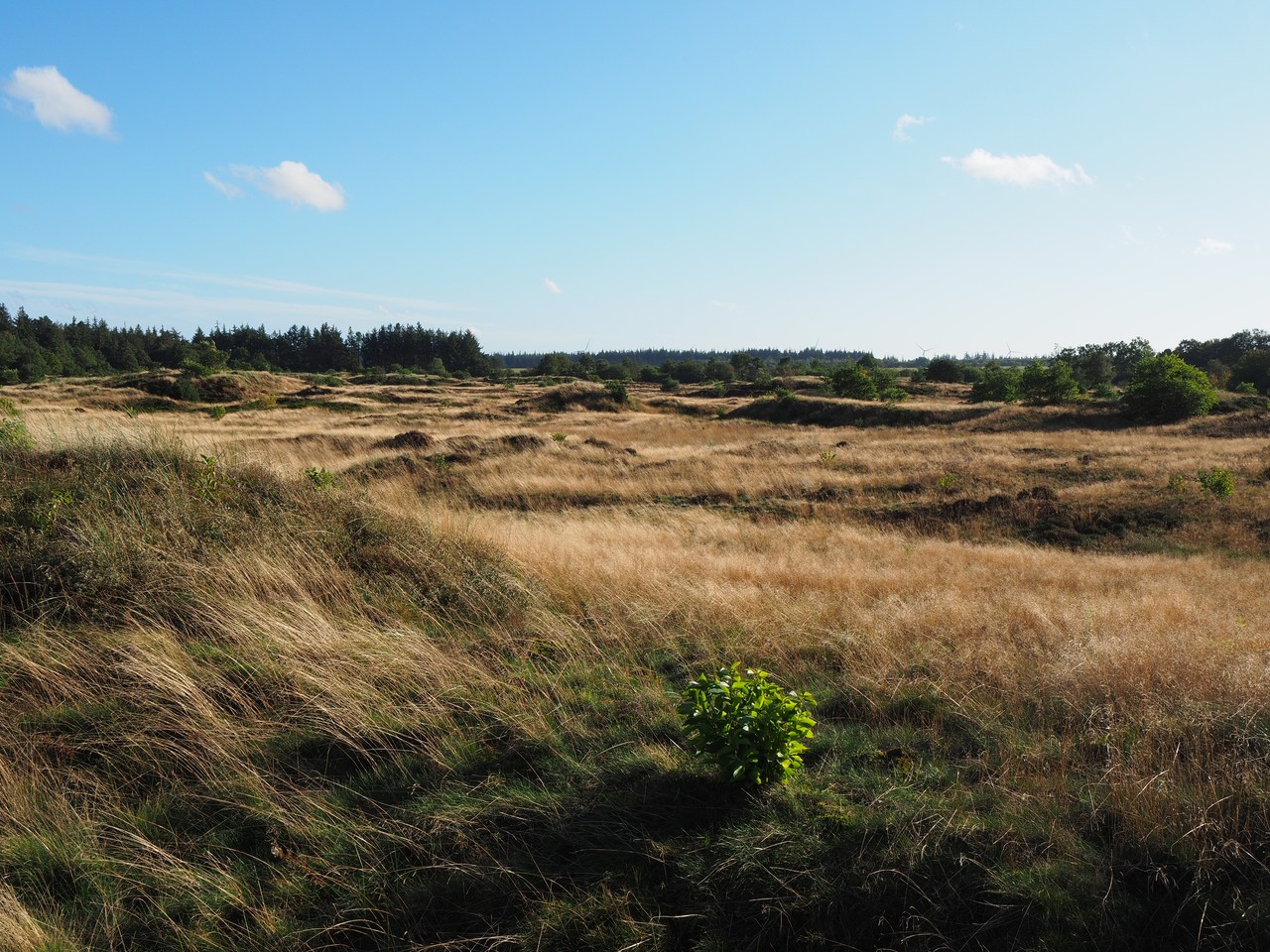
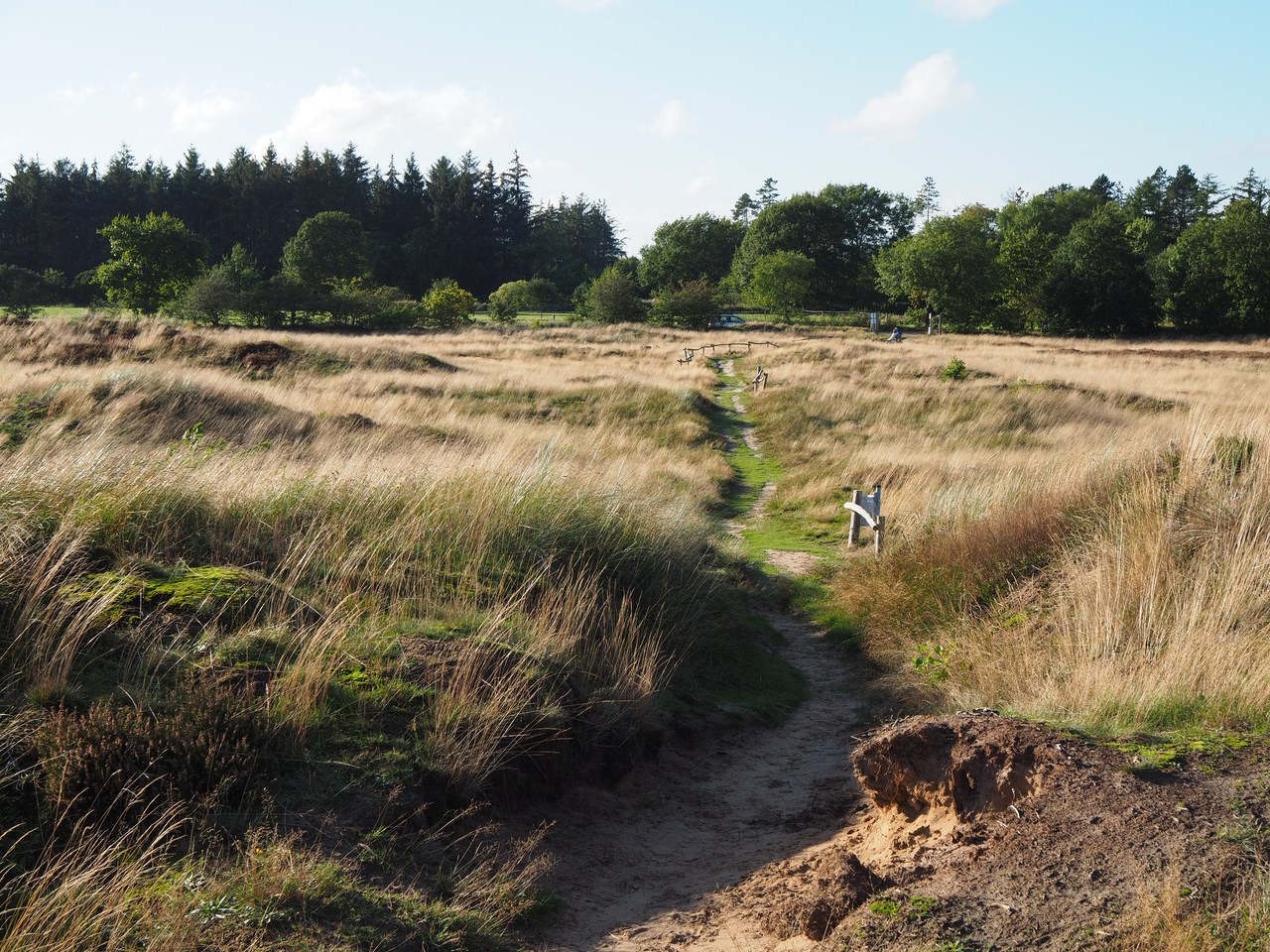
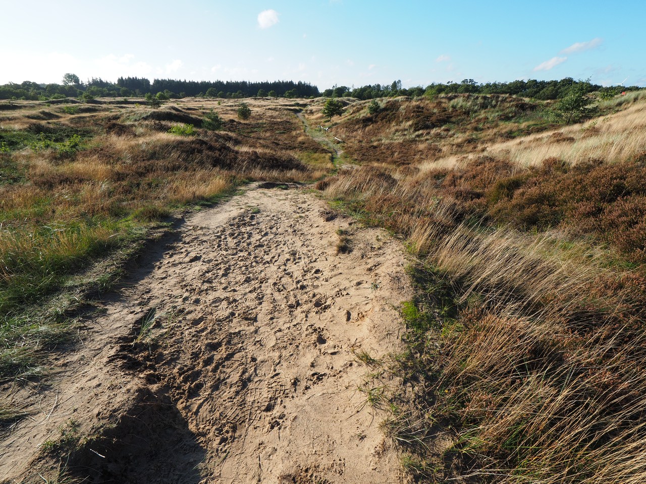
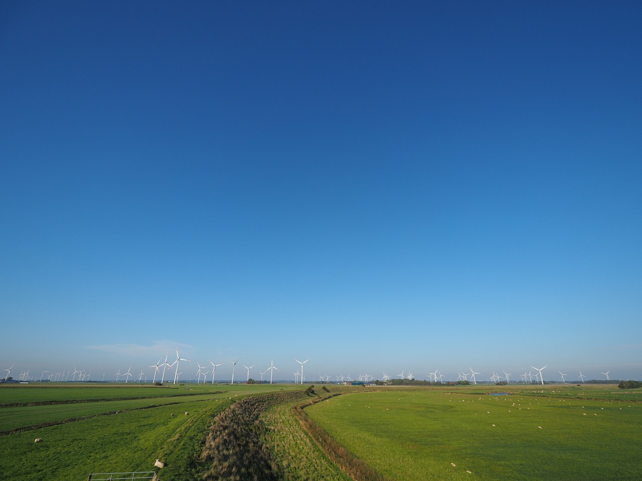
Our final stop today are the Süderlügum inland dunes, which is a nature reserve on the outskirts of the village. It is exemplary for a type of landscape that was much more widespread until (approximately) the Middle Ages, and presented issues for the villages in the area because large piles of sand could encroach on inhabited places and make trouble for the people there. They eventually figured out to plant marram grass on the dunes in order to stabilise the sand and make it stay in place. We take a brief walk across the dunes and back and then drive home again.
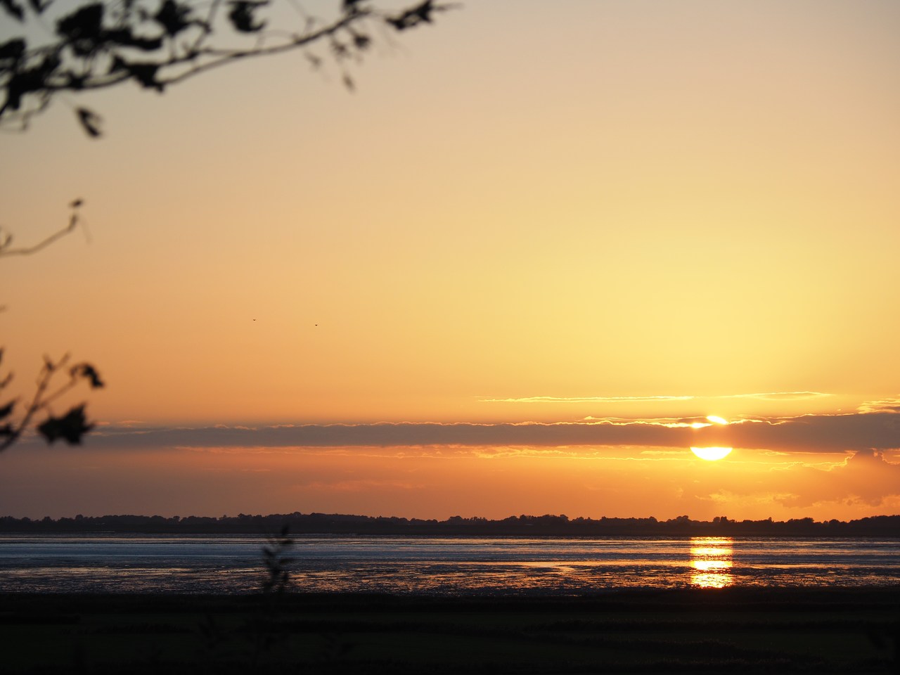
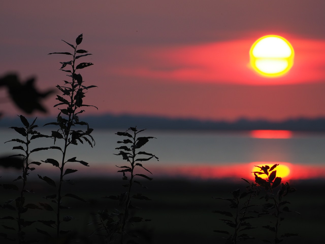
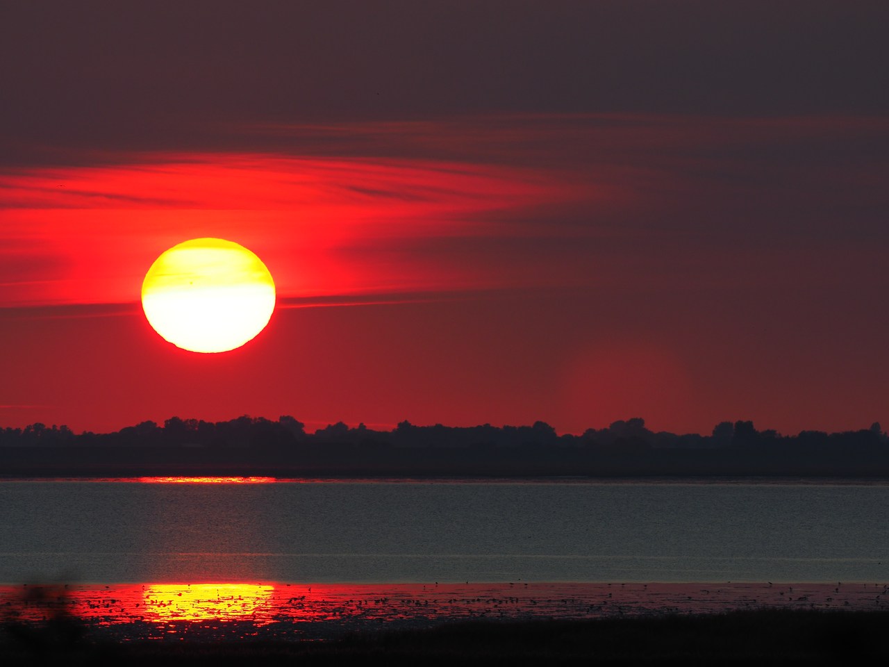
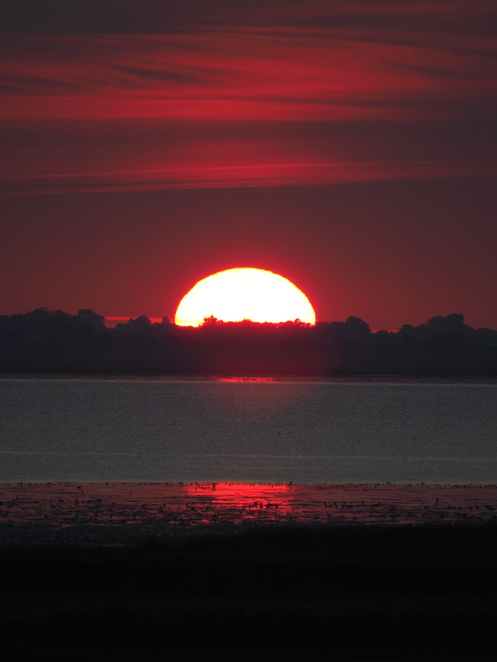
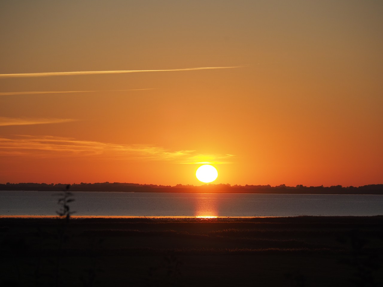
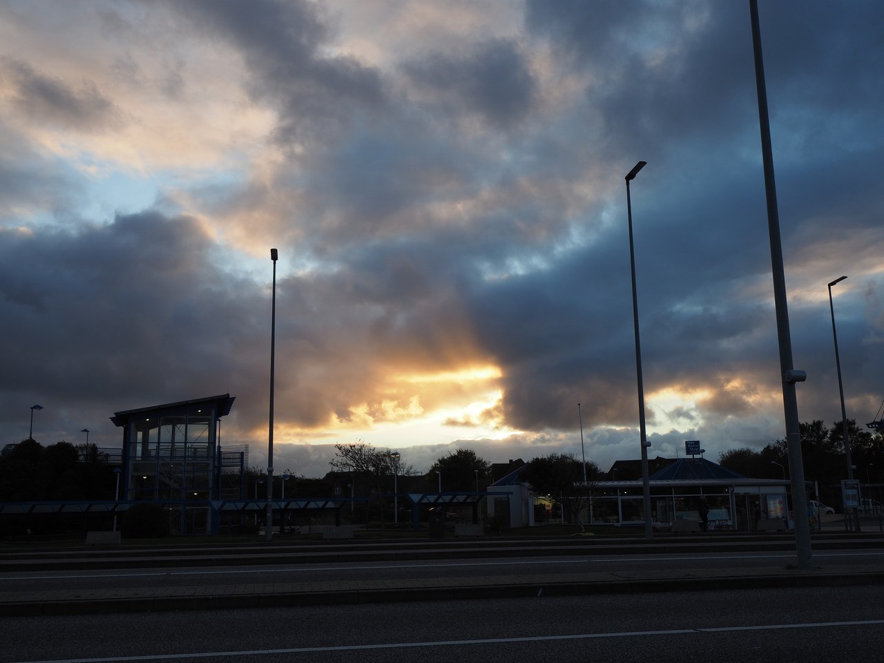
Today is the first time we can watch something resembling a sunset from our holiday flat window. Unfortunately there is a cloud bank immediately above the horizon which spoils the fun a little, but it's still better than nothing!
Dinner tonight is pasta in a mushroom/blue cheese/cream sauce, a staple recipe for self-catering holiday accommodation, washed down with some white wine from teacups because all our four wine glasses are in the dishwasher ready to be cleaned. We're not picky. Afterwards we continue with a few episodes of Shtisel before turning in.


5th October – Sand, Sea, a Lighthouse, and the “Red” Haubarg
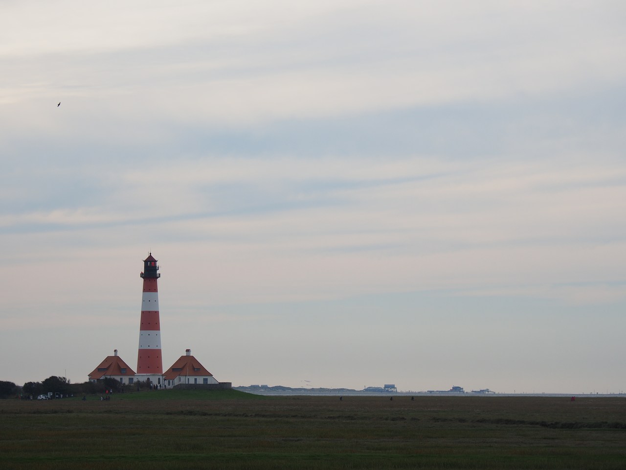
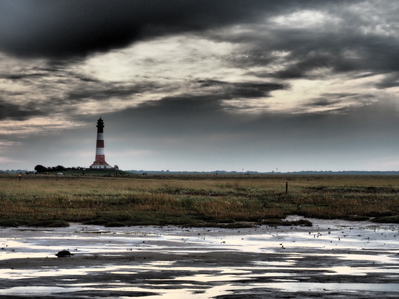
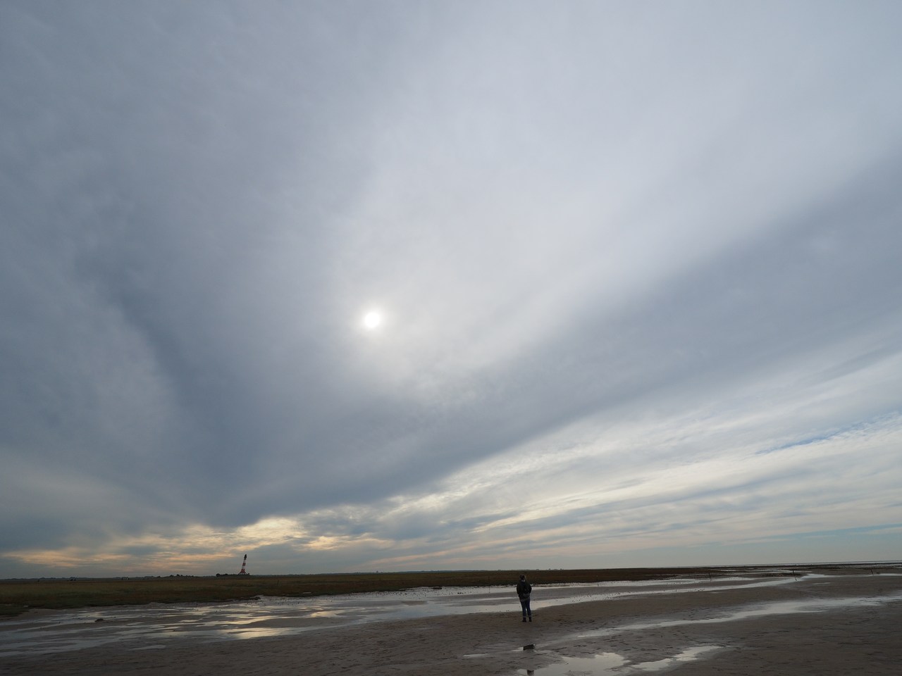
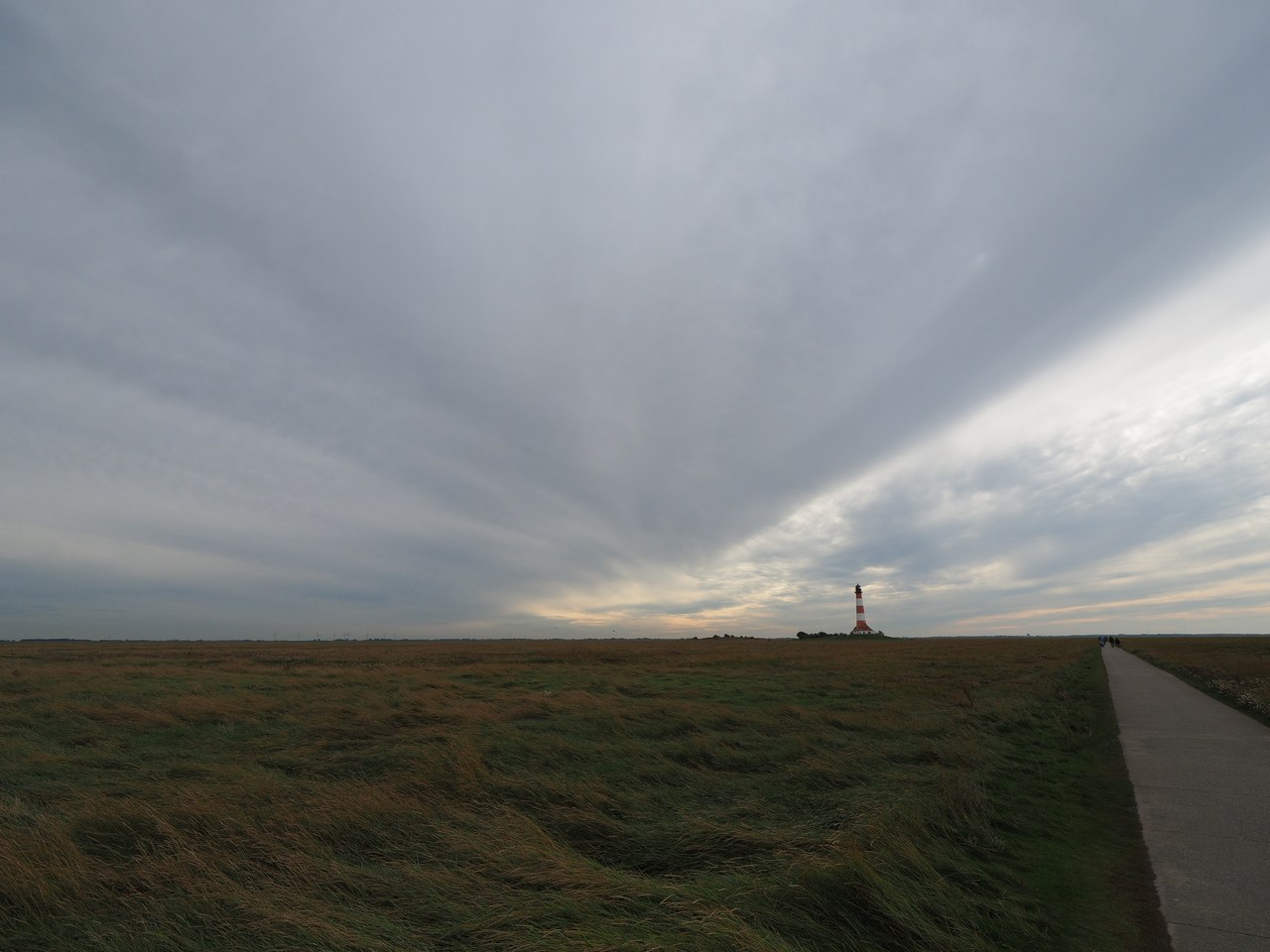
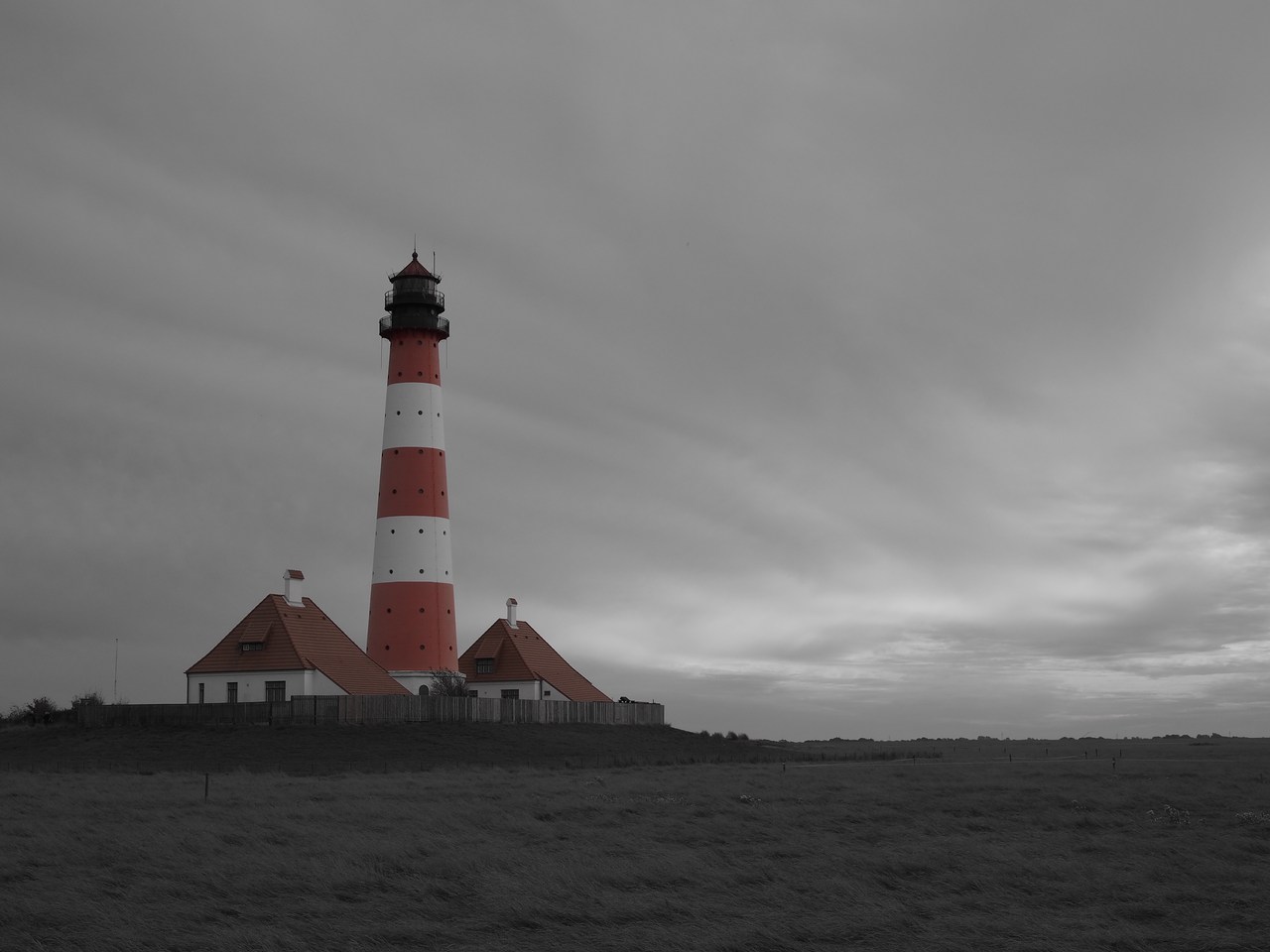
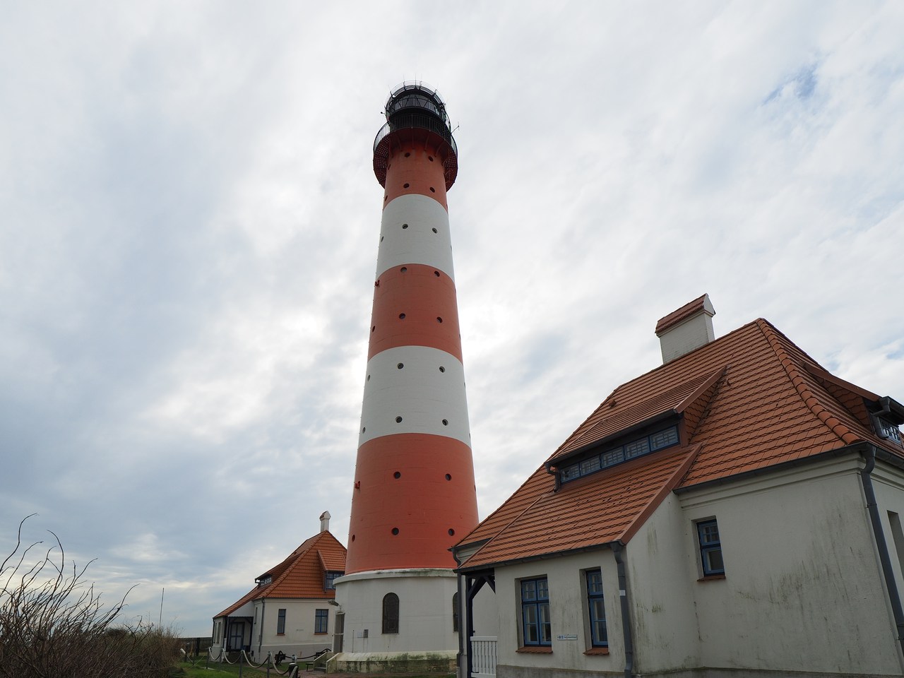
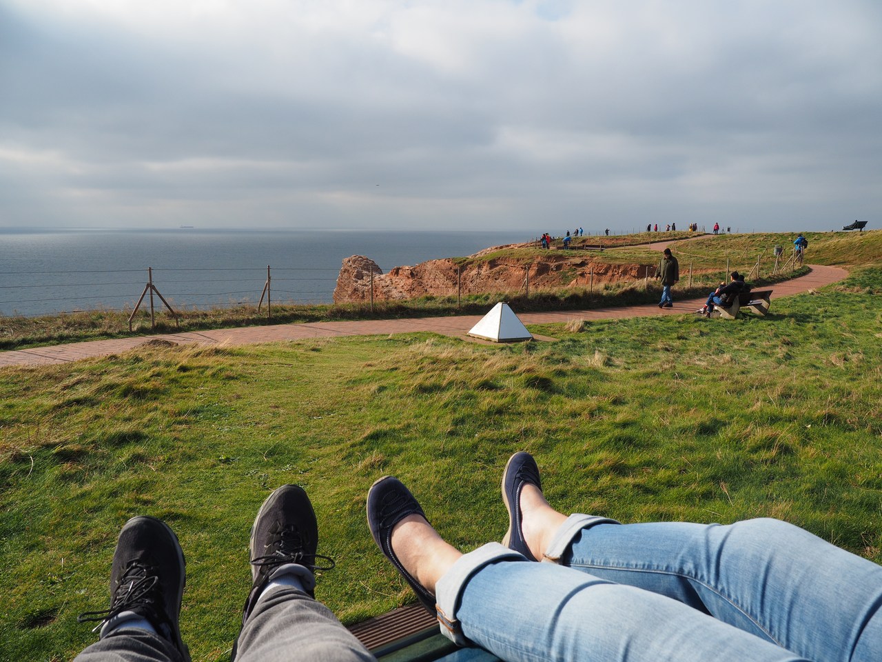
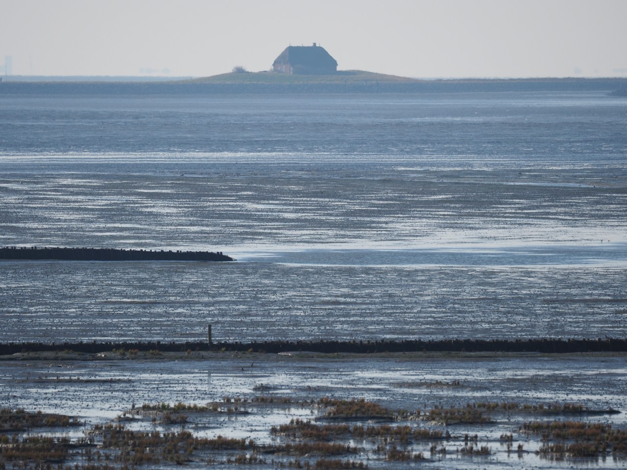
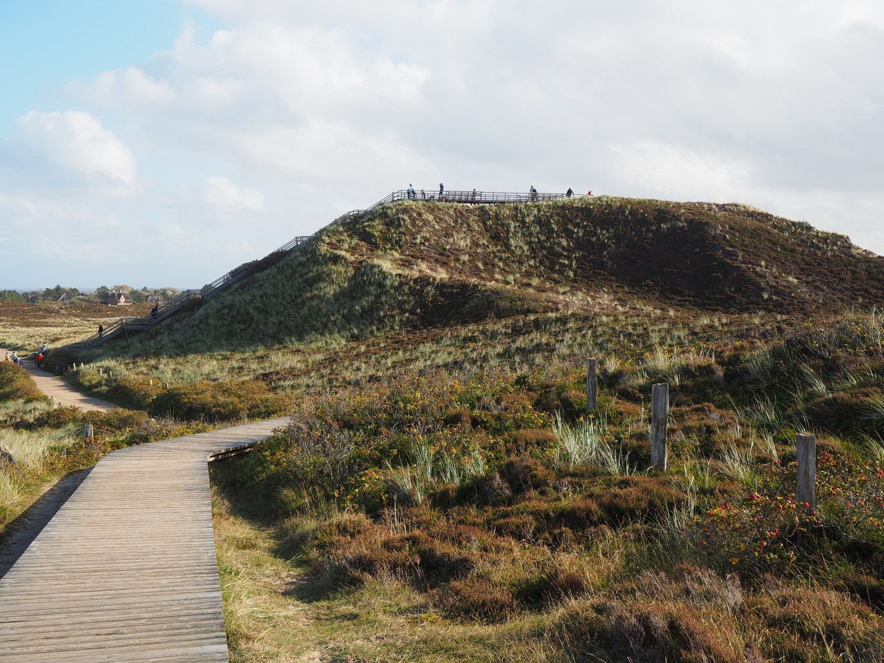
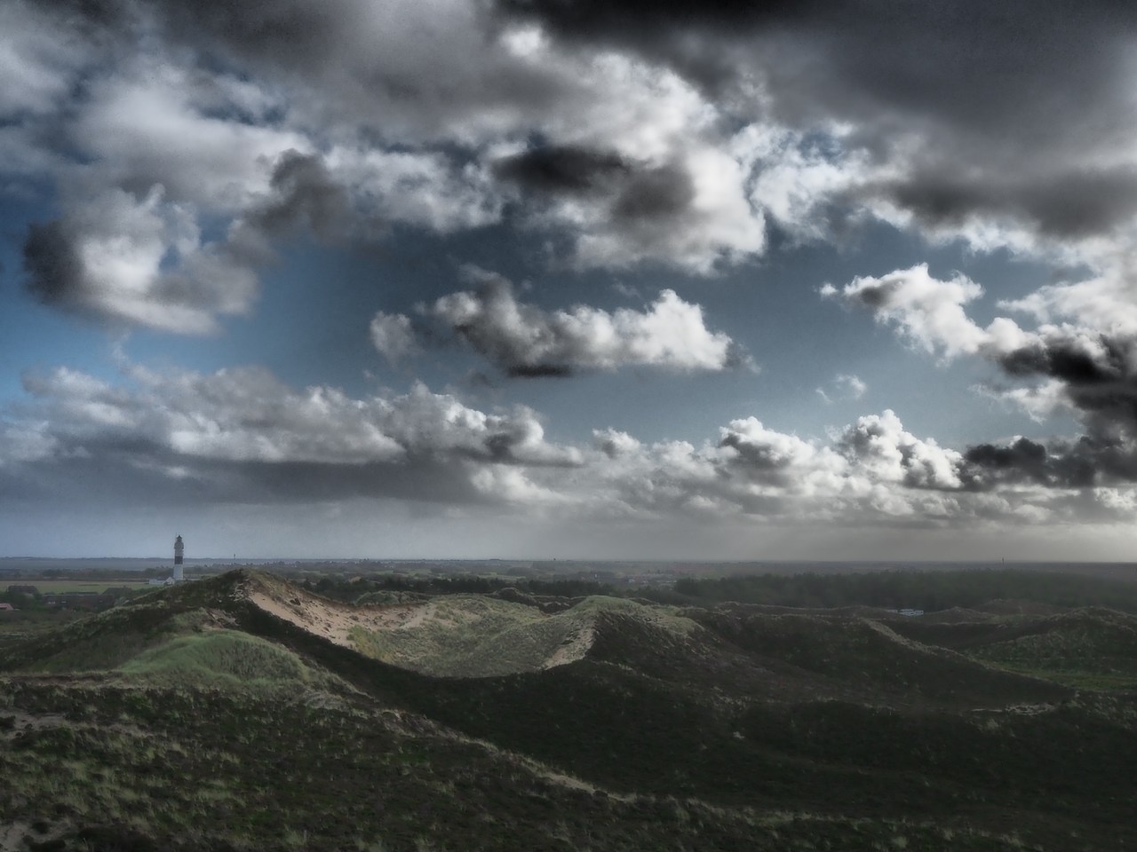
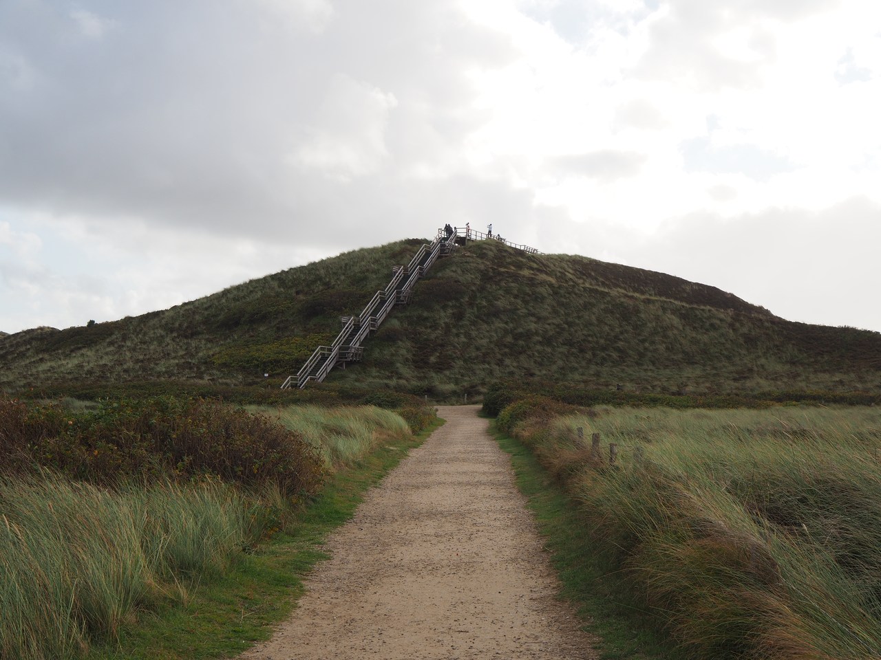
The weather forecast for today seemed pretty dismal, but in fact the actual weather appears to be not so bad, so we decide to visit the Eiderstedt peninsula south-west of Husum and, in particular, the Westerheversand lighthouse, which is considered to be the most iconic lighthouse in North Frisia, if not on all of the German North Sea coast (there's one near Greetsiel which would probably give this one a run for its money). People who watch German TV might be familiar with it from the Jever beer commercial, even though the town of Jever with its brewery is nowhere near here. It's a 45-minute drive along dike-top back roads that seem to become narrower and narrower, but at the end there is a fairly sizeable parking lot which is quite busy. The lighthouse is apparently a major tourist attraction.
From the parking lot you go past a visitor's centre and a snack bar, through a stile and then across the dike to the salt marshes of the foreshore. Instead of turning left to the lighthouse immediately, we continue straight on until we reach the sand flats – it's technically a little past high tide now but the sea is keeping a respectful distance. Lots of wet sand and tourists. It's approximately a twenty-minute walk from here through a nature reserve (i.e., stay on the footpath etc.) to the actual lighthouse.
The lighthouse itself was constructed at immense trouble and expense between 1906 and 1908 on a foundation of 127 long oak posts which were sunk 8 metres deep into the sand and then covered with concrete. It consists of a masonry base on which the actual tower rests – 608 cast-iron plates screwed together, for a total height of 41.5 metres. It's theoretically possible to climb to the top and enjoy the far-reaching vista across the Wadden sea and the Eiderstedt peninsula, but coronavirus restrictions mean that visits to the interior of the lighthouse are suspended for the time being. The twin houses that flank the lighthouse used to provide accommodation for the lighthouse keeper and deputy lighthouse keeper and their families, but since 1979 the lighthouse has been operating by remote control and does not require on-site staff. One of the houses is now used by volunteers who work for nature conservation and offer guided tours of the tidal flats or salt marshes, while the other serves as a training centre by the national park administration.
Unfortunately the old path to the lighthouse, which offers an interesting alternative route back to the visitors' centre, is already closed for the season, so we need to retrace our steps to get back to our car. Even so it is an impressive and enjoyable walk – the sense of emptiness and (if it wasn't for all the other tourists) solitude is overwhelming. One wonders what this place is like in winter, or for that matter during a storm when all of the foreshore is flooded and the lighthouse terp becomes an island in the sea.
On our way back we stop briefly at the Roter Haubarg, near the village of Witzwort. This is a ginormous farmer's house from the 17th century and in spite of its name isn't red but white – but the name derives from the fact that it used to be roofed with (expensive) red roofing tiles instead of the usual reed thatching. In a haubarg, the lord of the manor, his family and staff, and the animals all live under the same roof (albeit in different rooms) and there is also space to store things and a threshing floor. Having everyone (and everything) in the same house economises on the scarce building materials since only four outer walls are required. One interesting aspect of haubargs is that instead of resting on the walls, the roof is self-supporting and can keep itself upright even if the walls are blown in during a very severe storm; this also makes it easier to replace the brick walls, which in the rough North Sea climate is necessary every so often.
The Red Haubarg is so humongously big that according to legend it needed help from the Devil himself in its construction. In its place, as the story goes, there used to be a dismal little hovel inhabited by a poor farm labourer who was deeply in love with his rich neighbour's daughter – but, not surprisingly, his neighbour was less than enthusiastic about the proposed match. Therefore, the farm labourer – as one does under such circumstances – made a pact with the Devil and promised him his (the farm labourer's) soul if he (the Devil) could, overnight, build him (the farm labourer) a respectable house with 100 windows and finish before the first cock's crow in the morning. By the next nightfall Old Nick got to work, swept away the old hovel and constructed the new haubarg in record time. The farm labourer realised, to his horror, that he was about to lose the bet (and his soul) and in his panic went to his neighbour's house, woke up his prospective mother-in-law and told her about his predicament. She, obviously a smart and practical woman, went to the chicken coop and roused the rooster, which crowed loudly just as the Devil was putting in the 99th window – and thus lost the bet. Everyone presumably lived happily ever after, but we wonder why the Devil keeps making these pacts that inevitably seem to go against him in the end. – Today the Red Haubarg is a restaurant, coffee shop, and museum, and we originally wanted to stop by for coffee, tea, and cake, but unfortunately it is closed on Mondays and Tuesdays, so we have to leave without any of that.
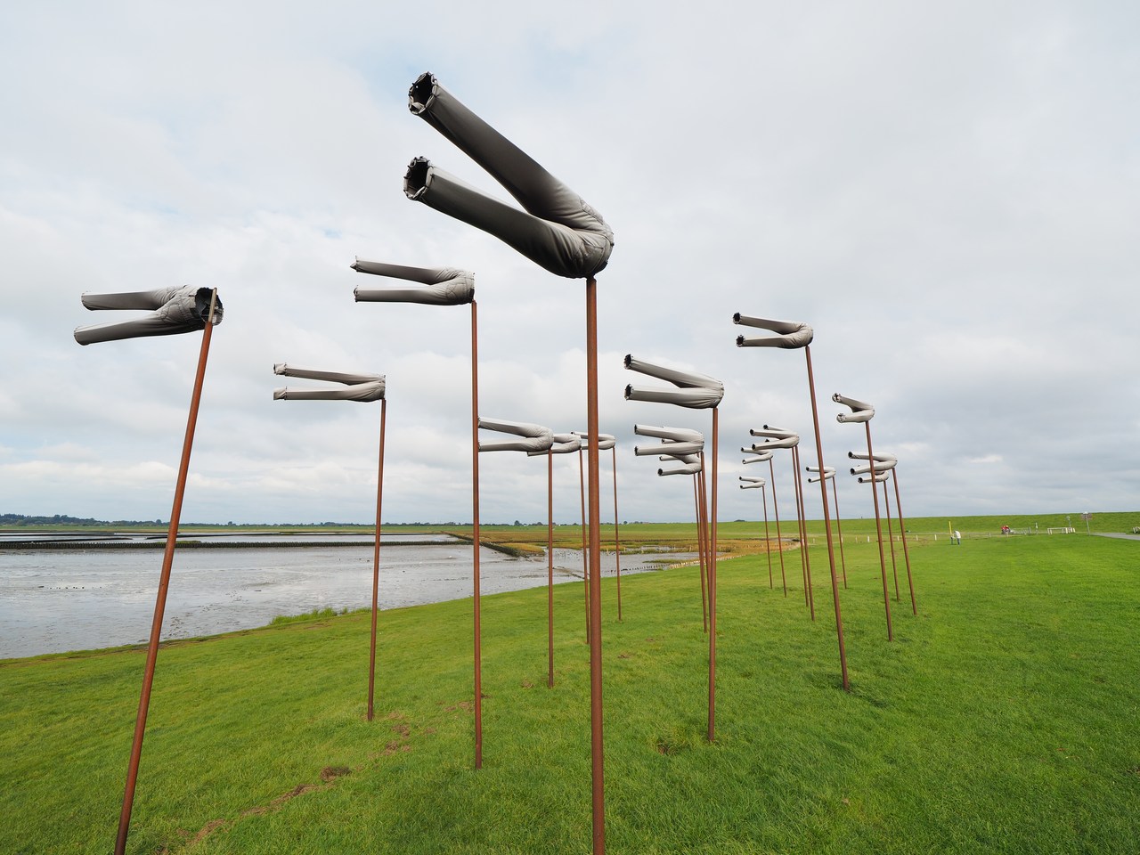
In our quest for refreshment we continue to the Dockkoog on the outer end of the Husum harbour entry. According to the guide book, from the parking lot there it's a pleasant 10-minute walk along the top of the dike to the “Wunderbar” coffee shop, but we find that this, too, has closed for the season. Too bad; we continue past it to a strange arrangement of metal “trousers” hanging from poles in the wind – these are obviously “Windhosen” instead of “wind socks” (but then of course a Windhose in German is a tornado in English, so the pun doesn't quite work).
Instead of a third attempt to visit a coffee shop, we decide to go grocery shopping (which we were going to do anyway) and pick up some cheese cake in the bakery there. We also purchase the ingredients for dinner, which today is a pizza on a pre-prepared dough base and some salad, and some other stuff for the next few days. Back home we enjoy tea and cake while the sun is setting over the Nordstrand peninsula, and after our pizza dinner watch yesterday's installment of University Challenge on YouTube plus another few episodes of Shtisel. The foibles of ultra-Orthodox Jews depicted in the series are both puzzling and entertaining; watching it takes considerable concentration because it is all in Hebrew with English subtitles (except for the Yiddish bits which we Germans can sort-of understand). We're probably going to finish it soon because there are only two episodes left after we're done for the day.


6th October – Vikings, Peat-Bog Bodies, and a Giant Globe
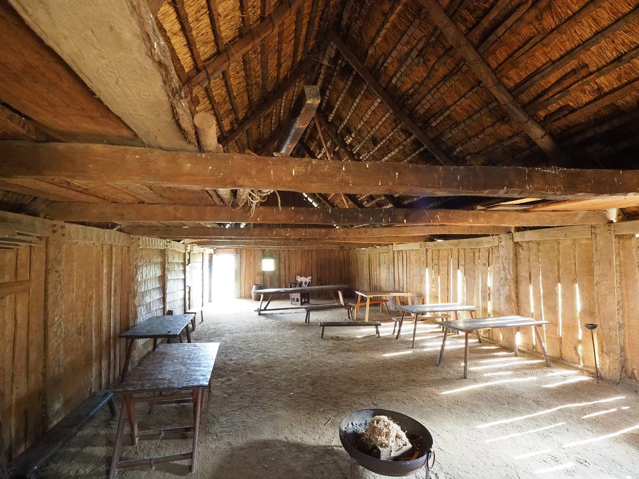
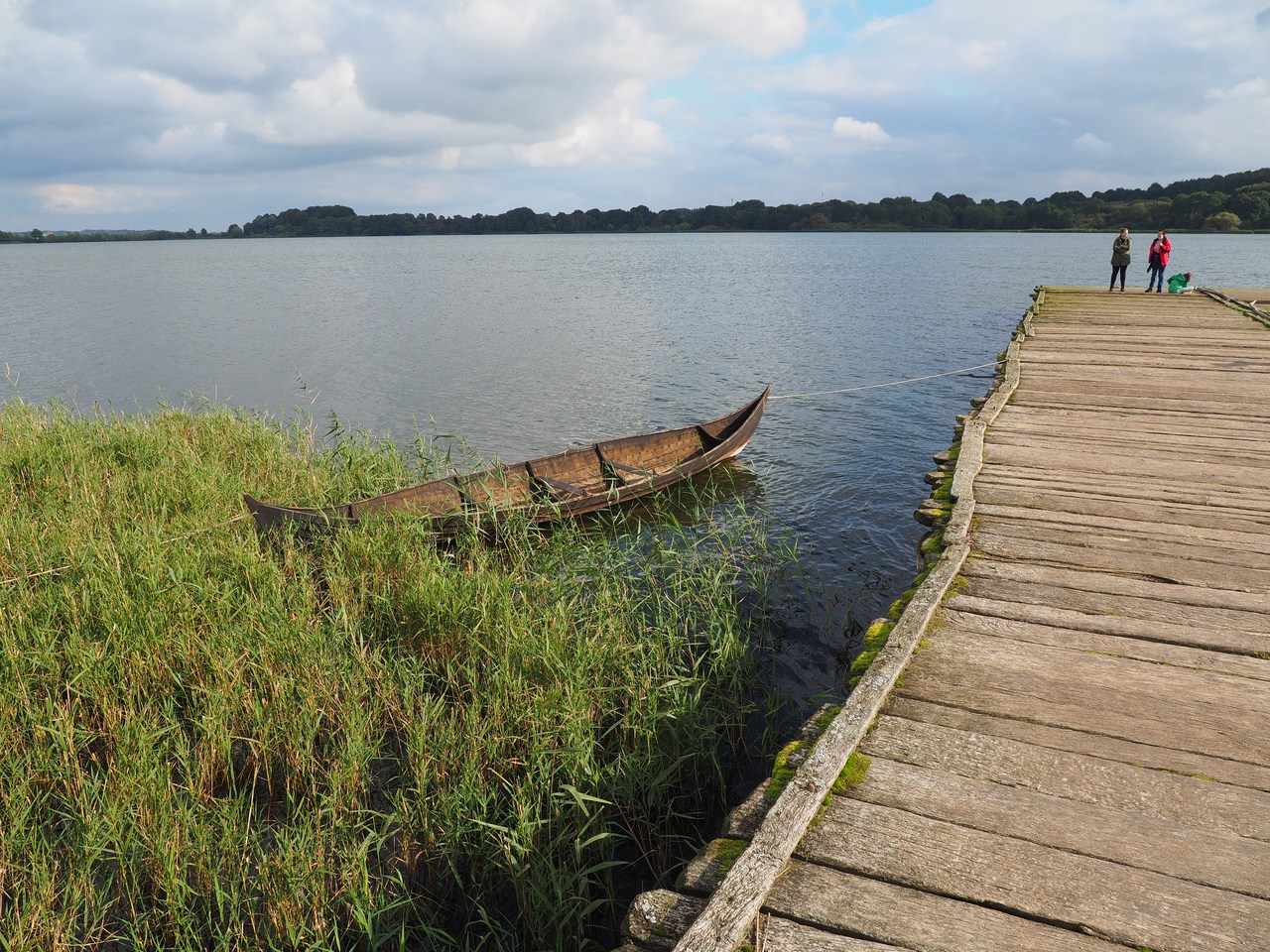
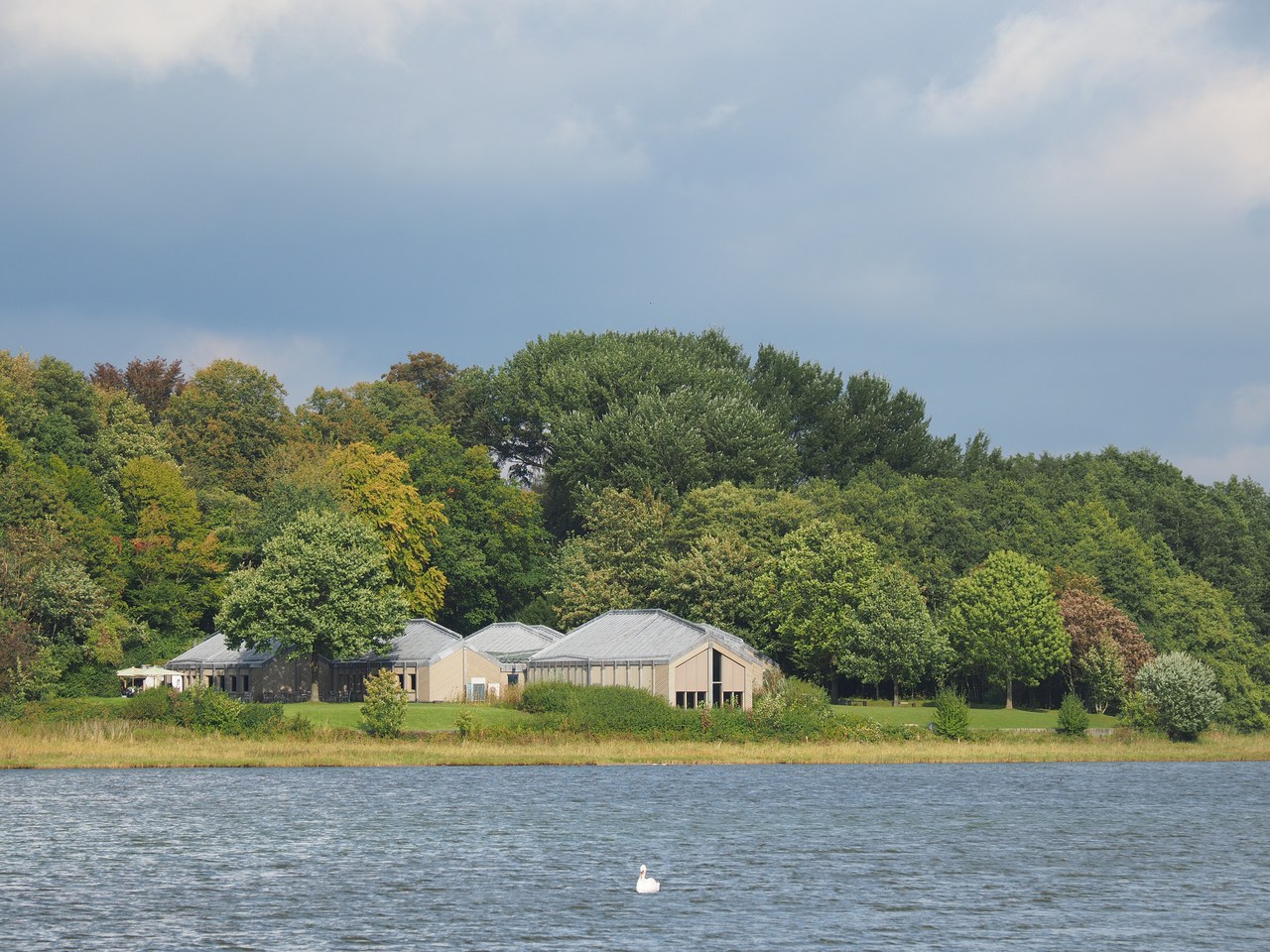
Today we're going east to the town of Schleswig, or specifically to some of the museums there. First on our list is the Viking museum at Haithabu, which in the 9th to 11th centuries was the main Viking trading place on the Baltic sea. Its location at the narrowest point of the Danish peninsula meant that goods could travel by ship 40 kilometres inland on the Schlei (a Baltic sea inlet) to Haithabu, then 18 kilometres overland to the Treene and Eider rivers and from there, once more on ships, to the North Sea. The alternative would have been a long and very dangerous sea voyage around Jutland. I actually visited the museum once almost 30 years ago, but it looks completely different now – it is very modern and contains lots of very well-presented artifacts illustrating the lives, activities, customs and history of the people here. Notably very little is said to cater to the popular cliché of Vikings as fearsome, brutal raiders – Haithabu is all about peaceful trade with goods arriving from all over Europe and as far afield as Buchara or even China.
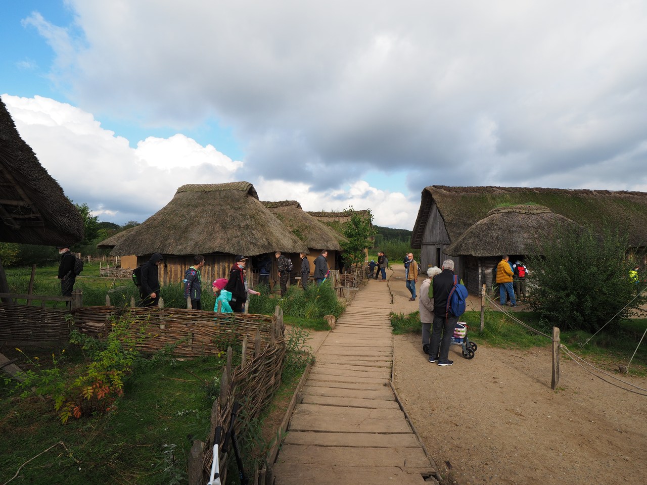
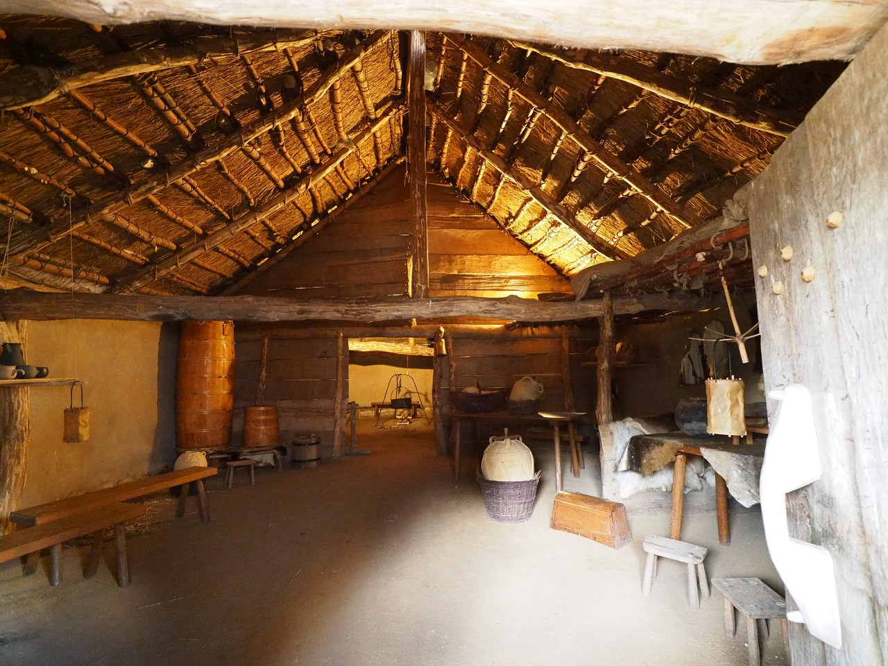
There's also a relatively recent reconstruction of a number of houses from the actual village, put up where the village was actually situated (a few minutes' walk south of the museum). This is very interesting but again, no horned helmets. (For the record, the Vikings didn't use those – nobody wanting to survive a fight would put something on their helmet that would catch an enemy's sword or spear instead of deflecting it; horned helmets are basically a 19th century invention by Wagner-opera prop designers.) This as well as the museum are very busy indeed with school groups on top of the usual tourists; the Viking museum is one of the main tourist attractions in the state of Schleswig-Holstein but it's well worth braving the crowds and coming here.
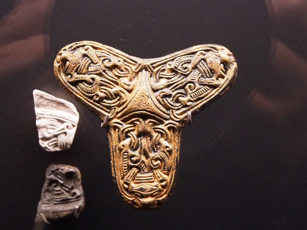
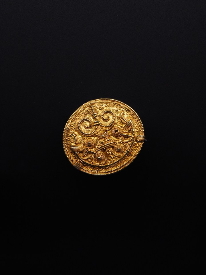
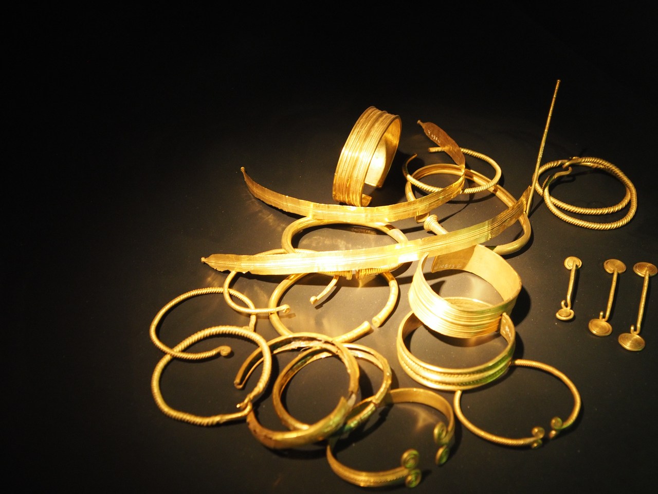
From Haithabu we continue 10 minutes up the road to Gottorf palace, which is located on a small island and houses the Schleswig-Holstein state museums for archaeology, art, and art history. This is still fairly busy but much less so than the Viking museum, which only goes to prove that Vikings are cool (according to Marie, they're “the older kids' dinosaurs”). We're mostly interested in the archaeology parts because unlike the art section they have stuff that can't be seen anywhere else, including lots of finds from peat-bogs in the area that are uniquely well-preserved. On the gruesome side, this includes a number of human bodies which (usually for reasons difficult to figure out after the fact) ended up in the peat bog and were basically mummified, but there are also many other items such as tools and especially weaponry – apparently there used to be wars between the Germanic tribes in the area where the victors would throw all the losers' stuff into a convenient peat bog by way of sacrifice. Good for archaeologists today, who have loads and loads of swords, arrow and spear heads, etc. to study.
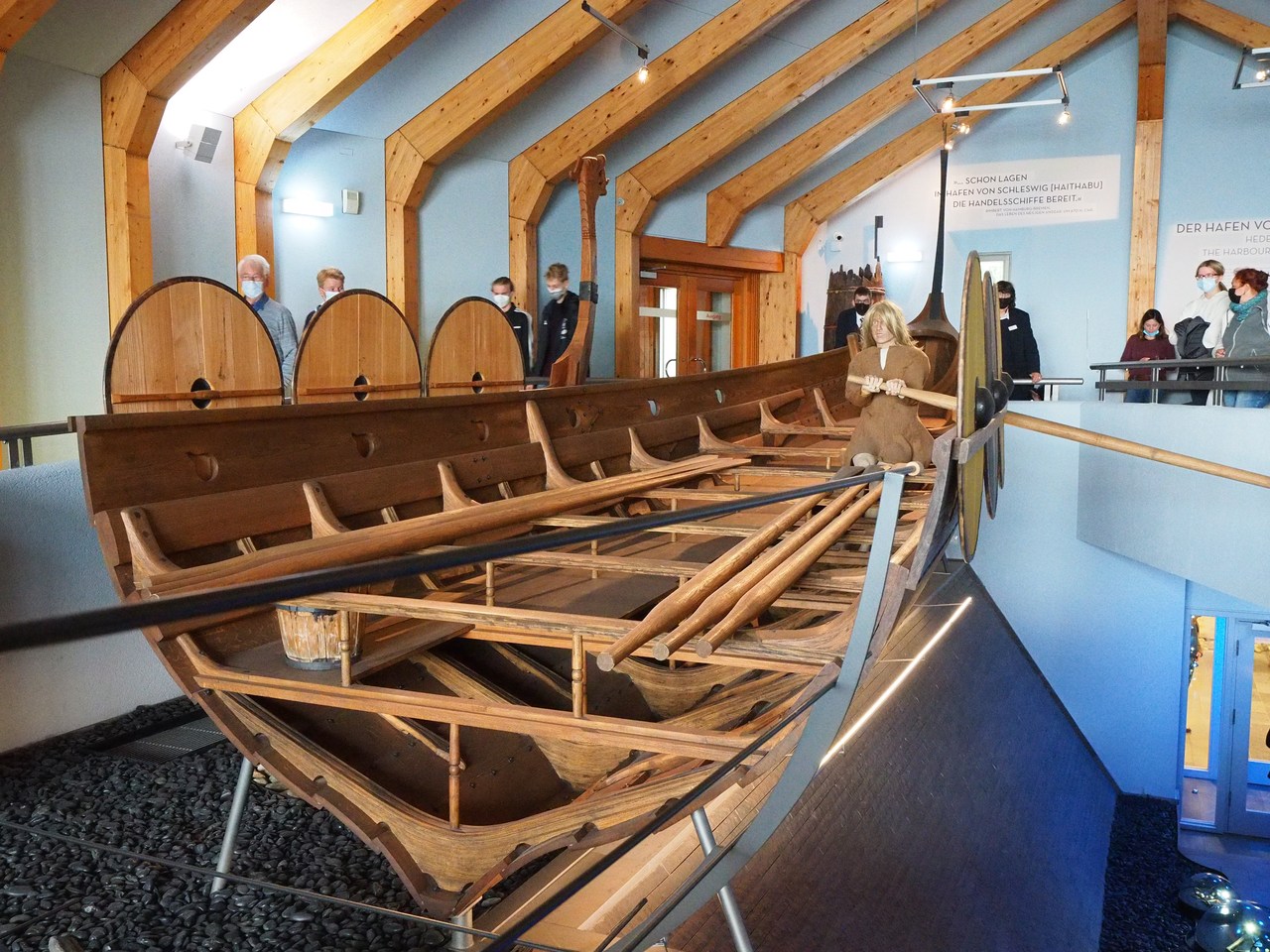
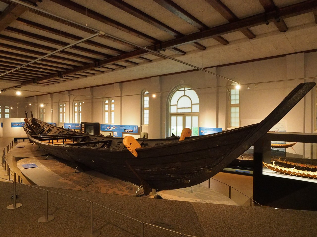
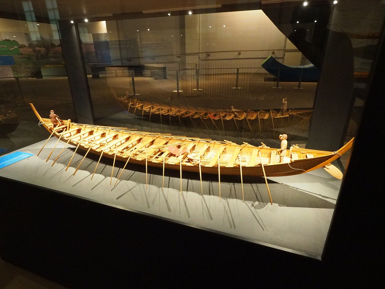
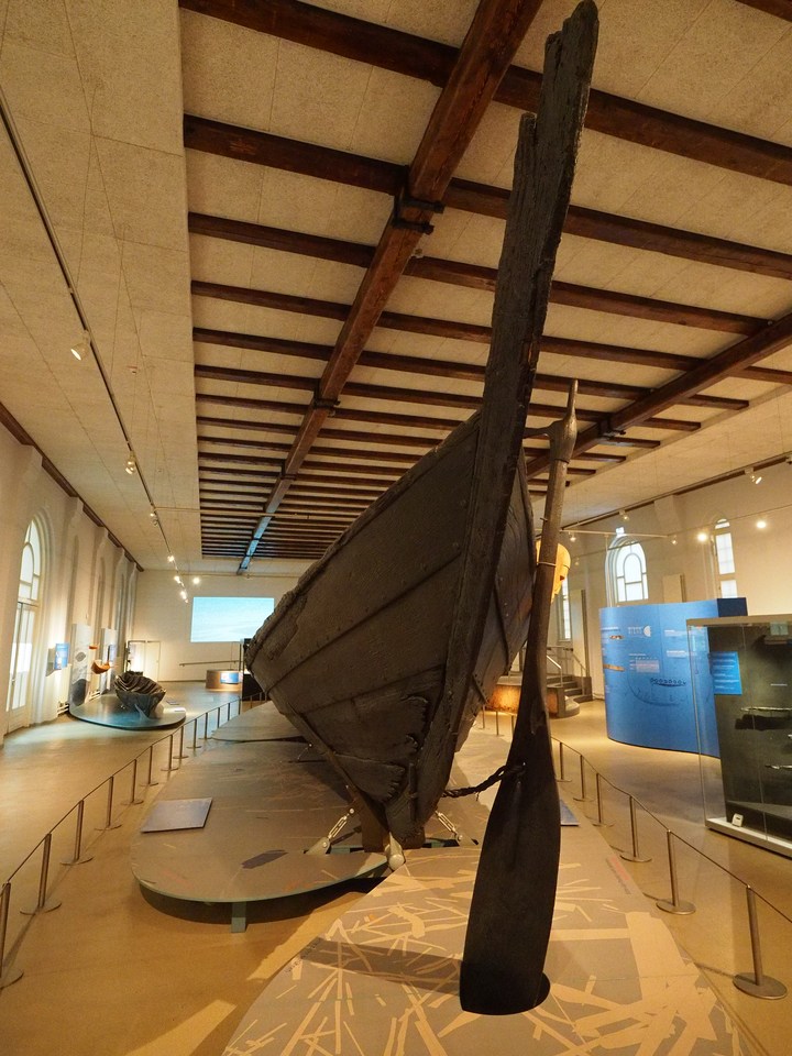
Pride of place goes to the Nydam boat, which was originally built in the 4th century CE and deliberately sunk in the Nydam peat bog (which today is located in Denmark) where it was found in the mid-19th century. This is a very large rowing boat – 23 metres in length, 15 pairs of oars – whose wooden parts were preserved by the peat and reassembled into something resembling its original shape after it was found (the received wisdom today is that it ought to look a little different – deeper and more V-shaped – but it's now impossible to change). Still, it is a very impressive artifact and invites comparisons to the Viking ships on display in Oslo, which we visited a few years ago.
After the main archaeological museum and before going to see the boat, which is in a separate house next to the palace, we stop in the cafeteria to buy some fruit juice and cake – a slice of a very nice nut-and-marzipan gateau, and another of the Friesentorte, an amazing concoction with plum jam, a choux-pastry lid, and lots of whipped cream.
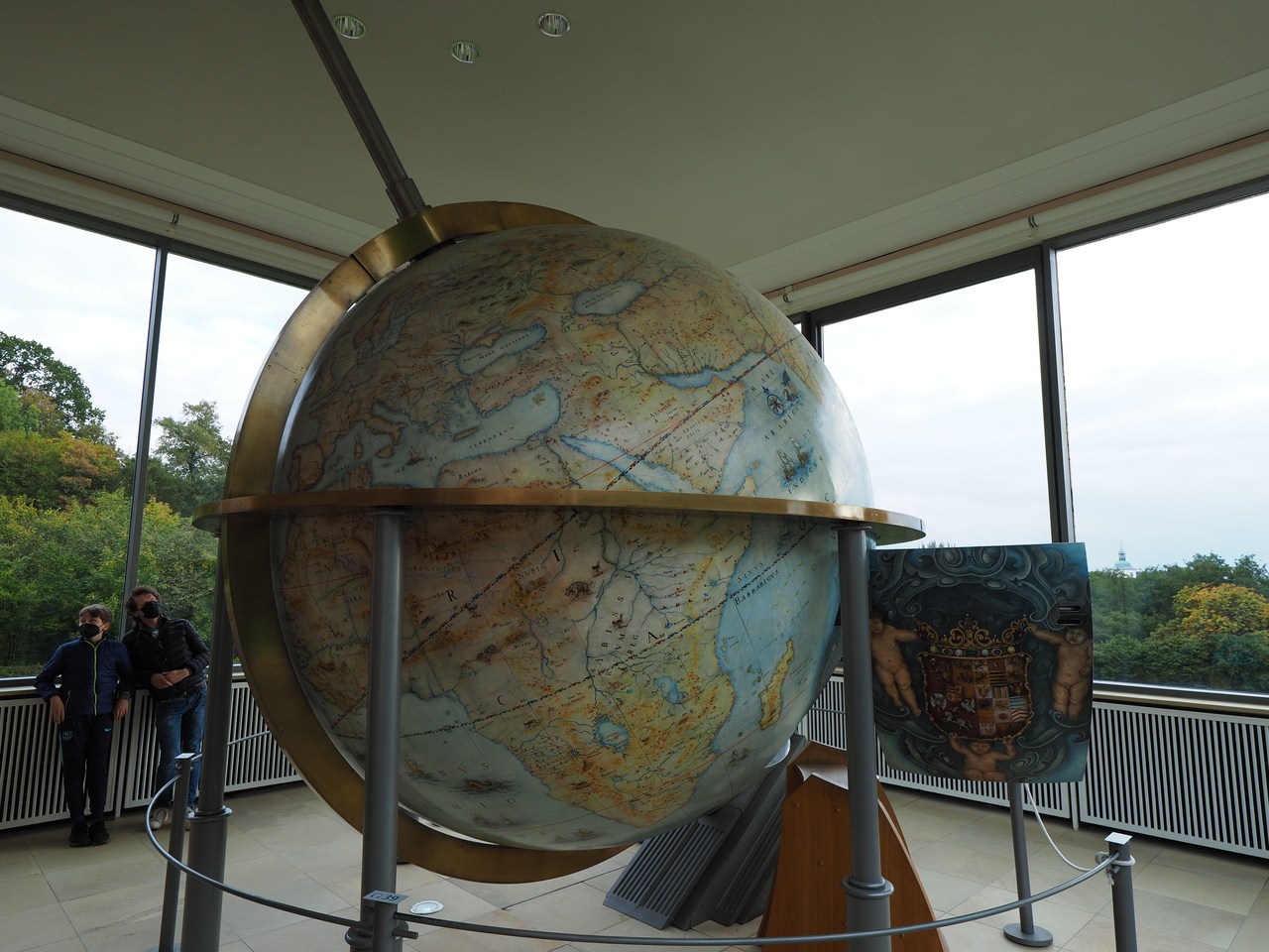
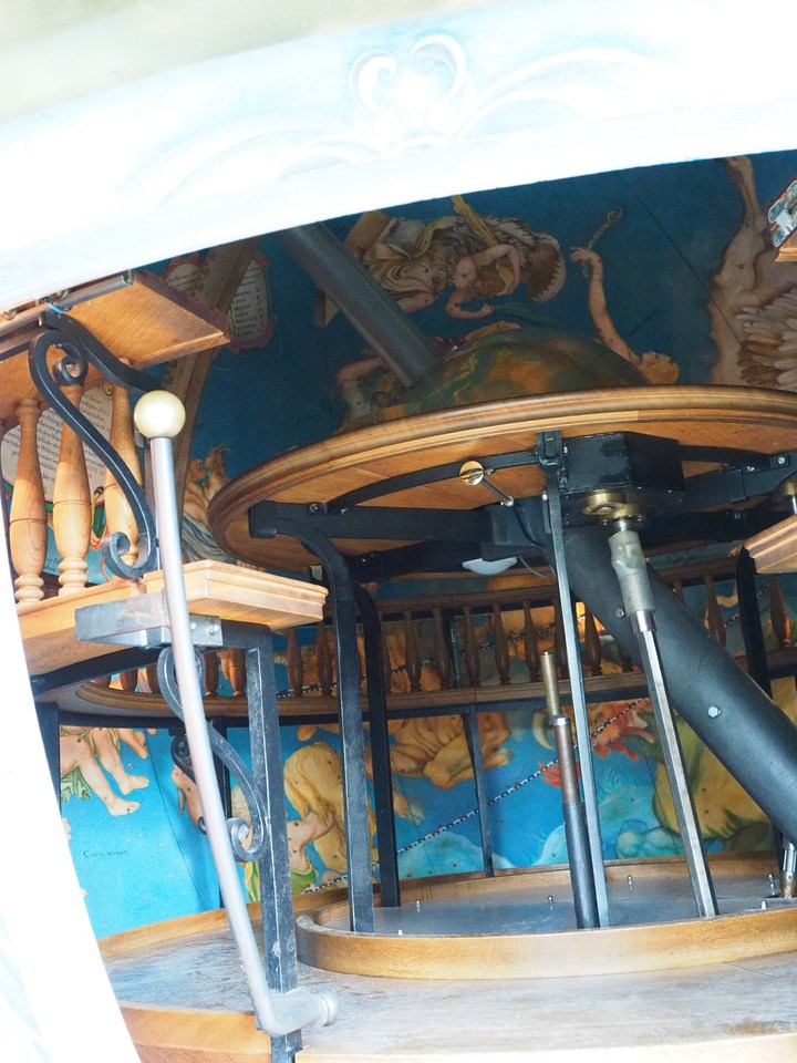
From the main palace it's a short walk to the Baroque garden (the earliest one north of the Alps) and the house containing the Gottorf Giant Globe. This is a reconstruction of a 3-m-diameter globe originally built for Duke Frederick III of Gottorf between 1650 and 1664. It has the continents and seas of the Earth on the outside and the constellations of the sky on the inside – it features a large hatch that lets up to 12 people sit inside and watch the stars, lit by candlelight, move by. There is also a contraption that moves a crystal model of the Sun along the ecliptic and therefore helps illustrate the annual as well as daily movement of the Sun in the sky. In effect, this makes the Gottorf globe the first large-scale planetarium. The original globe had an intricate water-driven mechanism that would make it move while the modern reconstruction, for safety reasons as well as (probably) convenience, uses an electric motor. (Unfortunately due to COVID-19 restrictions we don't get to sit inside the globe.)
The globe became internationally famous, and was visited in 1713 by the Russian tsar, Peter the Great, together with the Danish king Frederick IV. Unfortunately the duke of Gottorf had sided with the Swedes during the Great Northern War and lost, and that meant that Peter, who rather liked the globe when he saw it in Gottorf, could arrange to have it shipped to St Petersburg as spoils of war. Unfortunately much of it was destroyed in a fire in 1747, and today only the metal parts are left. The new globe currently in Gottorf is based on the metal construction of the original, while the cartographic designs derive from similar smaller globes in Heidelberg and Vienna.
After the globe we decide that this was enough for the day and drive home (this takes three quarters of an hour or so, depending on how often a tractor or other piece of agricultural machinery creeps along the road in front of you). Since we already had cake today, the remainder of yesterday's cheesecake rests safely in the fridge, but we prepare pasta all'amatriciana for dinner and chase that with part of a new tub of the Traum von Eiderstedt while we're watching the final two episodes of Shtisel. Then it's off to bed early because we have big plans for tomorrow!


7th October – Anchors Aweigh!
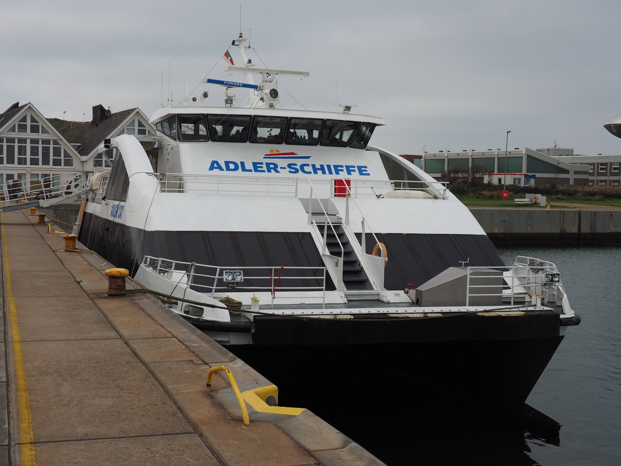
We're getting an early start today because we have a boat to catch at Strucklahnungshörn on the Nordstrand peninsula. This is a 20-minute drive from our holiday flat and we're supposed to be there by 9am at the very latest! Fortunately we make it with time to spare. This is the Adler Express, “the fastest boat in the Wadden Sea” and it conveys passengers between Nordstrand and the village of Hörnum on the island of Sylt, with various stops in between. We're travelling on it as far as the island of Amrum, where we're going to change onto the Adler Cat, an even faster ocean-going boat that will take us to the island of Heligoland.
We're not the only people with such plans, apparently, so we're happy to have been there early because it means we get reasonably good seats near the side of the open rear deck (we could sit inside, too, but where's the fun in that?). The boat leaves on time and calls at the island of Pellworm before zooming past some Halligen (Nordstrandischmoor, Hamburger Hallig, Gröde, and Langeness). A Hallig is a very low-lying island in the Wadden Sea; they tend to get flooded and therefore all houses are constructed on Warften (terps, artifical mounds of earth) to prevent them from damage. The boat then stops at Hallig Hooge, which is the second-largest hallig (there are 10 in total) and very well known as a nature reserve, before depositing us on the jetty in Amrum. This is where three different ferry services interconnect, and in the resulting chaos we're being shepherded onto the Heligoland boat by a young lady who also describes in very colourful language the various effects of seasickness and what to do about them (in a nutshell: there are barf bags near your seat, and you're supposed to use them if necessary; don't use the railing because the boat goes so fast that you won't hit what you're aiming at). The Adler Cat is a catamaran which runs at 30 knots (55 km/h) and takes somewhat more than one and a half hours from Amrum to Heligoland. Fortunately the North Sea is very smooth today and no barf bags are being used.
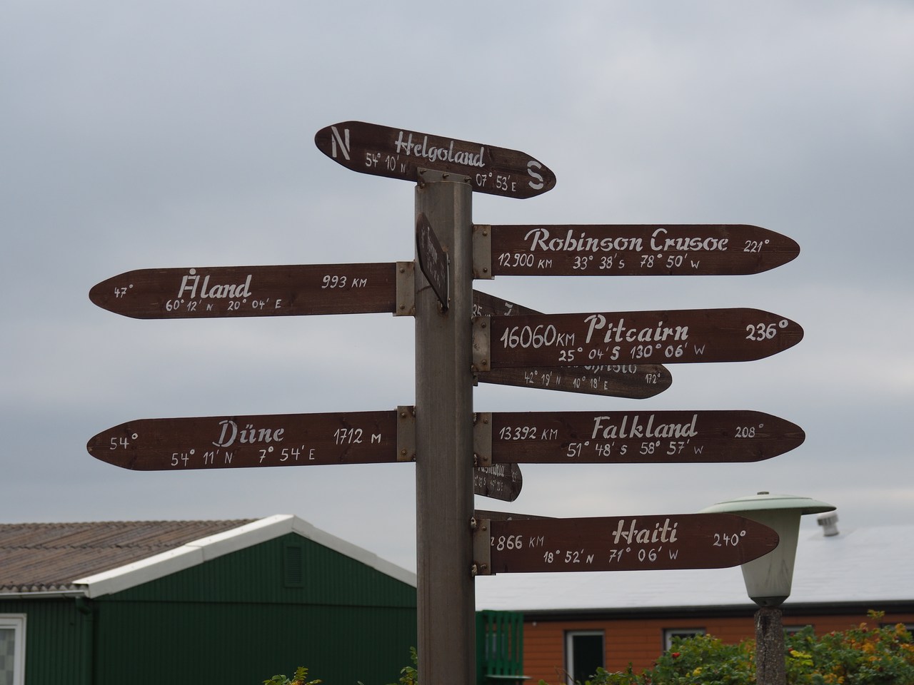
We set foot on Heligoland at 1.30pm or so and have been exhorted to be back at the jetty by 4pm, so that gives us two and a half hours to explore Germany's sole offshore island. The fact that, by a quirk of law, it is considered separate from mainland Germany and therefore VAT does not apply means that it is a shopping paradise for expensive items such as bottles of single malt whisky (among other spirits), designer clothes, etc. – in theory we're supposed to pay import duty but there are certain amounts of stuff one can take into the country duty-free, and there are other ways to game the system (the single-malt whisky outlet stresses on its web page that it is possible to take two 0.7-litre bottles of whisky because, even though there is a legal duty-free limit of 1 litre of spirits, duties of less than €3 in total aren't charged, and the duty payable on 0.4 litres of spirits is less than that – you just need to declare your uisge beatha but won't have to pay the duty). This is all very interesting but we have no plans to go whisky shopping this time.
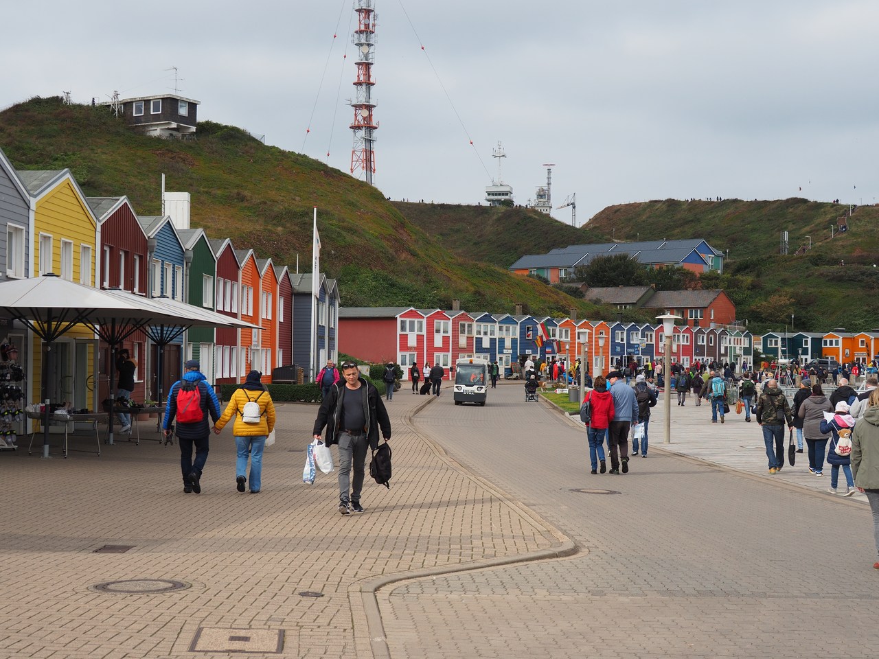
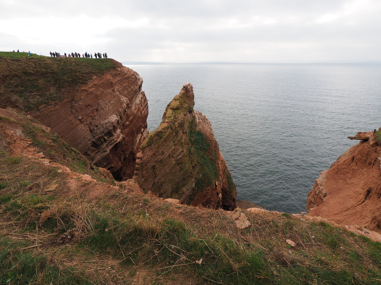
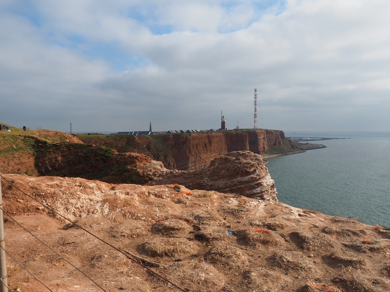
Instead we go past the colourful Hummerbuden (“lobster shacks”) that line the street from the jetty to the village – these used to be the fishermens' tool sheds but are now used by small shops, food stalls, or galleries – and ascend via a steep lane and a set of stairs to the top of the red sandstone cliffs that form the main part of the island. We go past the “upper village”, whose cliff-front presents itself as yet another succession of shops and restaurants, and through a Kleingartenkolonie (allotment area) before reaching the grass-covered open clifftop area that makes up most of Heligoland. The island is approximately 1 km² in size and roughly triangular and there's a 3-odd kilometre hiking path that runs all the way round it along the cliff edge (which, this being Germany, is of course fenced off for safety). Our plan is to take a walk round the island, which is perfectly feasible in the time we have even if we stop to read the little triangular markers that appear every so often along the path and entertain us with tid-bits from Heligoland's chequered past.
Heligoland used to belong to various of the regional powers until the Danes took it in 1714 and hung on to it until 1807, when the British annexed it as a base to help circumvent Napoleon's embargo. They then took it over officially in 1814 and kept it until 1890. The original plan was to use it as a naval base to protect Germany and Scandinavia from French aggression, but in the event nothing was actually done because it would have been too expensive and, more importantly, the Royal Navy considered Heligoland to be too exposed for the purpose. In the end the newly-unified Germany (where the idea of having a potentially hostile power with a foothold right where it could control the western entrance to the strategically-important Kaiser-Wilhelm-Kanal (now the Nord-Ostsee-Kanal) then being built was unpopular) basically swapped control of the island of Zanzibar, plus other bits of Africa, for Heligoland, plus different bits of Africa (the details are more complicated but you should ask Marie because she literally wrote a Ph.D. thesis about this and I didn't). Imperial Germany did use Heligoland as a naval base and consequently all of the island's normal inhabitants were evacuated during the First World War to make room for the military (the inhabitants were not happy when they returned to their homes in 1918). Werner Heisenberg stayed on Heligoland in the summer of 1925 because he suffered from severe hay fever on the mainland; there are no allergenic pollen on Heligoland (not the ones that bothered Heisenberg, anyway), and that gave him enough peace of mind to come up with most of his foundation of quantum physics.
The Nazis wanted to turn Heligoland into a major naval base (again) but didn't quite get around to it; even so there was a considerable military presence and the island was bombed severely in April 1945, which led to its evacuation (again). The British then used it as a bombing range and in fact tried to blow it up altogether in 1947 but failed. Heligoland was “invaded” in 1950 by two students from Heidelberg and their professor, which started a movement to have the island returned to Germany. This happened formally on 1 March 1952; a lot of unexploded ordnance had to be cleared before the inhabitants could return from exile but they've been there ever since.
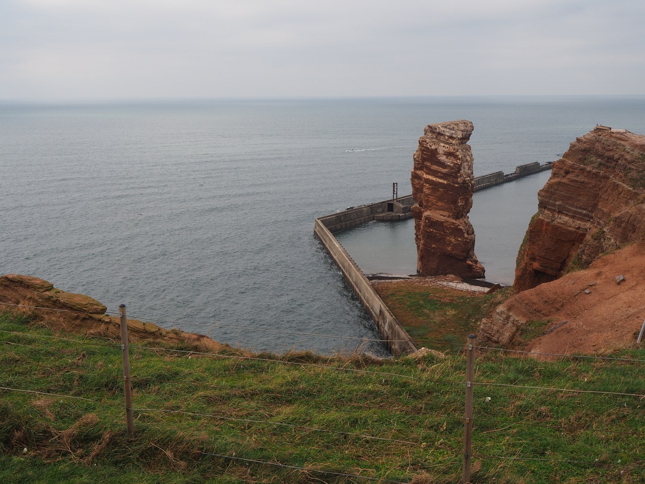
At the northern tip of the island there is an iconic 47-m pillar of rock called the Lange Anna, which is generally considered the island's landmark. This was originally an arch washed out by surf action until the bridge collapsed in 1860. There were efforts to protect the Lange Anna by constructing a sea wall to deflect the surf, but studies have shown that its further decline through frost cannot be prevented without very expensive measures that would thoroughly change its appearance, and probably not even then. The current approach is to not do anything, which means that it will eventually fall over. (We remember the “Azure Window” on the island of Gozo, which did collapse shortly after we visited it some years ago; maybe now that we were there, the Lange Anna is also on borrowed time.)
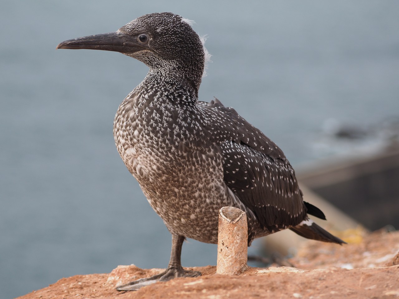
Also notable is the “guillemot rock” not far from the Lange Anna, where thousands of guillemots nest and rear their young. That, though, happens earlier in the year and very few of the birds are in evidence right now. Neither did we see any gannets, which are also nesting on Heligoland now.
We sit on a bench for a few minutes and enjoy the sunshine – the weather out here is not quite as nice as on the mainland, but even so there are breaks in the clouds and it is quite warm in spite of the wind – before completing the path and climbing down to the lower village for a fish-sandwich lunch on the jetty (the fish-sandwich lady reminded us to beware of the gulls). This lets us reach the Adler Cat in very good time for our trip back, which is very smooth and uneventful; we make our connection at Amrum and finish back on Nordstrand by 8pm. It takes us a little time to find the car in the very large and completely unlighted parking lot (yay for remote-control key fobs that make your car beep and flash its lights) but then we're on our way back to Husum.
Since we already suspected that we'd be in no mood to cook tonight we picked out our dinners at the Pizza-Eck takeaway in the morning and have phoned in our order before leaving the Strucklahnungshörn parking lot for Husum. This means that when we reach the Pizza-Eck – which is off the main ring road around Husum near the turnoff for Hockensbüll – our food is waiting for us ready to be picked up, and shortly afterward we reach the holiday flat with something delicious already prepared. It's a shrimp-and-garlic-sausage pizza for Marie and rice with vegetables and gyros-style turkey meat (plus a small salad) for me – all quite yummy. After that we watch the TV news and read a chapter from our reading-aloud book before we call it a (very eventful) day.

8th October – Walking in Schobüll
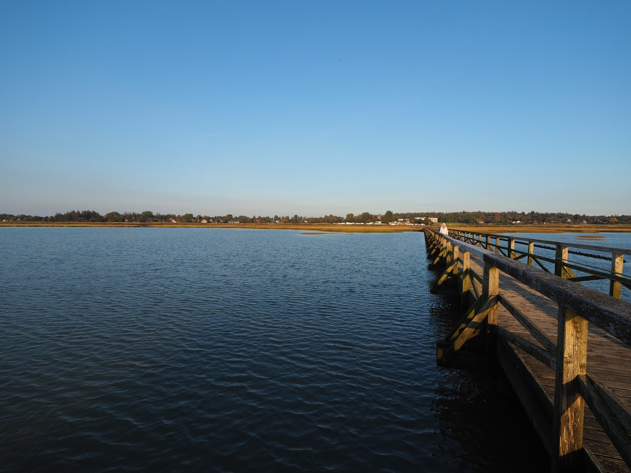
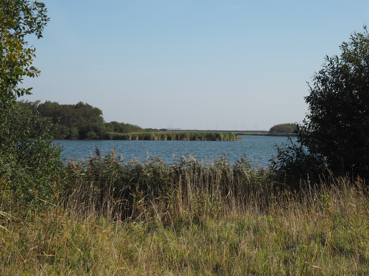
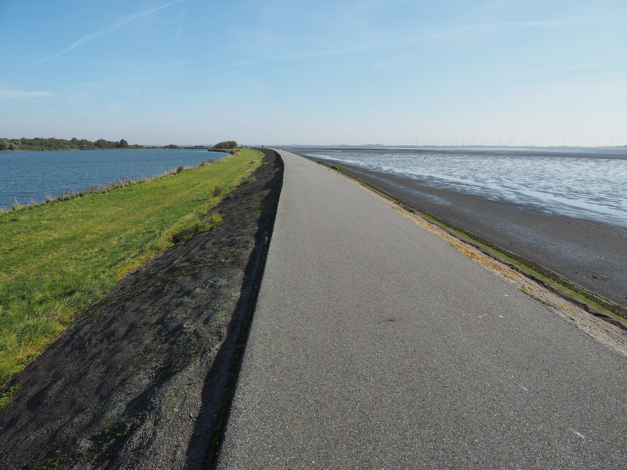
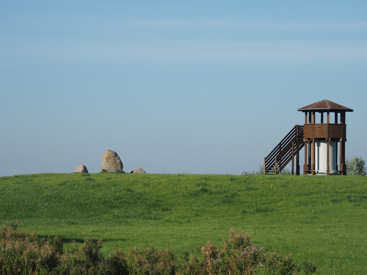
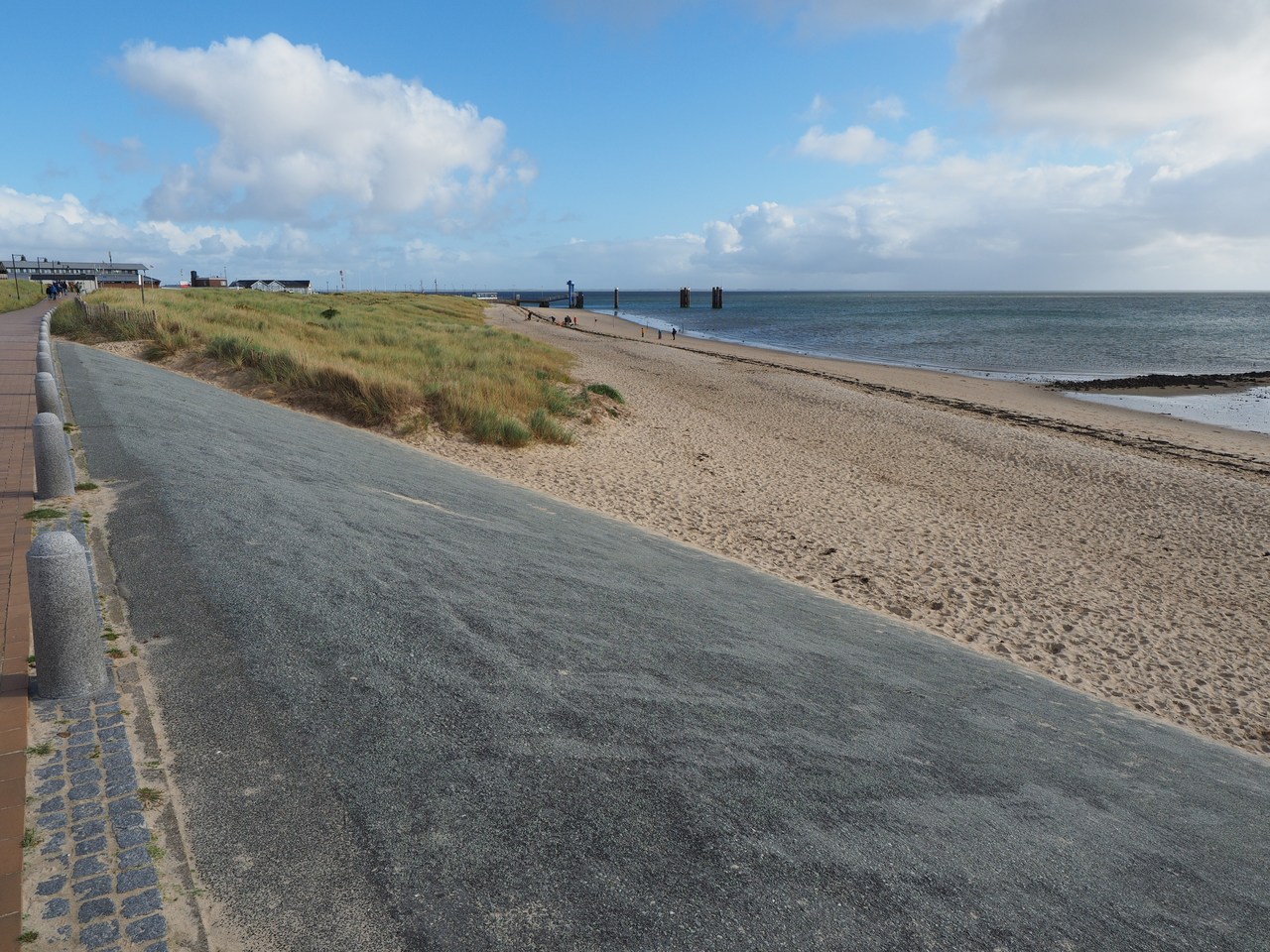
After two big excursions we decide that we have deserved some rest today, and spend most of the day putting our feet up. But eventually we take this opportunity to go out and explore the village of Schobüll, right next to where our holiday flat is. Schobüll used to be an independent entity until it merged with the town of Husum in 2007 (a fact that is commemorated with an engraved stone right in the middle of the village). It is notable as, unlike most places on the North Frisian coast, it gets by without a dike between the village and the sea – the Geest (higher ground consisting of sandy heath) runs all the way to the waterline, and a tall dike is not needed for protection. We're profiting from this through the unobstructed view from our living room window to the shore, which is unusual for a holiday flat that is only on the first floor (second floor for our American readers).
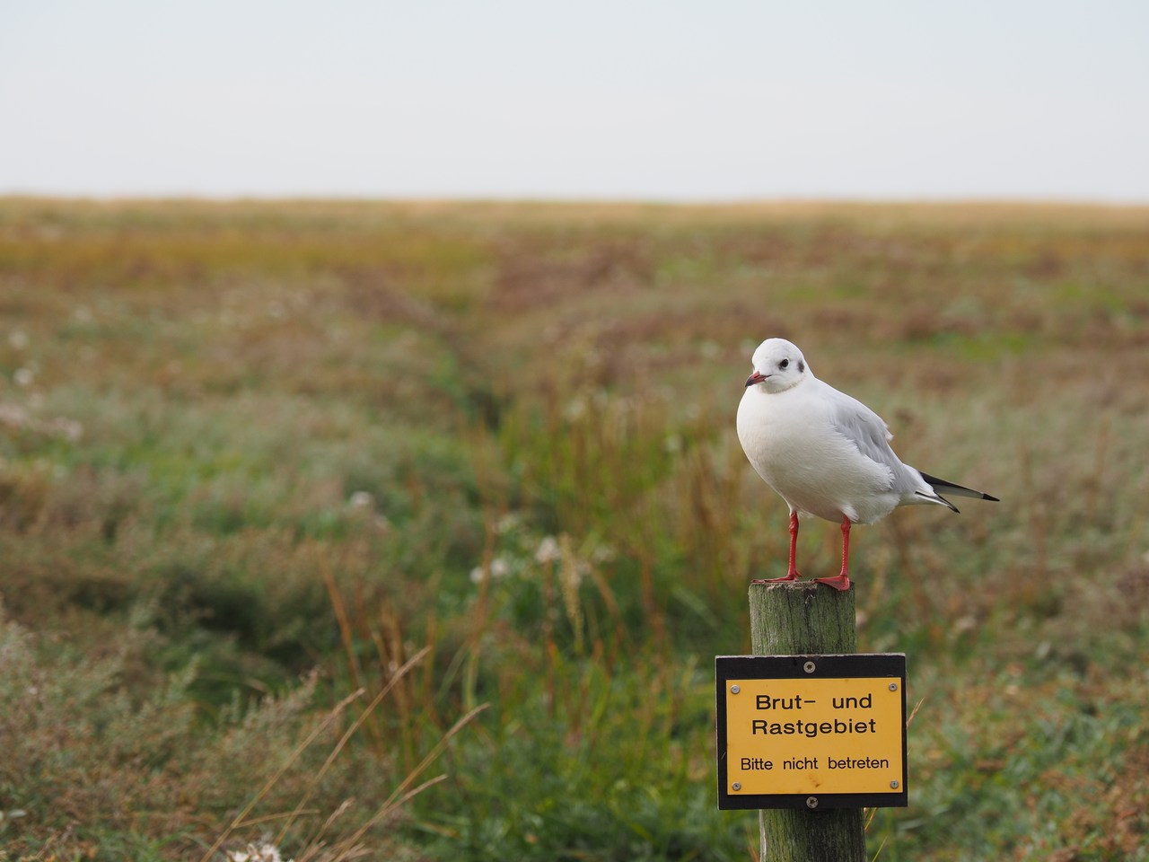
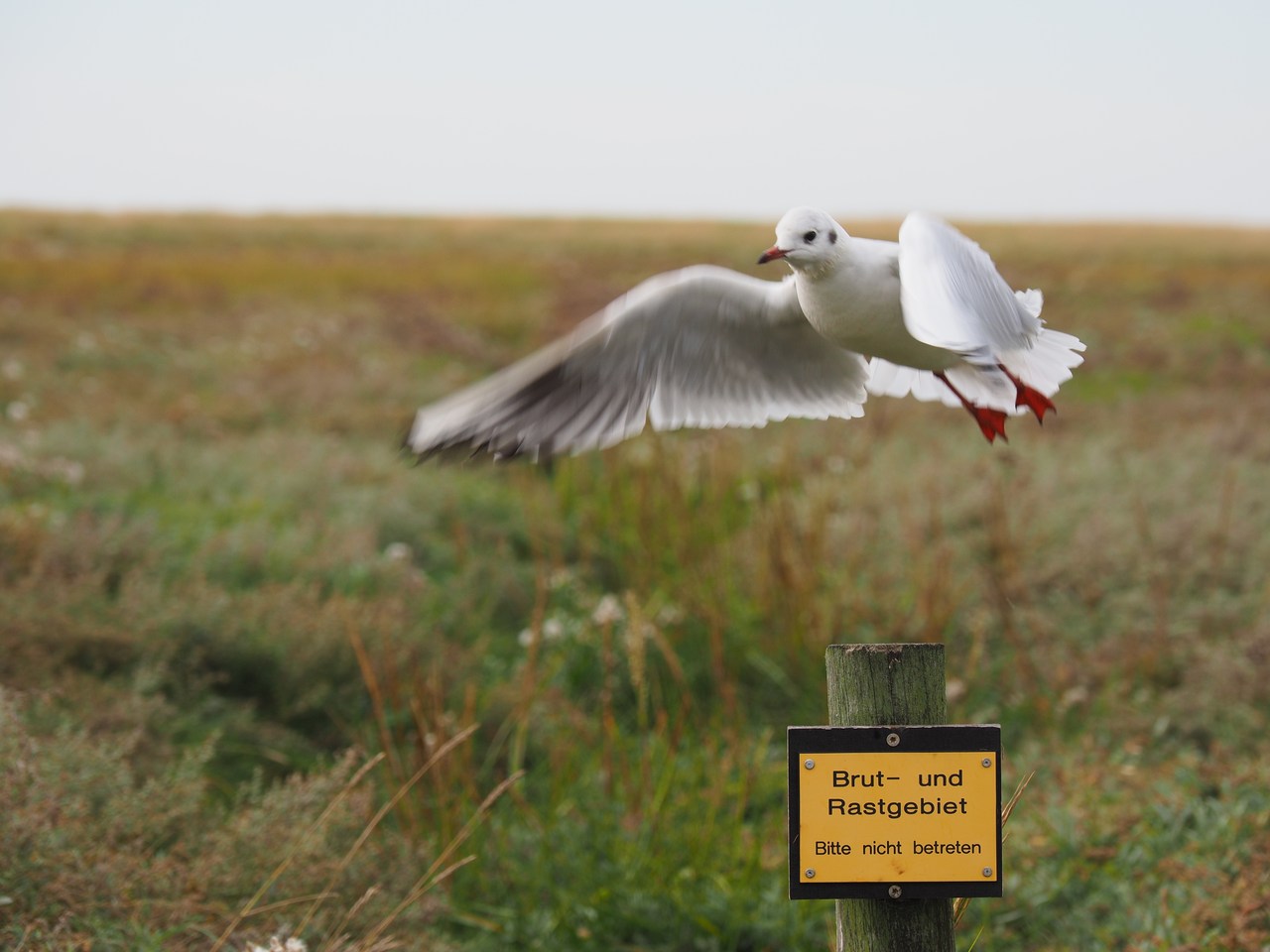
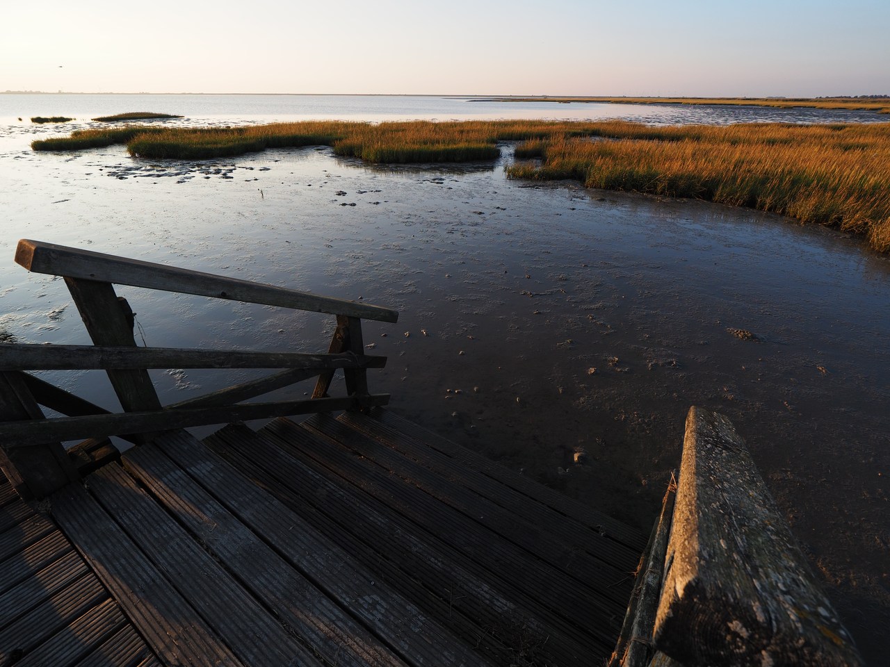
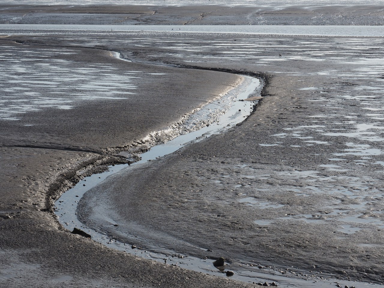
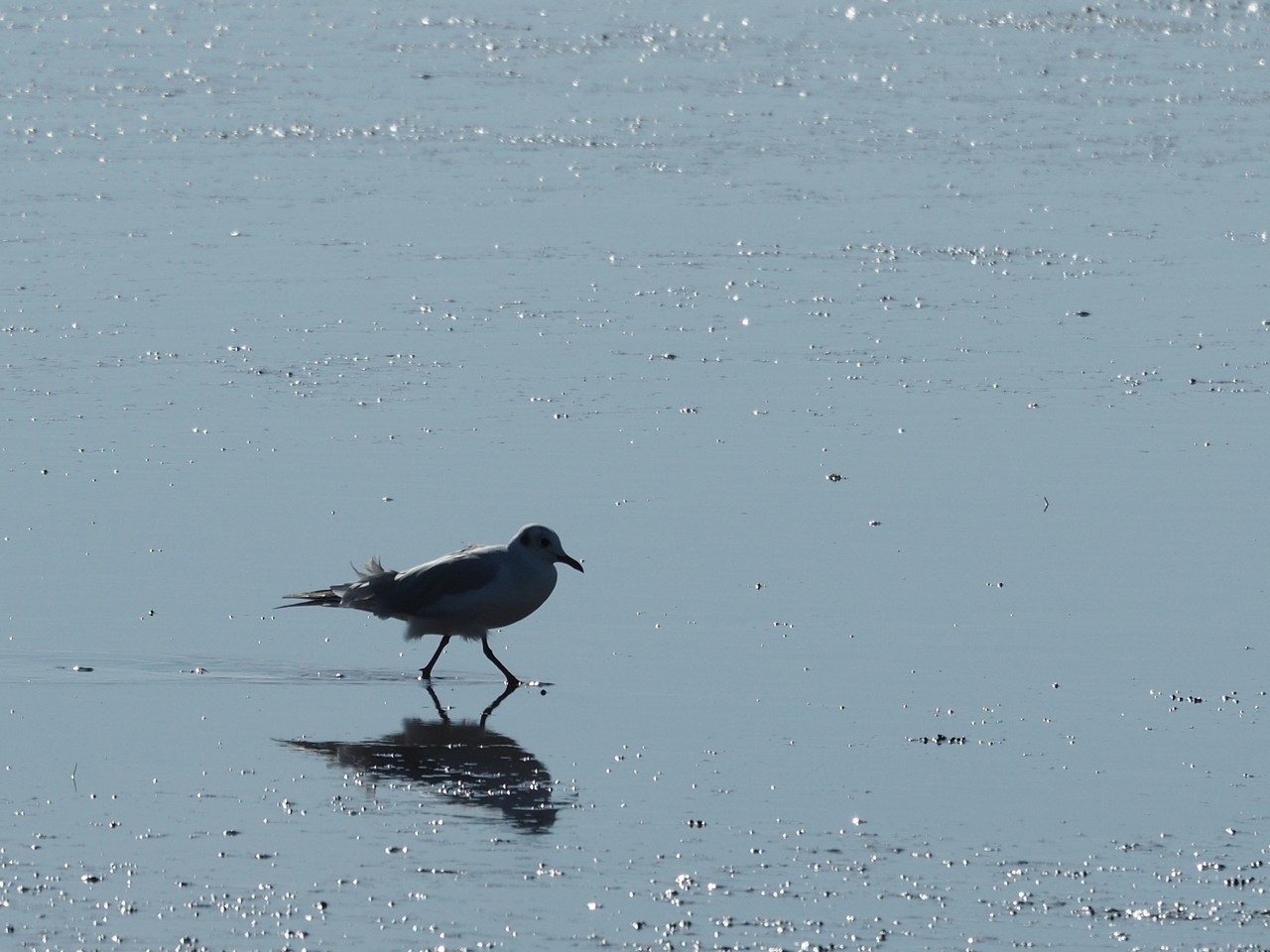
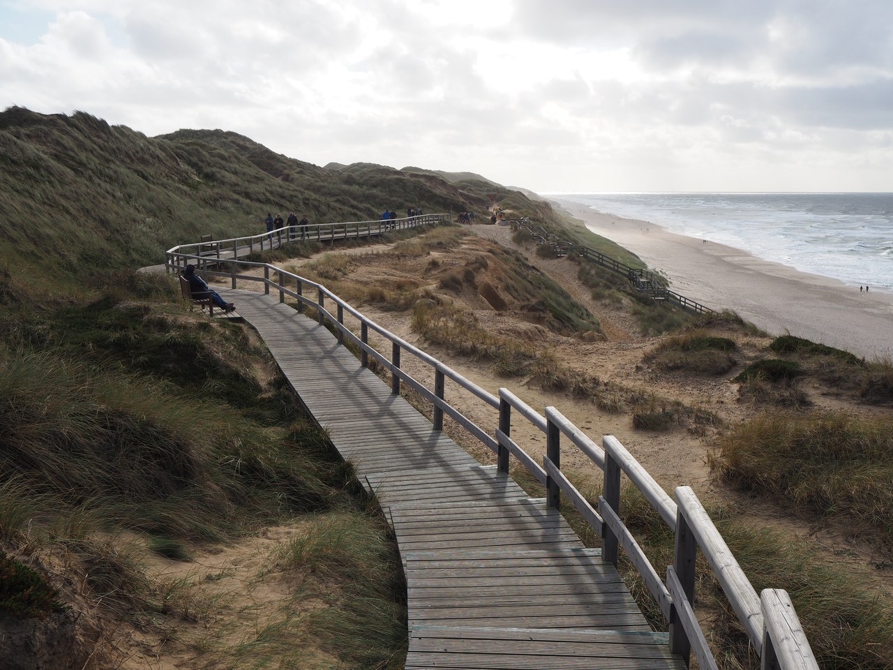
We'd like to go down to the waterline but it seems difficult to find a public right of way from near our holiday flat across the backshore (which is mostly fields and a few houses whose access roads have fierce warnings saying unfriendly things like PRIVATE and KEEP OUT). So instead we're walking along the combined pavement/cycleway into the village and then turn off onto a side street. Eventually, this becomes a path with a conspicuous sign saying “To the beach”, and we're taking it at its word. It turns out that Schobüll doesn't actually have a “beach” as such – at the waterline there is a large area with reeds that is a protected bird reserve. A few hundred metres along the shore, though, is a wooden pier that extends all the way across the nature reserve until it reaches the open water and ends in a set of steps. This is where intrepid people can go for a swim (during high tide) or a walk in the mud (during low tide). Both these activities are apparently not without their dangers – especially walkers are exhorted not to let themselves be caught by the tide as it is coming in. The tidal flats are so, er, flat that a little rise in water level can cover quite a distance along the mud, and it is impossible to outrun the high tide.
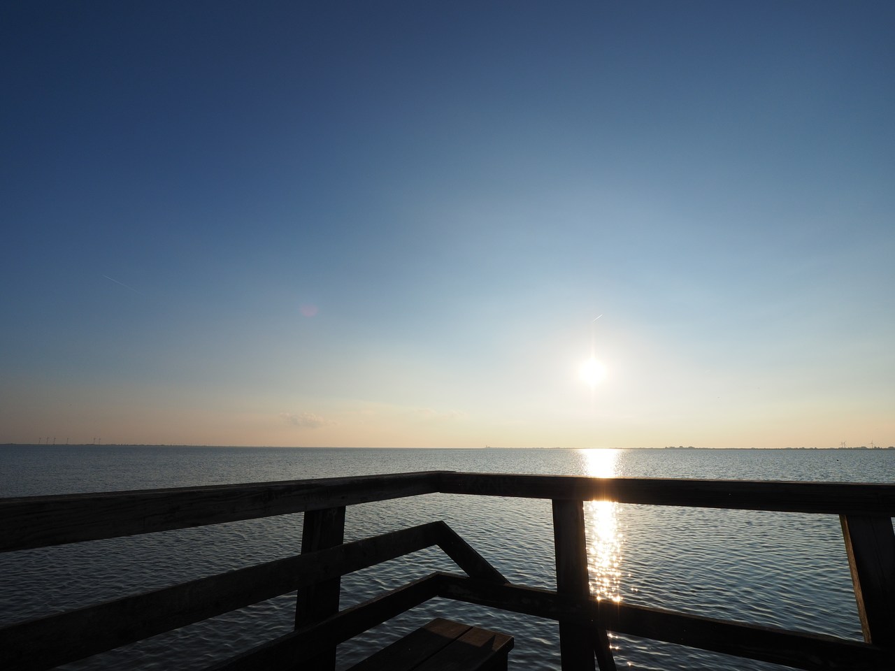
We are happy just sitting on a wooden bench at the end of the pier for a while, watching the sun approach the horizon, and only decide to leave when it becomes uncomfortably chilly. This turns out to be a wise idea since it seems that half of Schobüll is coming to the end of the pier to watch the sunset – as we walk back towards the village, lots of people are going the other way, and the small space at the end is likely to become irritatingly crowded. But what do we know – perhaps they're breaking out the Küstennebel (local aniseed schnapps) and fish sandwiches, and this is what one does in Schobüll on a Friday evening.
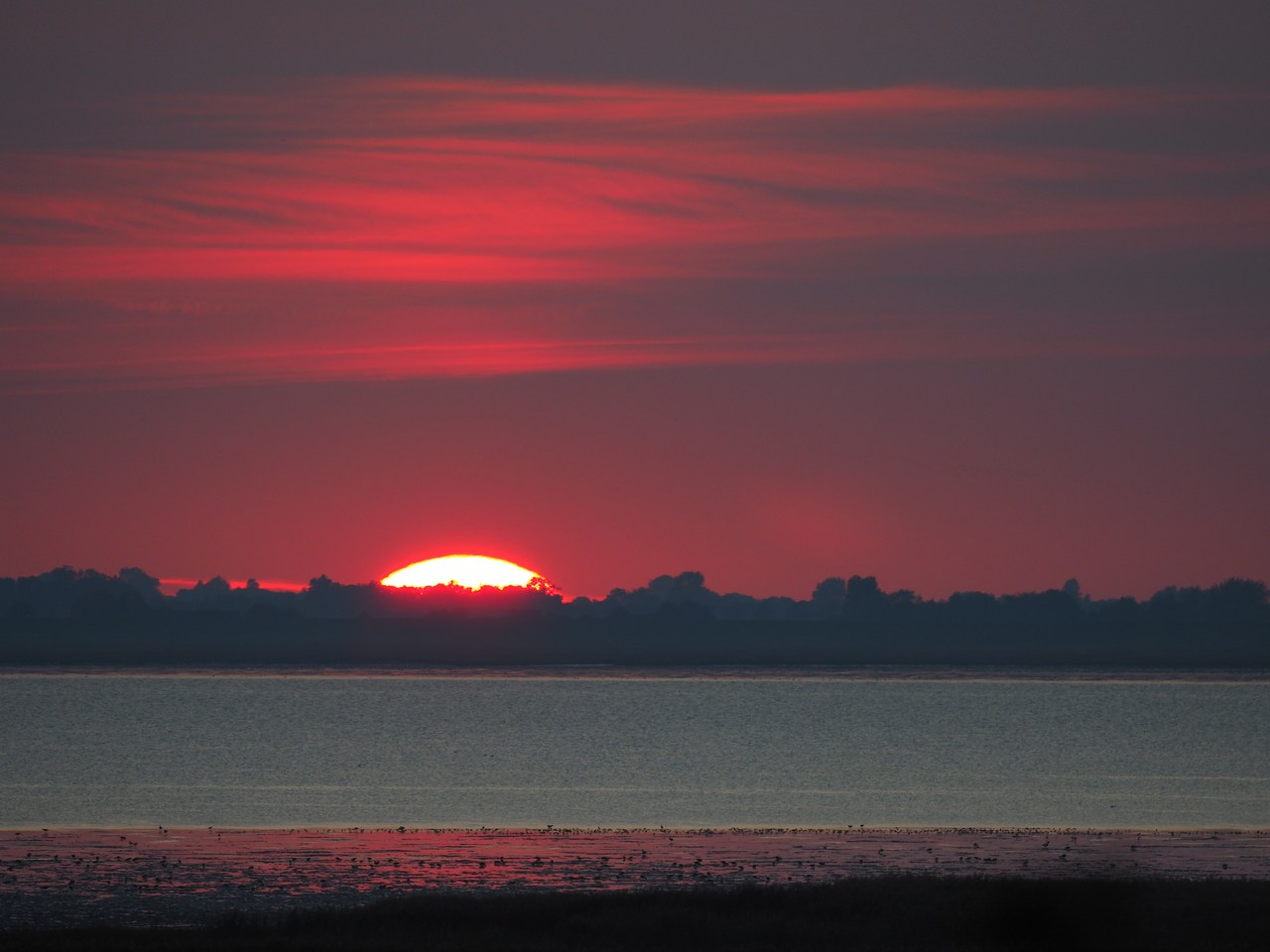
Back in the village we decide to have a quick look at the church, which unfortunately is only open to the public from 10am to 4pm but looks quite idyllic from the outside in the warm “golden hour” light. Then we walk back along the main road to our flat, occasionally stopping to look at the magnificent sunset (for once not with a thick cloud bank directly on the horizon). Luckily we make it back home in time for me to take more sunset photographs from our living room window, using the big 100-400mm/5.0-6.3 lens which is too heavy and inconvenient to take along on casual walks.
Dinner is Nigella Lawson's orzo pasta “risotto”, except that we don't have frozen peas and so use some leftover mushrooms and bell pepper instead, which as far as we're concerned is not a problem. There's also a nice salad to go with it, and more of the Traum von Eiderstedt for dessert. Our new post-Shtisel entertainment, courtesy of Netflix, is Emily in Paris, which explores the trials and tribulations of an American marketing executive and social-media geek in the capital of France. It works as light entertainment. One wonders who is worse, the Americans or the French, but Emily in Paris makes for a nice change from ultra-Orthodox Jews and the dialogue is in English and French (with English subtitles), not Hebrew, so it has that going for it at least.


9th October – Around the Katinger Watt, and the Eider Barrage
The weather is still fine today and we plan to combine a visit to a technological marvel of our time with an extended walk (we find it difficult to call these “hikes” because they're basically level, which coming from a hilly area like Rheinhessen seems a little bit like cheating). Specifically, we're driving down to the North Frisia/Dithmarschen border to see the Eidersperrwerk (Eider barrage), and walk around the adjoining Katinger Watt.
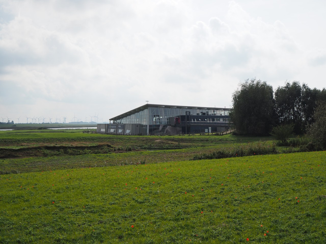
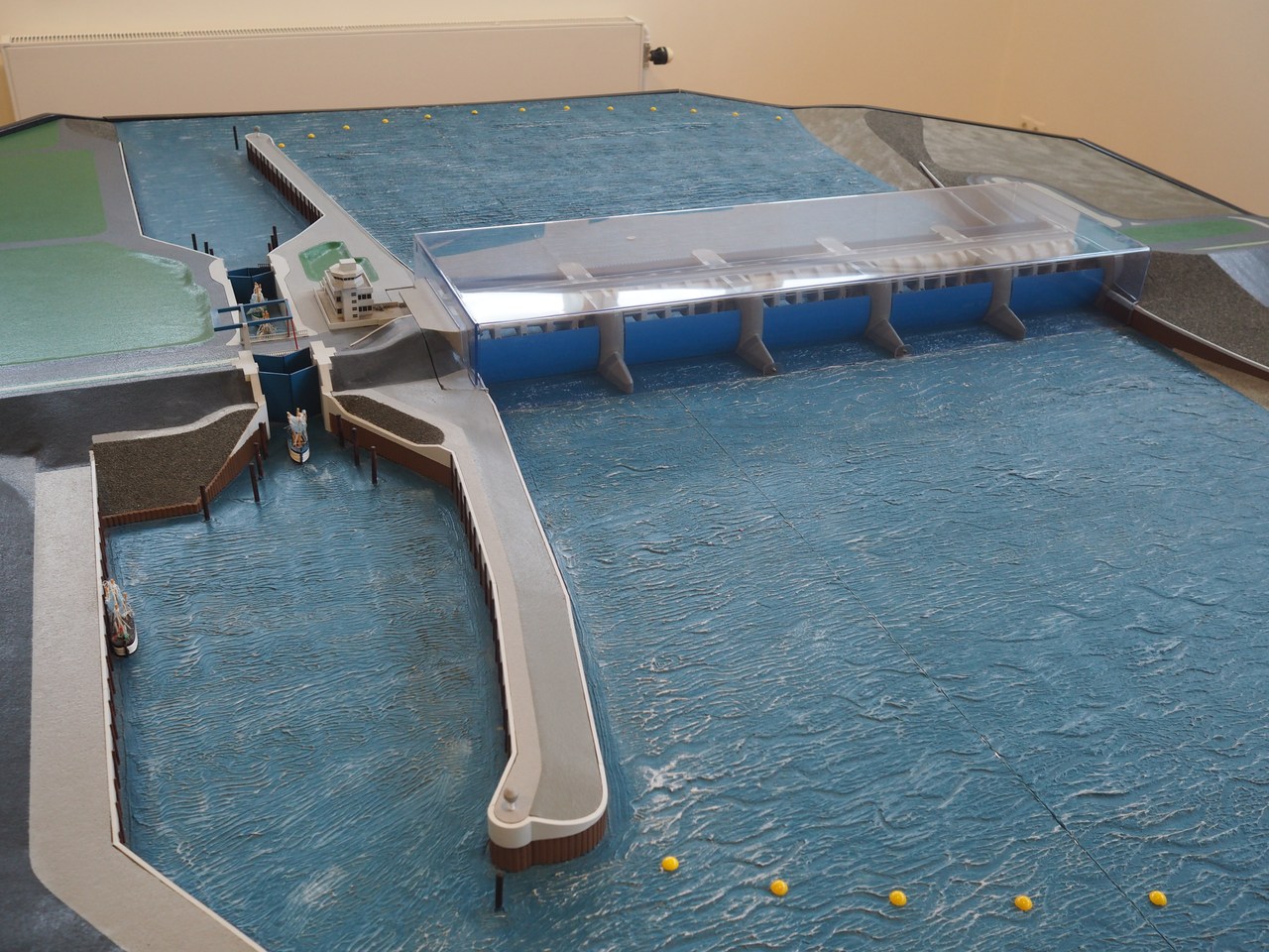
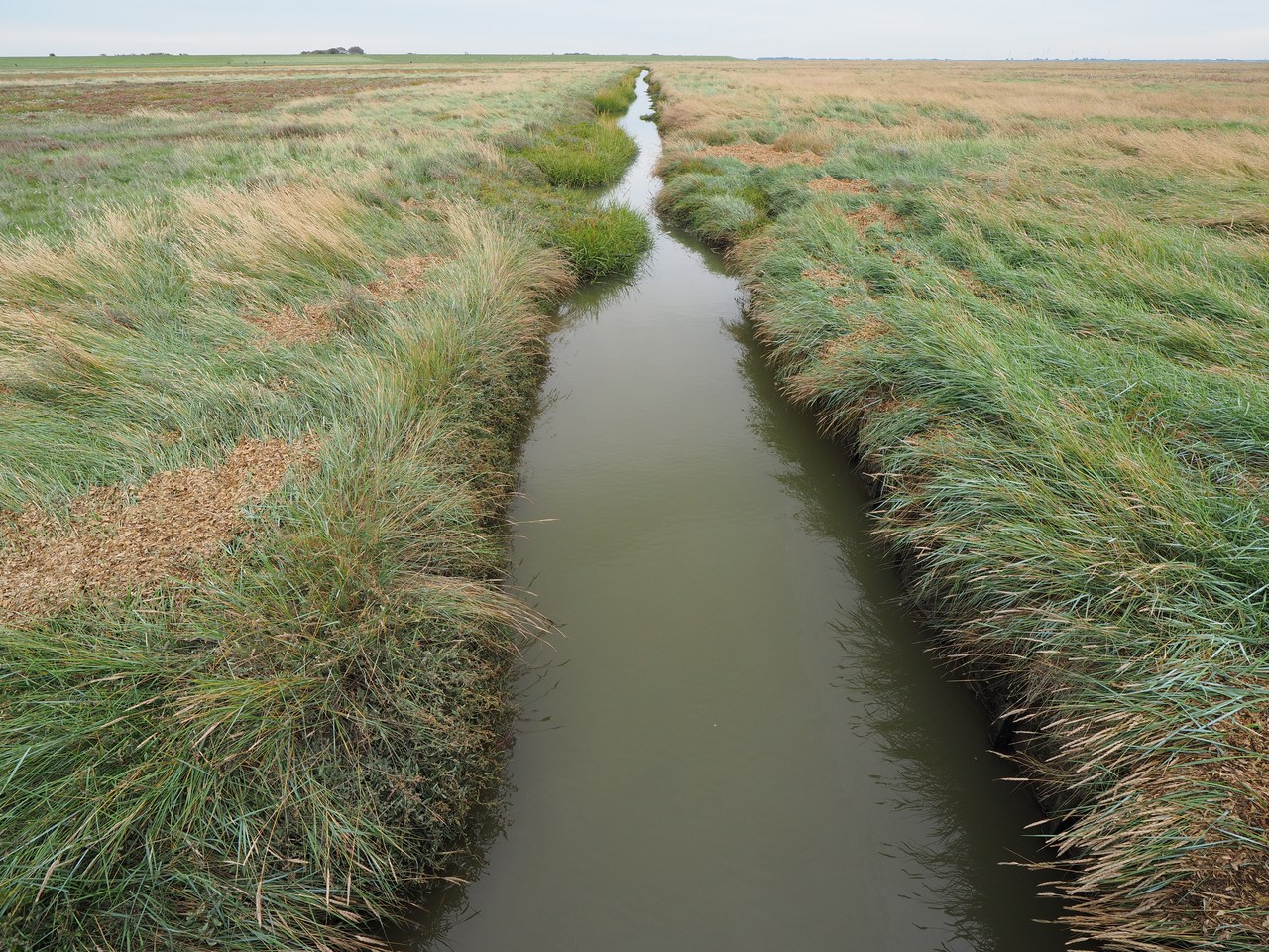
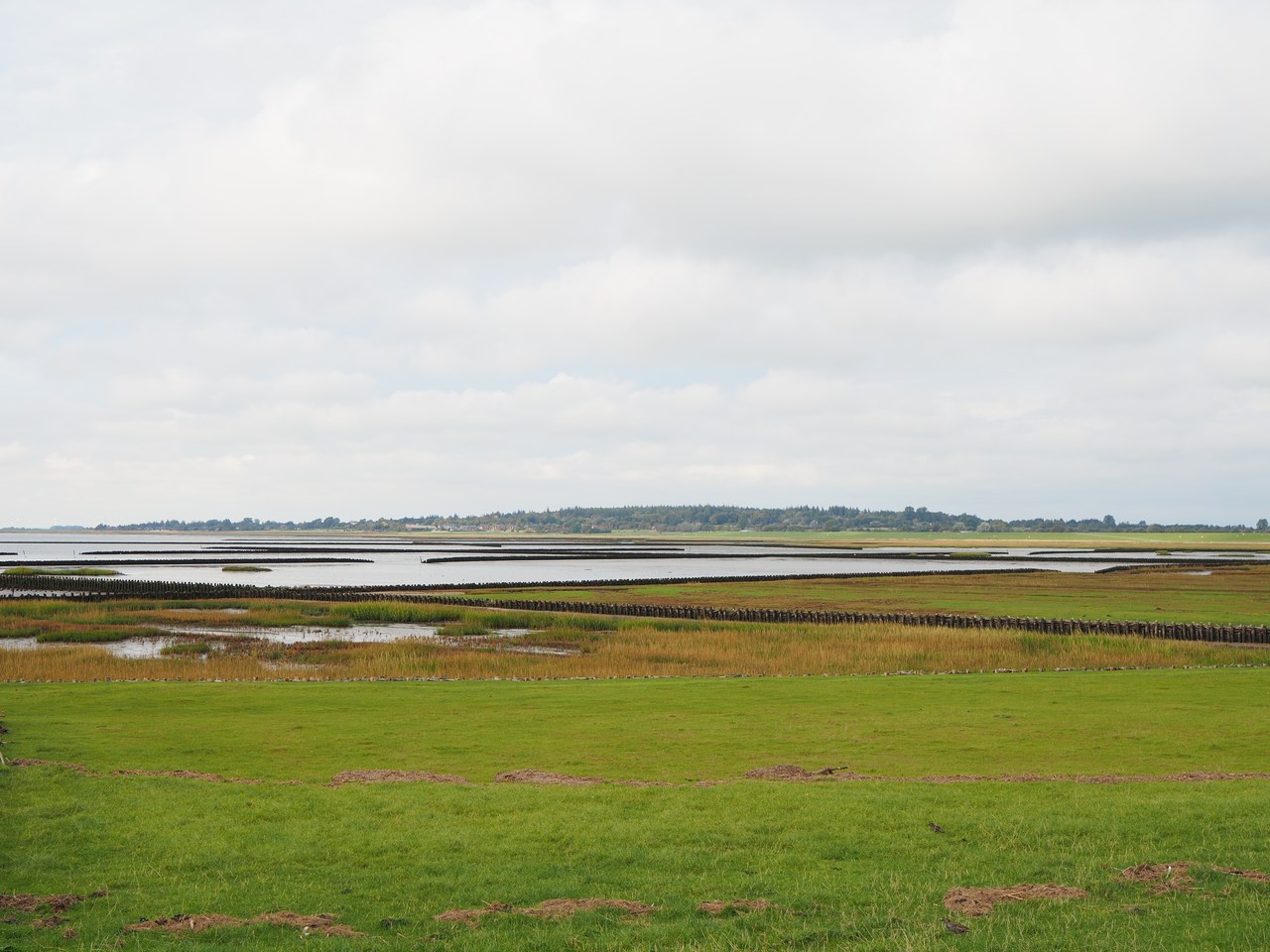
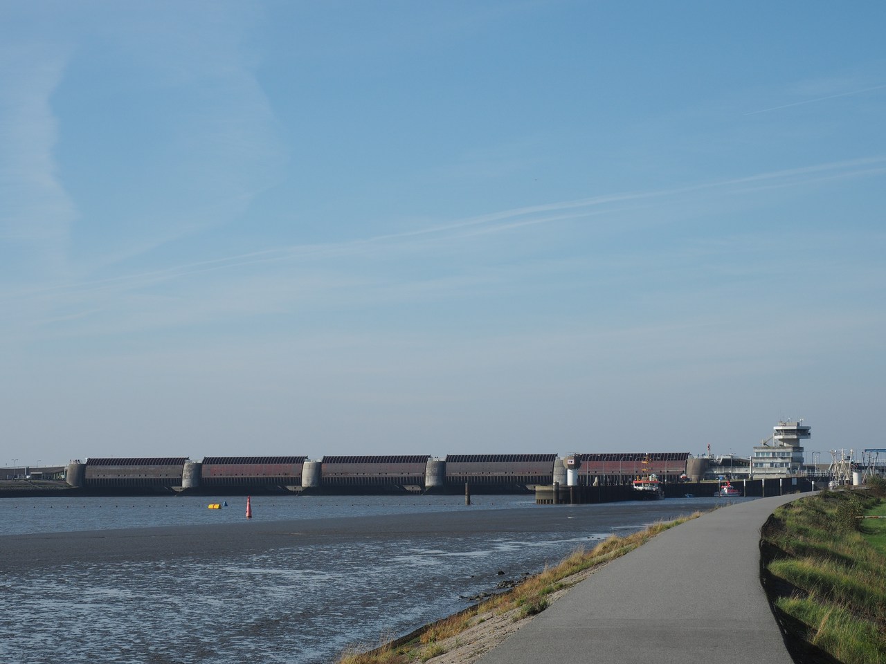
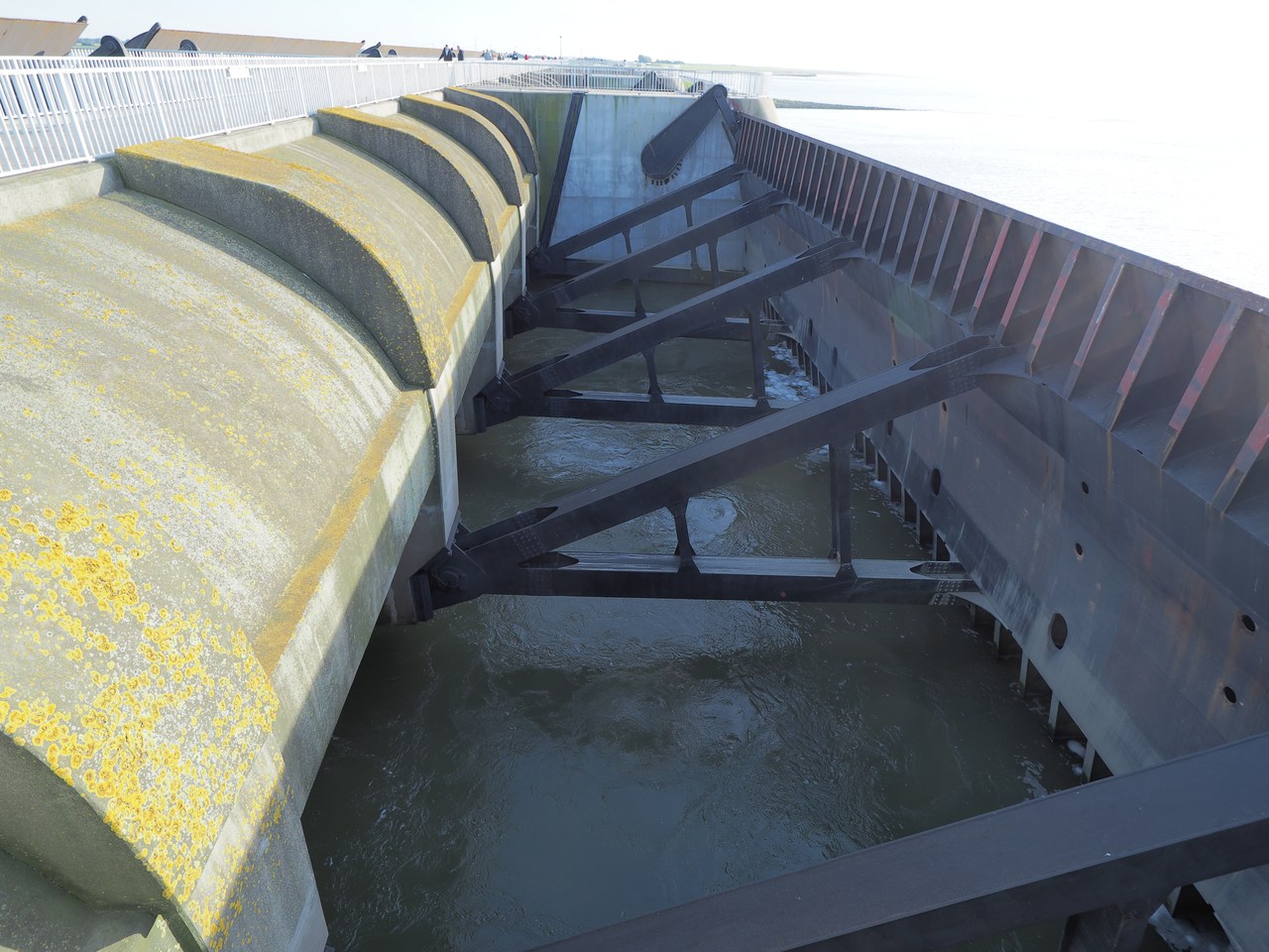
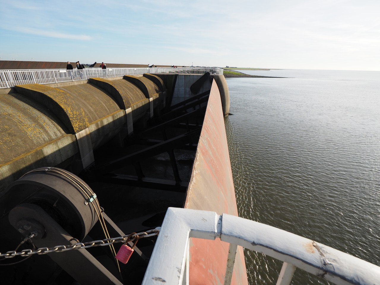
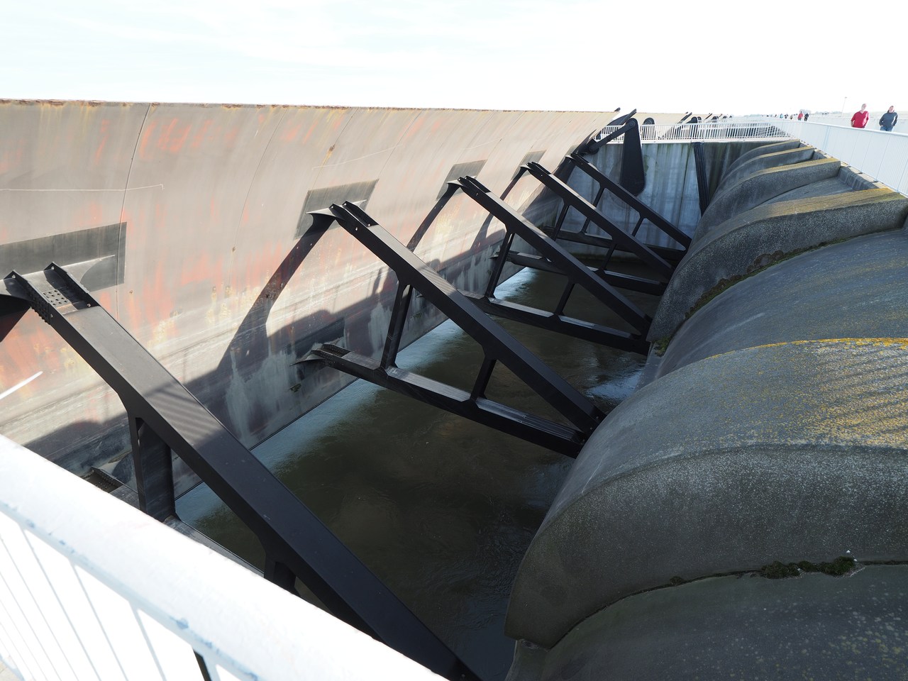
The Eider used to be Schleswig-Holstein's longest river at almost 200 kms, until the Nord-Ostseekanal (Kiel canal) bisected it near Rendsburg, with the upper Eider becoming a tributary of the Elbe. Formerly the Eider was an important trade route (see our discussion of Haithabu on 6th October), but nowadays the lower Eider is only used recreationally and by a few fishing boats. The Eider barrage was finished in 1973 and aimed to reduce flooding in the Eider estuary, as an alternative to building higher dikes all along the river. Tides on the Eider could reach up to 100 km (near Rendsburg), and during floods extensive damage often happened even far upstream. The Eider barrage consists of a 5-km dam and the barrage itself, which is 300 metres wide and features five large double doors. Normally it lets the tides pass mostly unconstrained, but if a catastrophic flood is about to happen, the doors are lowered to protect the inland area. The Eider barrage is Germany's largest coastal-protection edifice and also features a lock to let shipping pass even if the doors are closed. The construction of the Eider barrage also created two large nature reserves in the former Eider estuary, the more northerly one (the Katinger Watt) being the centre of our attention today.
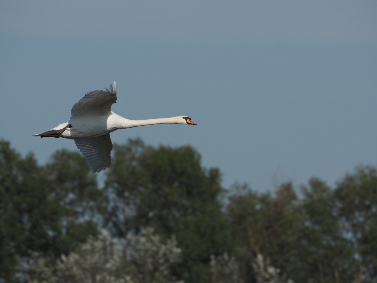
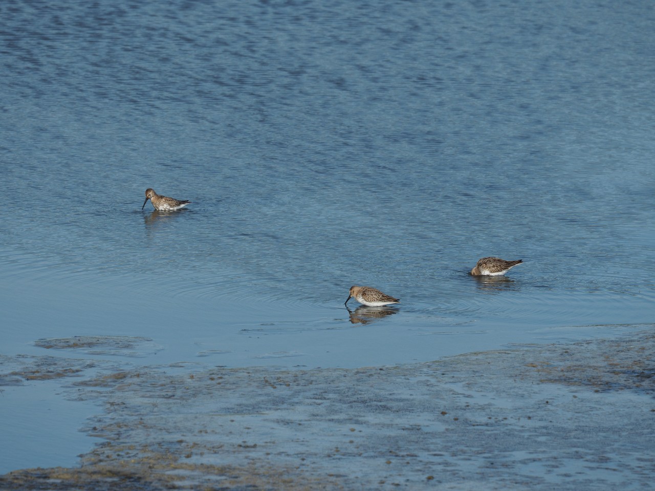
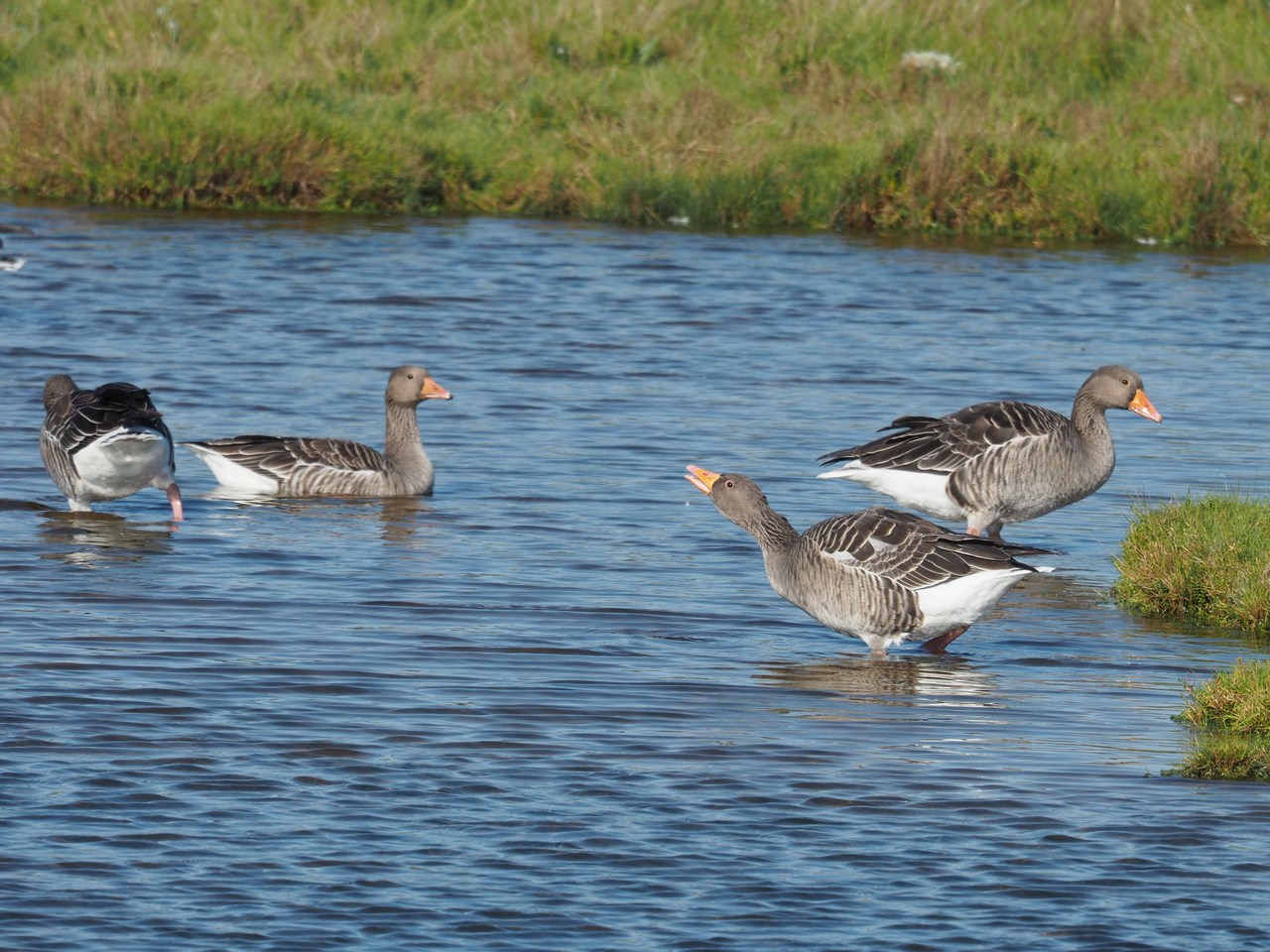
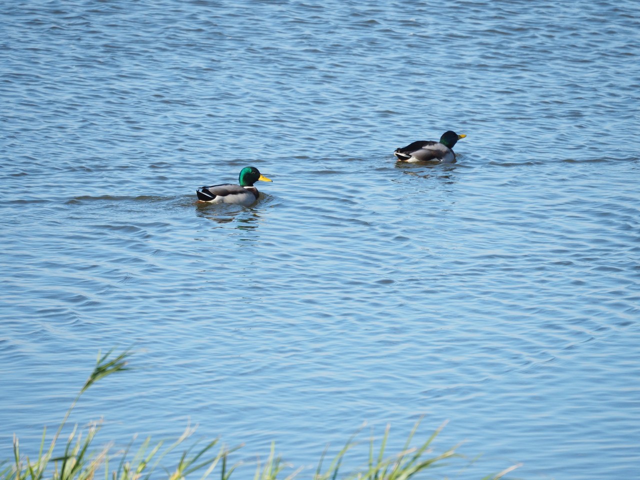
We leave the car in the big car park on the north side of the Eider barrage (conveniently close to the “fish bistro”) and then start towards the east on a cycleway/footpath parallel to the Tönning road. I'm having the first big shock of the day when, as I'm taking the first photograph, my camera tells me NO CARD – apparently I managed to forget the camera's memory card in my computer when I transferred yesterday's pictures! I'm about to resign myself to a day of mobile-phone photographs when I remember that in my mobile phone cover I have an SD card that I normally use to carry picture files to the chemist's to print greeting cards. This is an old slow 4-gig card but it is certainly better than nothing and, when reformatted inside the camera, good for 120 pictures or so (back in the days of analogue photography that would have been almost four rolls of film, or a week's supply at 8 marks per roll, so I'm not complaining). Soon afterwards we cross the road and walk along a gravel path to the dike separating the Eider tidal flats from the actual nature reserve. Various species of bird are in evidence, including swans, geese, ducks, and stints, and of course the ubiquitous gulls. We walk along the top of the dike for a couple of kilometres and then turn inland to reach a small viewing tower on an artificial hill where sheep used to take refuge in times of flooding, and the “Nature Experience Area Forest – Water” which is part of the Katinger Watt nature reserve. This small forest was created in the 1970s in order to prevent the reclaimed land from drying out and getting carried away by the wind and rain, and it now contains a looped foot path that offers various recreational activities such as a “low rope garden”, a “jungle path” with balancing logs etc., picnic areas, a sundial, a bird observation hut, etc. We leave the nature experience area at the far end and continue on a grassy path along a tidal creek. After a while (having rested for a bit and consumed a small bag of trail mix in a refuge hut off the path) we reach the other side of the forest near Katingsiel. Eschewing the lure of the public house that is only a few metres away from where our path joins the old Katingsiel dike, we continue back towards the coast, past the NABU nature-reserve centre, across the St.Peter-Ording road and on to the sea dike that leads back to the Eider barrage. The last few kilometres on top of the sea dike are a bit of a slog because of the wind, but we finally make it back to the barrage and – more importantly – the “fish bistro” where we're lucky enough to find a just-vacated table outside for a late lunch. The hike itself was around 15 kilometres (11 miles) and took us 3½ hours – incidentally just what the guidebook claimed. (We're using the OutdoorHandbuch Nordfriesland, published by Conrad Stein Verlag, ISBN 978-3-86686-595-2, and I'm happy to recommend it for its varied suggestions of hiking routes and their very detailed and accurate descriptions. For the record, I bought our copy with my own money and have not received any consideration from the publisher.)
Marie is having a Tote Tante (“dead aunt” – not a form of cannibalism but hot chocolate topped with cream and liberally laced with rum, basically the equivalent to the Pharisäer discussed earlier), while I, as the designated driver, drink black tea without any alcoholic additions. We also enjoy a selection of fish sandwiches, which are made fresh to order and are worth the wait – the place is very busy and the waiter laments that some of his colleagues have given notice and that they are very short-handed. But we're not going anywhere and enjoy sitting for a while.
After fortifying ourselves we walk a few hundred metres along the dike in order to inspect the Eider barrage from close up. It is impressively big and seems to live up to its reputation as a big technological achievement. Perhaps a placard or two explaining how it actually works would be nice (we get the general idea from looking at it and there was an interactive display in the North Frisia museum in Husum, but even so …). OTOH, we didn't check out the south end of the barrage, which also has a visitors' parking lot, and perhaps all the public information is concentrated there. We return to our car along the bottom of the dike and drive back to our holiday flat, with a detour to the supermarket to pick up dinner and a few other miscellaneous groceries.
For dinner we make “Chicken Kashmir” based on a spice mix package I was gifted by Eva S., which is quite delicious. My strain of bad luck continues as I manage to break one of our four water glasses – fortunately most of the shards are relatively easy to find and dispose of, and our flat has a vacuum cleaner for the fine work. But it doesn't seem to be an object of great value and presumably leaving a few euros in compensation should take care of the issue when we leave.


10th October – Birds, Birds, Birds, Some Sheep, and a Stack of Pigs
Today's excursion takes us north once more, to the tiny village of Schlüttsiel and the surrounding Hauke-Haien-Koog.
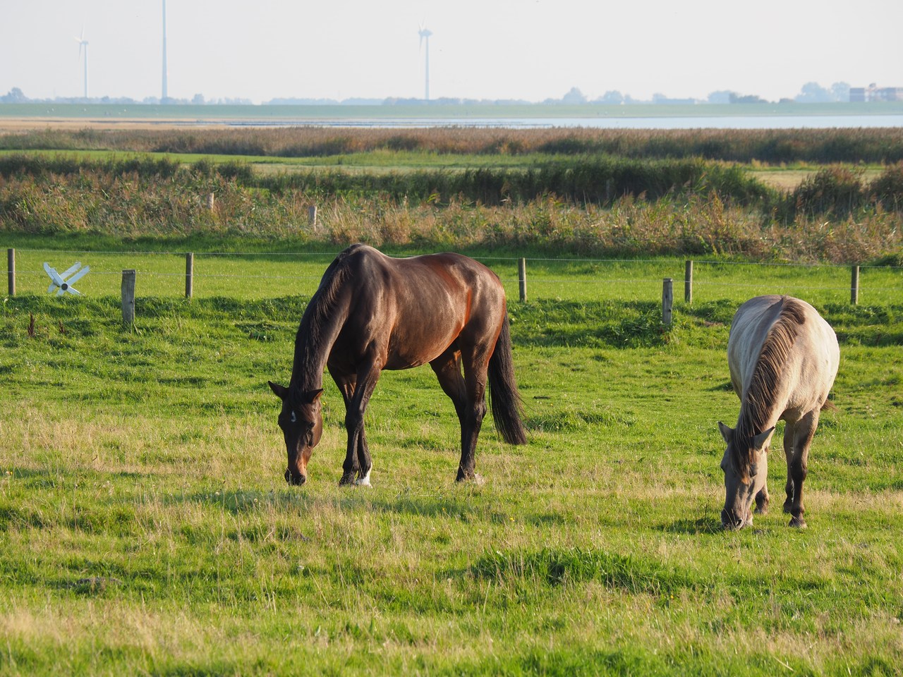
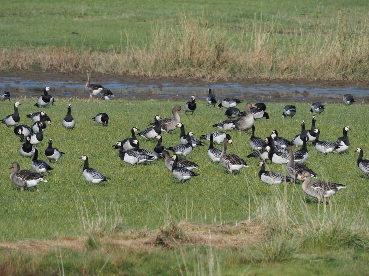
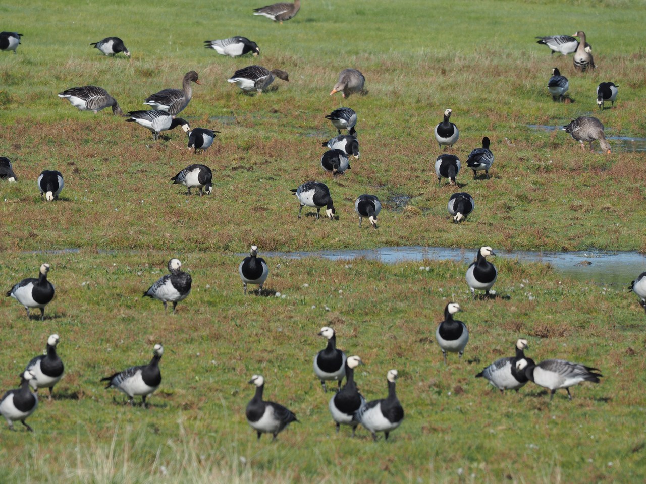
Named for the tragic hero of Theodor Storm's novella Der Schimmelreiter (The Rider on the White Horse), dike reeve Hauke Haien, the Hauke-Haien-Koog was constructed in 1958-9 to alleviate flooding issues caused by the rivers Lecker and Soholmer Au – when the sluice gates are closed during a flood to keep the sea out, the river water would still flood the marshes behind the dike. Half of the new 1200-hectare polder consists of two large flooding basins which are used to contain the river water during a flood, until the sluice gates can be opened again to let it drain to the sea. (The other half is used for agriculture.) The flooding basins and surrounding marshes are now an EU bird reserve and offer both shelter for various native birds as well as rest areas for migratory ones.
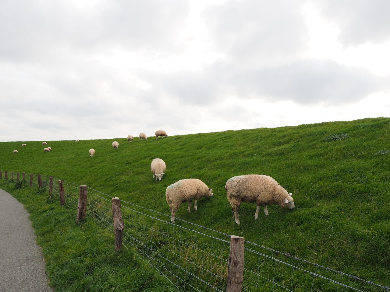
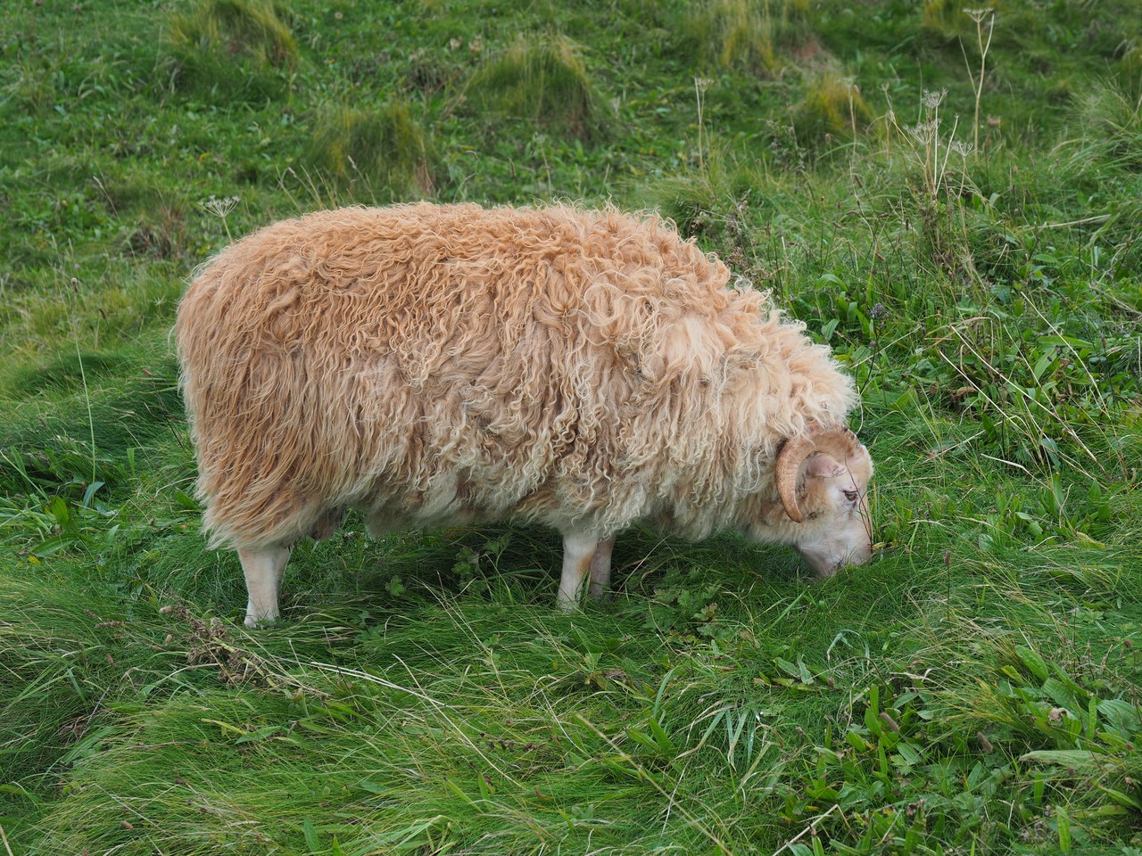
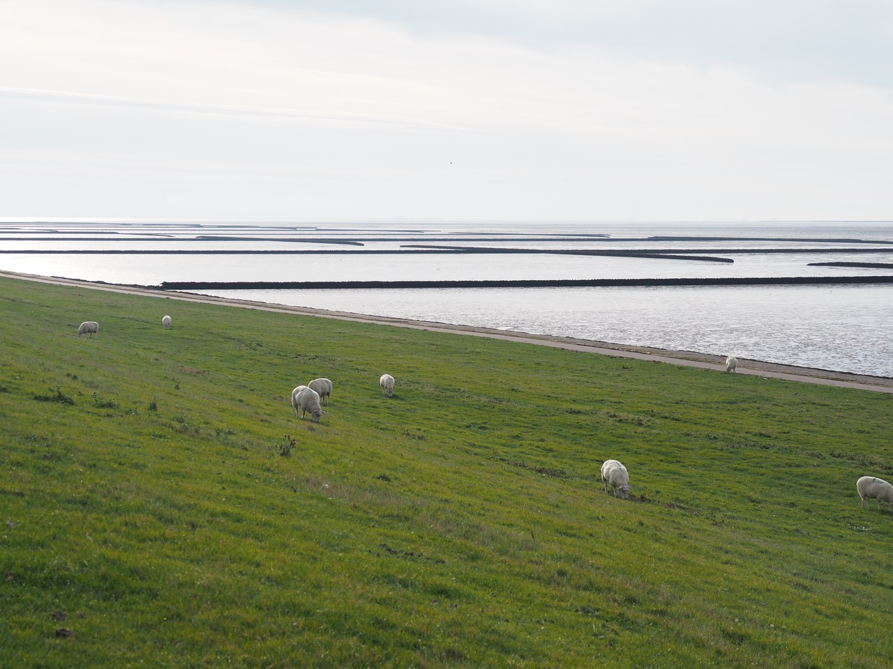
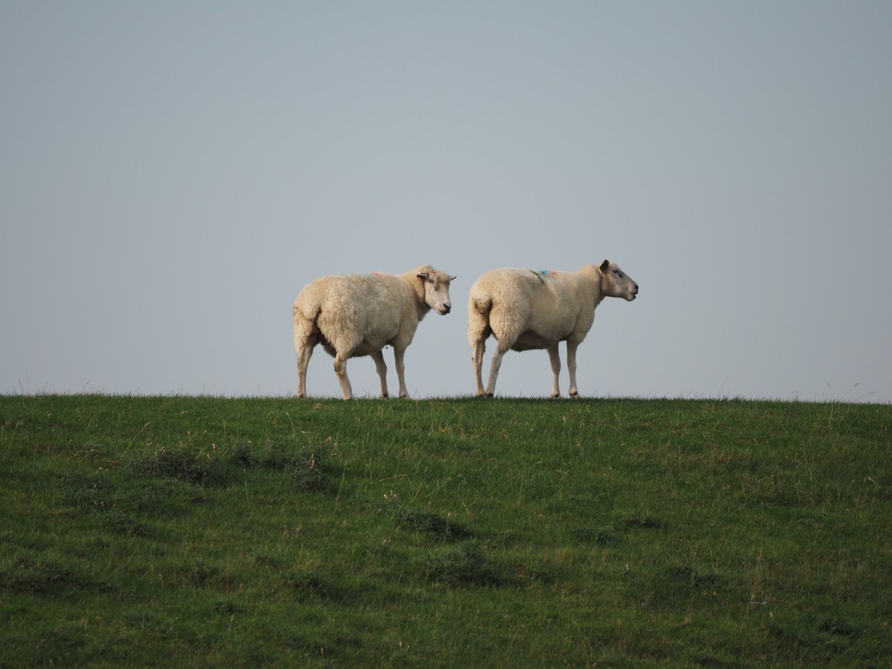
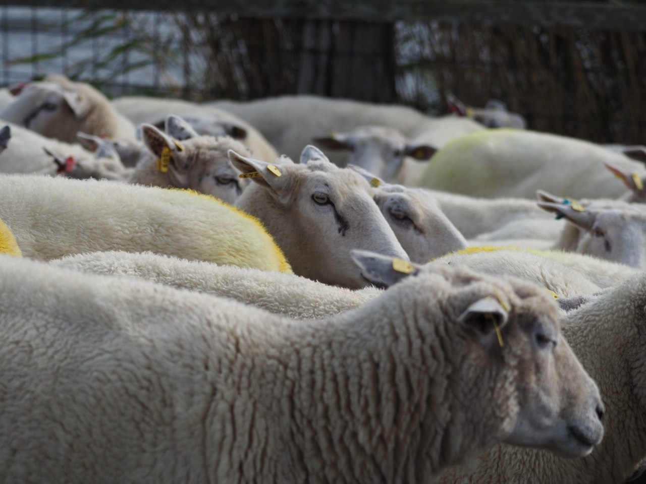
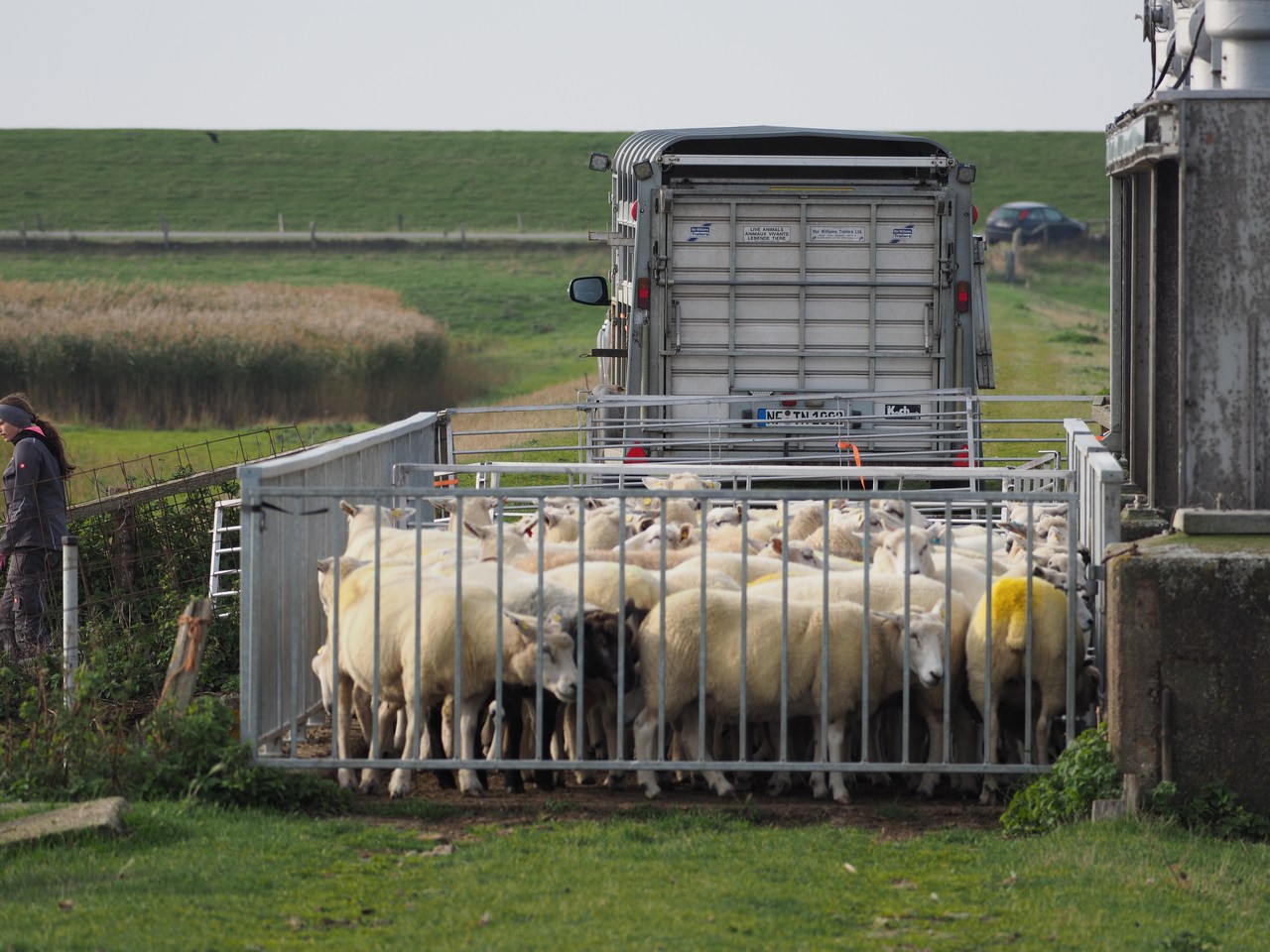
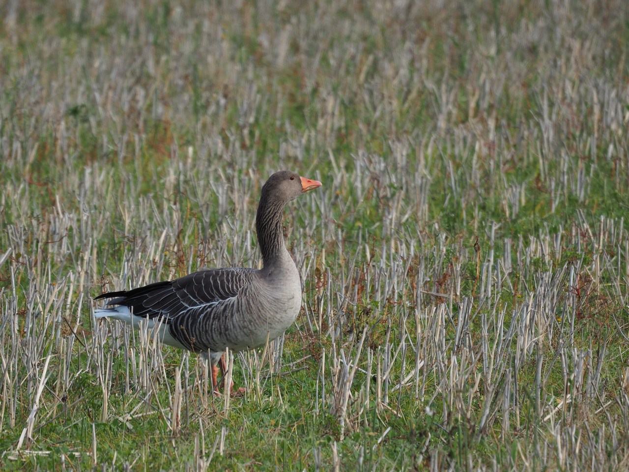
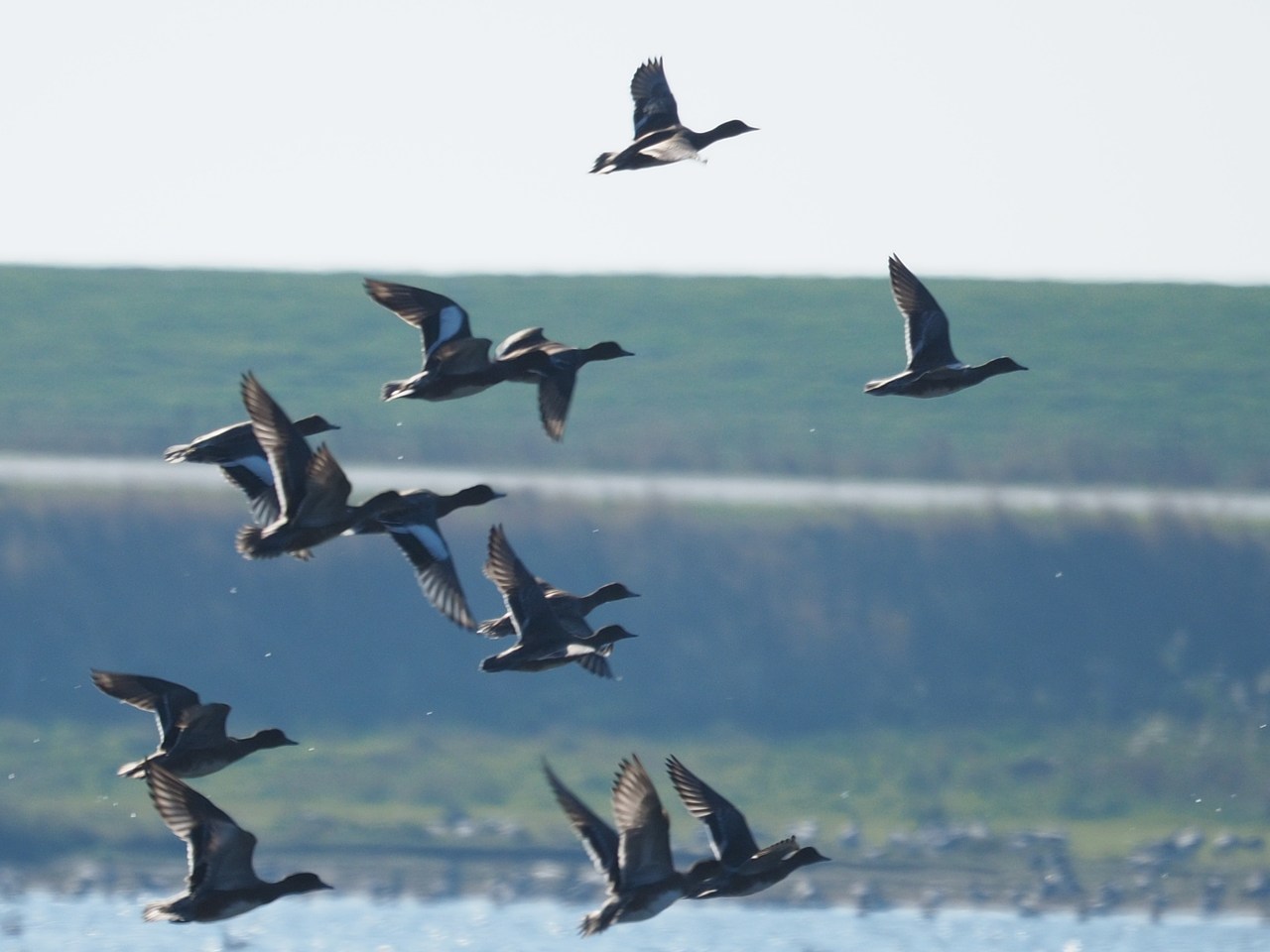
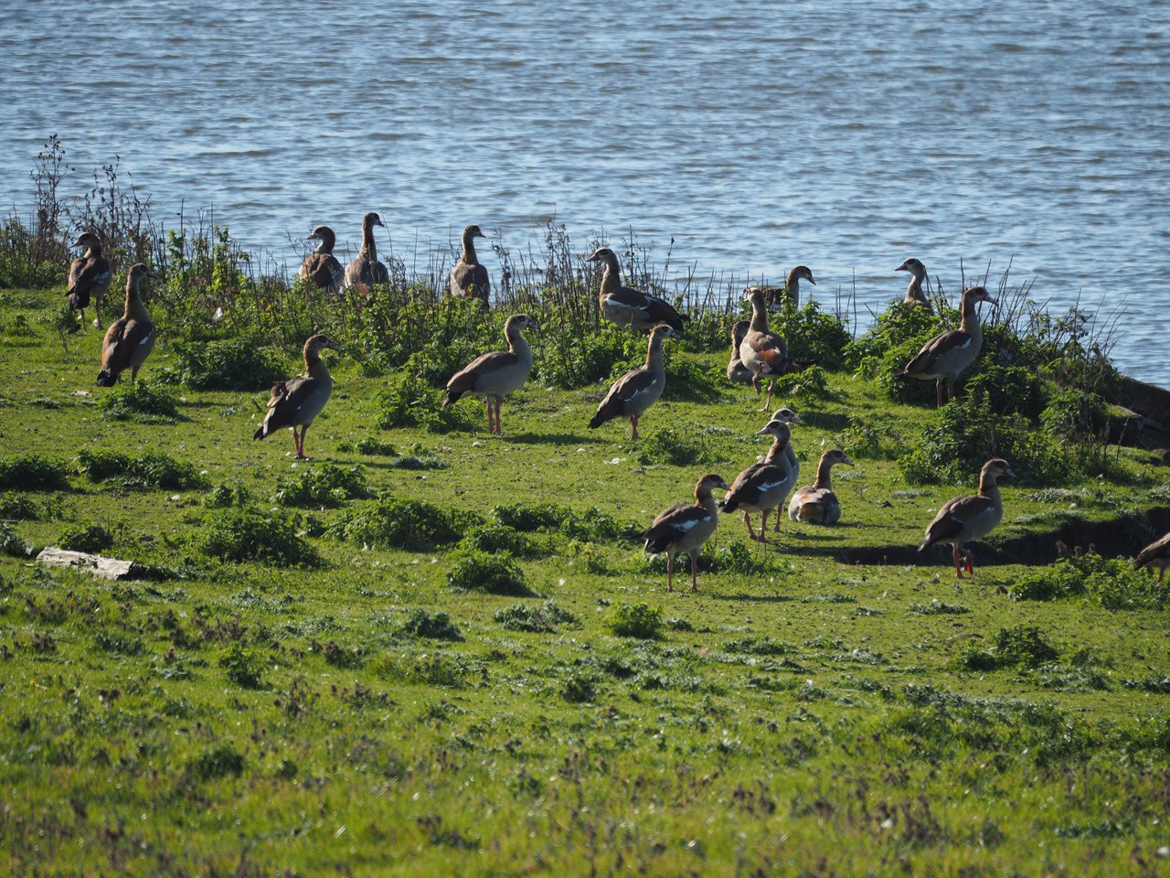
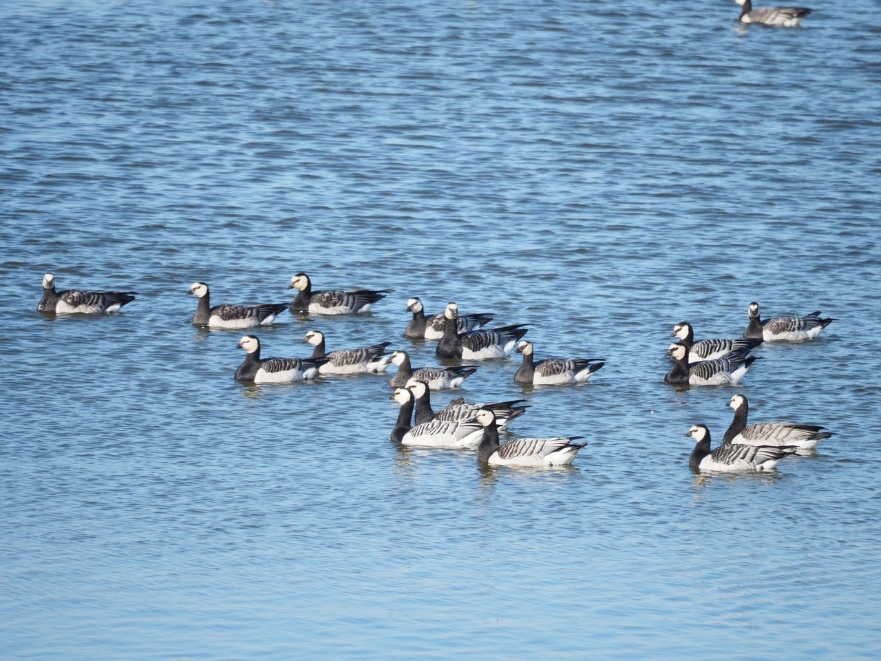
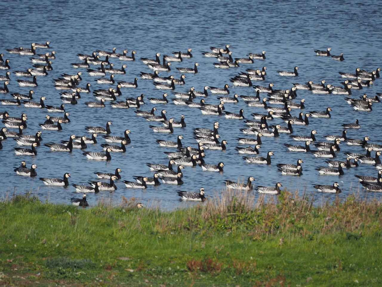
We leave the car at Schlüttsiel – not much more than a hotel/restaurant and a small ferry terminal - and enter the nature reserve via a field gate. The gates here seem to have been set up as intelligence tests for tourists because figuring out how to open them is often a challenge – as far as we're concerned, it is often easiest to simply climb over them. Soon after, a sluice-gate bridge is completely blocked by a penned-in herd of sheep, which we manage to squeeze past with a little help from the shepherdess. The main issue throughout, though, is not stepping into sheep droppings, which is virtually impossible because there are so many of them all over the place (both sheep and droppings). A sheep is essentially a digestive tract with some wool around it and it shows. The walk round the nature reserve and back on the sea dike is approximately 10 kilometres (6 miles) long and offers lots of opportunities to watch birds, at this time of year mostly migratory wild geese which fly overhead in very large and loudly honking flocks and alight on fields or the flooding basin. There are also swans and ducks and we manage to sight a few cormorants and lapwings.
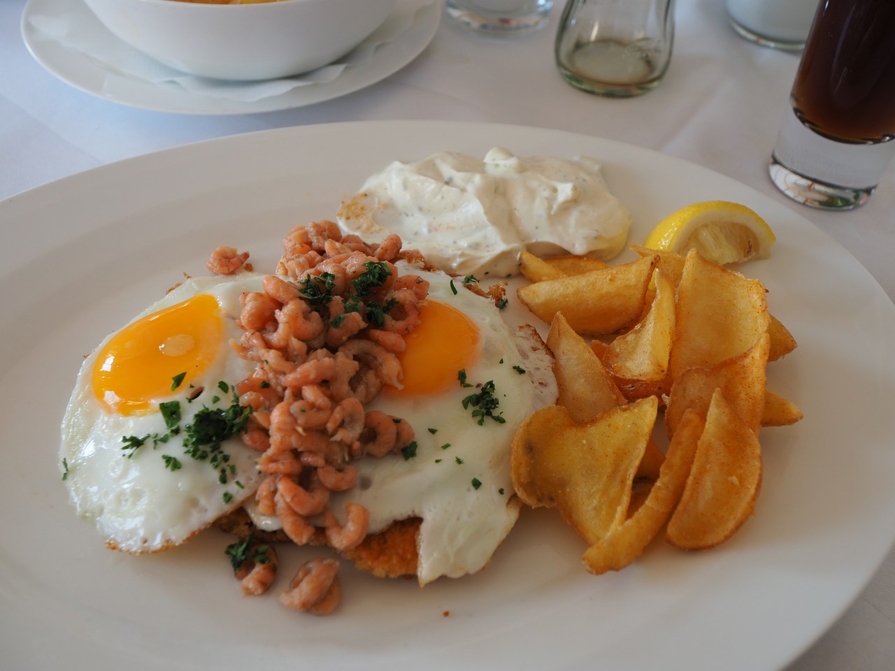
Afterwards we decide to go for Sunday lunch at the Deichgraf (dike reeve) restaurant at the Arlau lock in Hattstedtermarsch. This is a nice-looking place and as there is a distinct chill in the air and once more the waitstaff seems overworked we opt to sit inside in a cosy dining room. The food is yummy – Marie has shrimp soup with cream and I a Frisian cheese soup, and both our main courses are the “Frisian-style schnitzel” topped with shrimps and fried eggs.
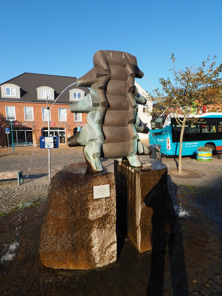
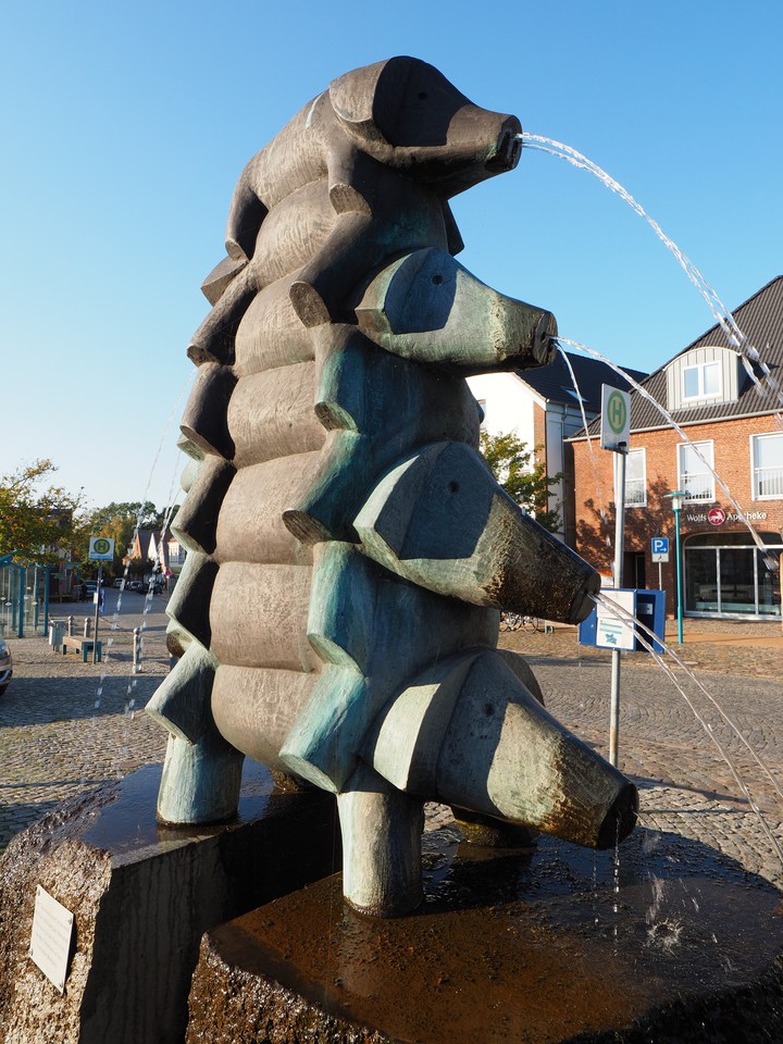
On the way home we're going through Bredstedt, formerly a major trading centre in the heart of North Frisia. Its importance in the pig business is commemorated by the Schweinebrunnen (pig fountain) in the middle of the town. Designed by Kiel-based sculptor Ben Siebenrock and installed in 2000 on the occasion of the 100-year anniversary of Bredstedt officially receiving town privileges, this alternating stack of seven piglets reminds us strongly of the Brothers Grimm fairytale, Die Bremer Stadtmusikanten (“The Bremen Town Musicians”). We like to think that the pigs are their backing choir.
We arrive back at our holiday flat at around 5pm and put up our feet for the rest of the day. Dinner is a miscellany of stuff from our fridge, and we're watching a Tatort crime drama from Kiel on NDR (where they're trying for the “Nordic noir” vibe) and then an episode of Emily in Paris to counterbalance.


11th October – Ready for the Island
A holiday in North Frisia is probably not complete without a visit to Sylt, purportedly the Germans' most favourite island (although we suspect Majorca would also be a very strong contender, but perhaps it's the Sylt tourist board talking) and highly recommended in song by the punk-rock group, Die Ärzte. Sylt is the largest of the North Frisian islands and you can only go there by car if you buy an (expensive) train ticket, drive onto a train at a special car-terminal station in Niebüll (which is nowhere near the seaside), and hang in there for an hour or so while the train crawls, jolts and shudders across the Hindenburg-Damm, an 11-km causeway connecting Sylt to the mainland, before you get to drive off the train again in Westerland on Sylt. We're pretty sure the train ride was more bumpy and nausea-inducing than our trip across the open North Sea to Heligoland the other day, and we also agree that we're not eager to make the trip in winter, where the weather is likely to be much worse and you'll be pretty cold because your car must naturally be switched off completely while you're stationary on the train. Having made similar trips through the Lötschbergtunnel in Switzerland on various occasions, I note that even though the ride there is much smoother, on the Sylt run the views are way more interesting!
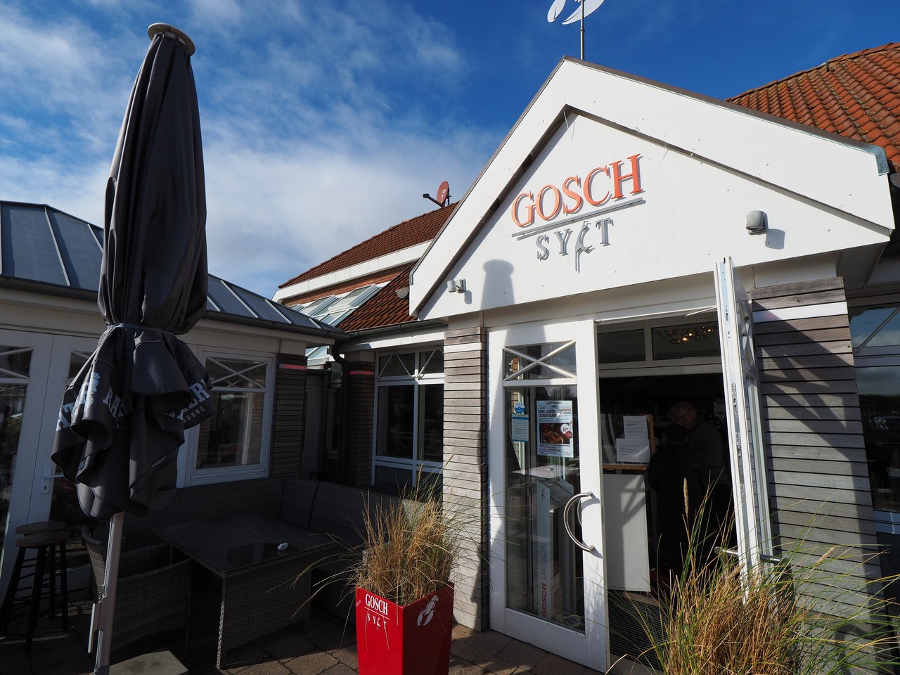
Once off the train in Sylt with five hours or so to kill (we get there at around 12.15pm and are supposed to present ourselves in time for the ride back at 6pm) the plan is to give the island a quick once-over, and we start at the top in List, the northernmost village on Sylt, and incidentally also the northernmost municipality in Germany overall because the north end of Sylt is north of the German-Danish border on the mainland. (The place is now officially called List auf Sylt, presumably to differentiate it from the other List which is a suburb of Hannover. We don't know how many tourists mistakenly ended up there, having entered “List” into their satnavs, and wondered where the hell the sea is.) It takes approximately 20 minutes to drive there from the train terminal in Westerland, and we're delighted to see that (a) you can park for free off the main street for one hour, and (b) there are actually empty spaces available for our car. We're taking this opportunity for a quick stroll on the beach promenade down to the harbour (a tourist trap if there ever was one), a brief comfort break, and a walk back on the main street to Gosch's Fischhaus, where we buy a few fish sandwiches “to go” for later. The Gosch fish-sandwich empire originated in List but is now present in various locations in Germany, usually the larger train stations, and we're happy to report that the fish sandwiches we bought are very nice, made to order, and great value for money (they look a bit expensive to us, but hey, we're on Sylt, and they're big and fresh and very tasty). But we're getting ahead of ourselves here.
Driving south again from List we stop at a parking lot on the outskirts of Kampen, supposedly the village where the glitterati hang out. Kampen has all the luxury-brand shops and apparently very nice restaurants and coffee shops (which presumably also cater to normal people); driving through the place we don't manage to spot any obvious celebrities, though. Our actual plan is to go see the Rotes Kliff (Red Cliff), a steep 30-m-high precipice that runs along the beach for almost 4 kilometres (2.5 miles). The cliff is the western edge of the Westerland geest core which forms part of the main mass of the island, and gets its colour from the oxidation of iron-containing components of the till that forms the Geest. To be frank, from close up the “red” cliff looks more brownish/earth-coloured, and the red is supposedly most pronounced at sunset (go figure). We don't have time to hang around that long, so we hike along the beach – close to the surf line because the sand is harder and walking is easier there, even if you need to give a sideways jump every so often to avoid getting your feet wet (we're wearing waterproof hiking boots but why take the chance?). It's good to see a proper beach with sand and surf for a change instead of a vast expanse of tidal mud flats; one can imagine why Sylt is so popular with tourists.
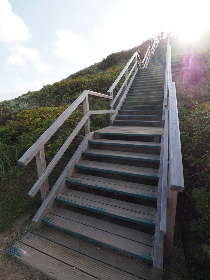
After a while we reach a set of wooden stairs that takes us to the top of the cliff and a boardwalk that leads back to the parking lot. We sit on a bench for a while but the wind is really strong and that hurts our appetite for the fish sandwiches in Marie's bag. Getting going again we reach the Uwe-Düne, named for Sylt reformer and Schleswig-Holstein early constitutional theorist, Uwe Jens Lornsen (1793-1838) and at 52 metres the highest point of the island. This can be climbed by means of an 110-step set of stairs, and the views are quite impressive (and popular). From there it's back to the car, where we finally eat the fish sandwiches (it's about time, too – the aïoli sauce on the shrimp sandwich has been quietly oozing through the packaging into Marie's bag but apparently didn't cause lasting damage).
Having reached (almost) the north end of the island, we figure we'd like to check out the south end, too, and drive past the main island town of Westerland to the village of Hörnum. The weather has been steadily getting worse and now there are squalls of rain in addition to the wind, so we're not getting out of the car in Hörnum and, as we have time to spare, decide to go somewhere for coffee and cake. The place where we end up at is Hus in Lee in Rantum (between Hörnum and Westerland), and while at 5pm they don't have any tables inside for coffee-and-cake guests (they're getting ready for the dinner crowd) we're free to sit outside and end up in a wicker beach chair that offers some protection from the wind (the place is called “house alee”, but that seems to be mostly propaganda). We're having coffee (Marie) and tea (Anselm) and yummy waffles with vanilla ice cream, whipped cream, and plum puree (Marie) and Rote Grütze (red-berry compote) (Anselm).
From Rantum it's a short drive to the car-train terminal in Westerland, with a brief stop at the supermarket to pick up some rolls for breakfast tomorrow, and we're getting there almost half an hour early only to find out that all trains are running half an hour late. So we're sitting in our car for quite some time, listening to I'm Sorry I Haven't a Clue from the podcast player, until we eventually get on the train to be pitched and tossed in the dark back to Niebüll. We arrive home in our holiday flat at half past eight and prepare a packet of quick-cook tortellini which we bought the other day, plus the fast tomato sauce that is becoming one of our staple foods. After that we're sitting on the sofa reading and eventually watch another episode of Emily in Paris before we're ready for bed.


12th October – Lazy Day
Today the weather is so-so – bright moments interspersed with heavy showers that seem almost apocalyptic. Not exactly encouraging for the walk that we had vaguely contemplated – we don't want to get caught in the torrential rain in the middle of a peat bog with another 5 kilometres to go. So instead we decide that we're having a lazy day in the flat, to catch up on our reading and some “computer things” that have accumulated in the meantime. Hence, (almost) no photographs. For a late lunch (or early tea break) we have the apple-streusel cake we picked up in Bredstedt on Sunday, and dinner is a mixture of leftovers from the fridge and the food cupboard – scrambled eggs with onion, garlic, a few cherry tomatos, and grated cheese, plus rice and a can of sweetcorn. There's even some Traum von Eiderstedt and cherry compote left for dessert! We're watching the TV news and see Birmingham trounce Sussex in yesterday's episode of University Challenge, then we're finishing off Emily in Paris. We hope to get out again for a bit tomorrow but we'll also have to make time to pack our stuff and clean the flat so we won't have too much left to do on Thursday morning.

13th October – Small Churches and a Windmill Café
It's our last full day in Husum, and we're planning to spend some time on Nordstrand, simply because it is near where we live and there are a few interesting sights to look at. Nordstrand used to be part of the larger island of Strand, which was obliterated in the big “Burchardiflut” flood of 11 October 1634. (Other remnants of Strand include the island, Pellworm, and the hallig Nordstrandischmoor.) Since 1935, Nordstrand has been linked to the mainland by a 4.3-km causeway which makes it permanently accessible (even during high tide), and since the completion of the Beltringharder Koog in 1987 it is a proper peninsula.
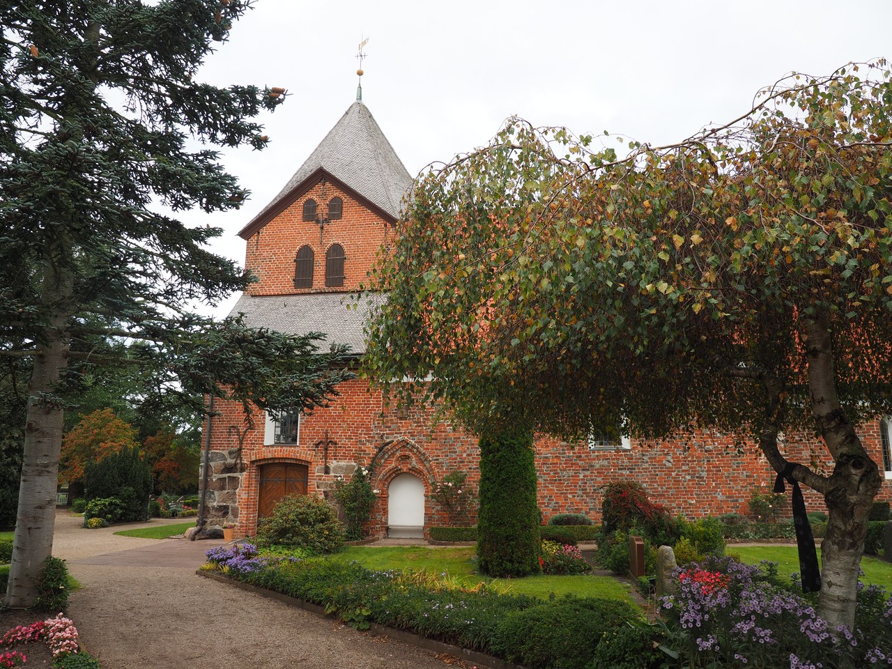
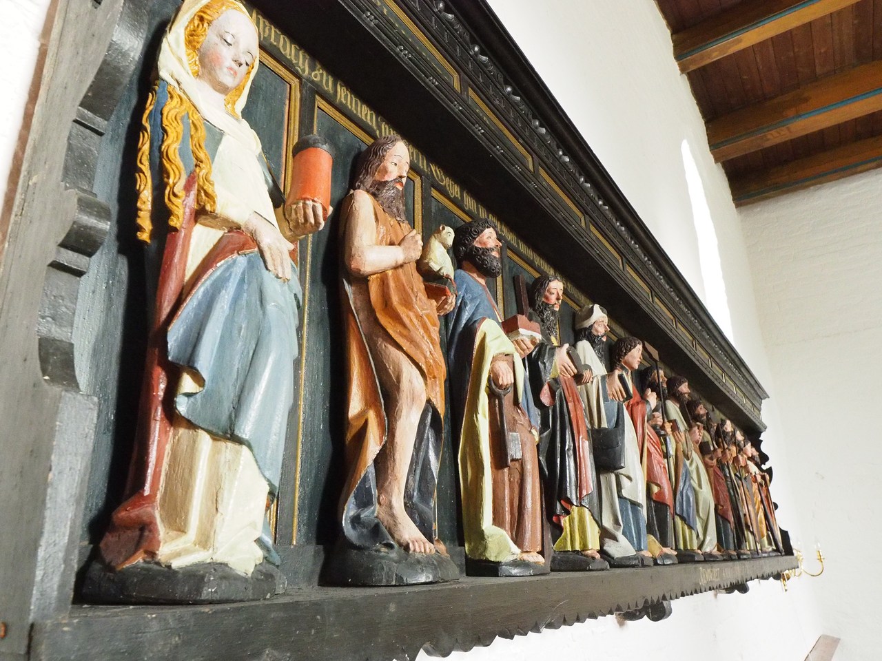
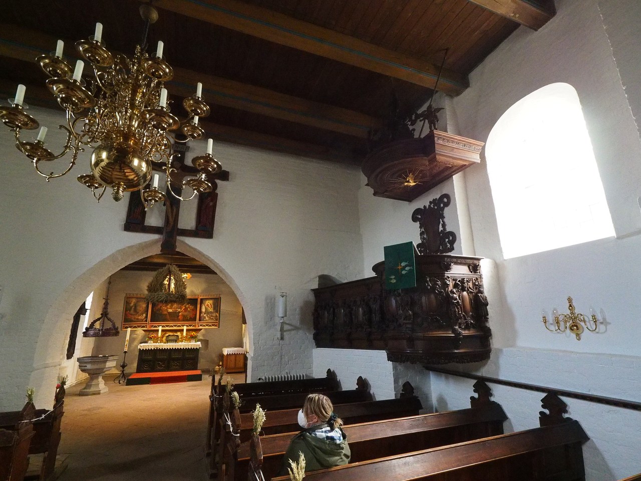
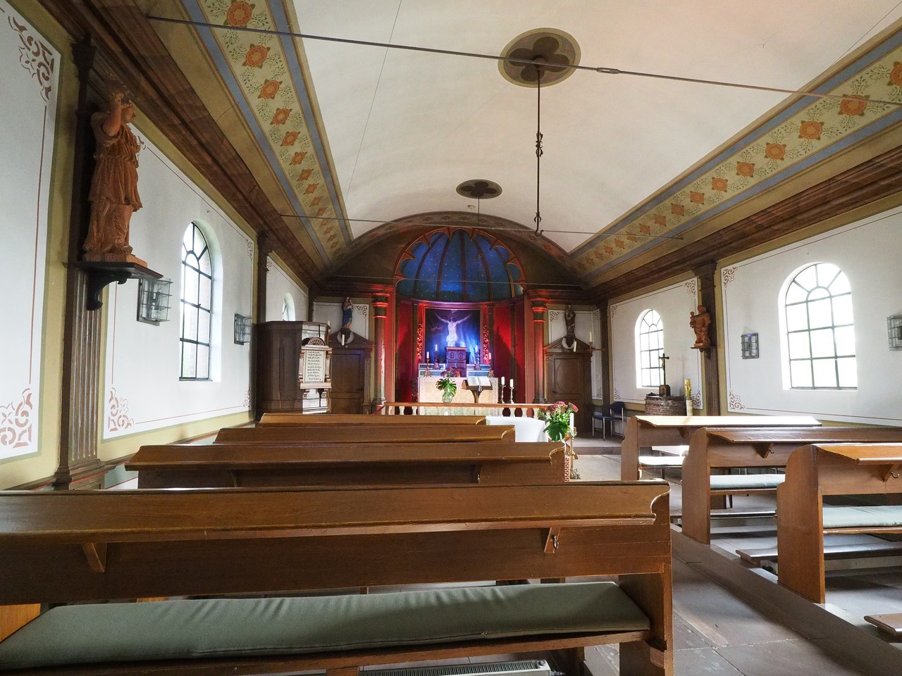
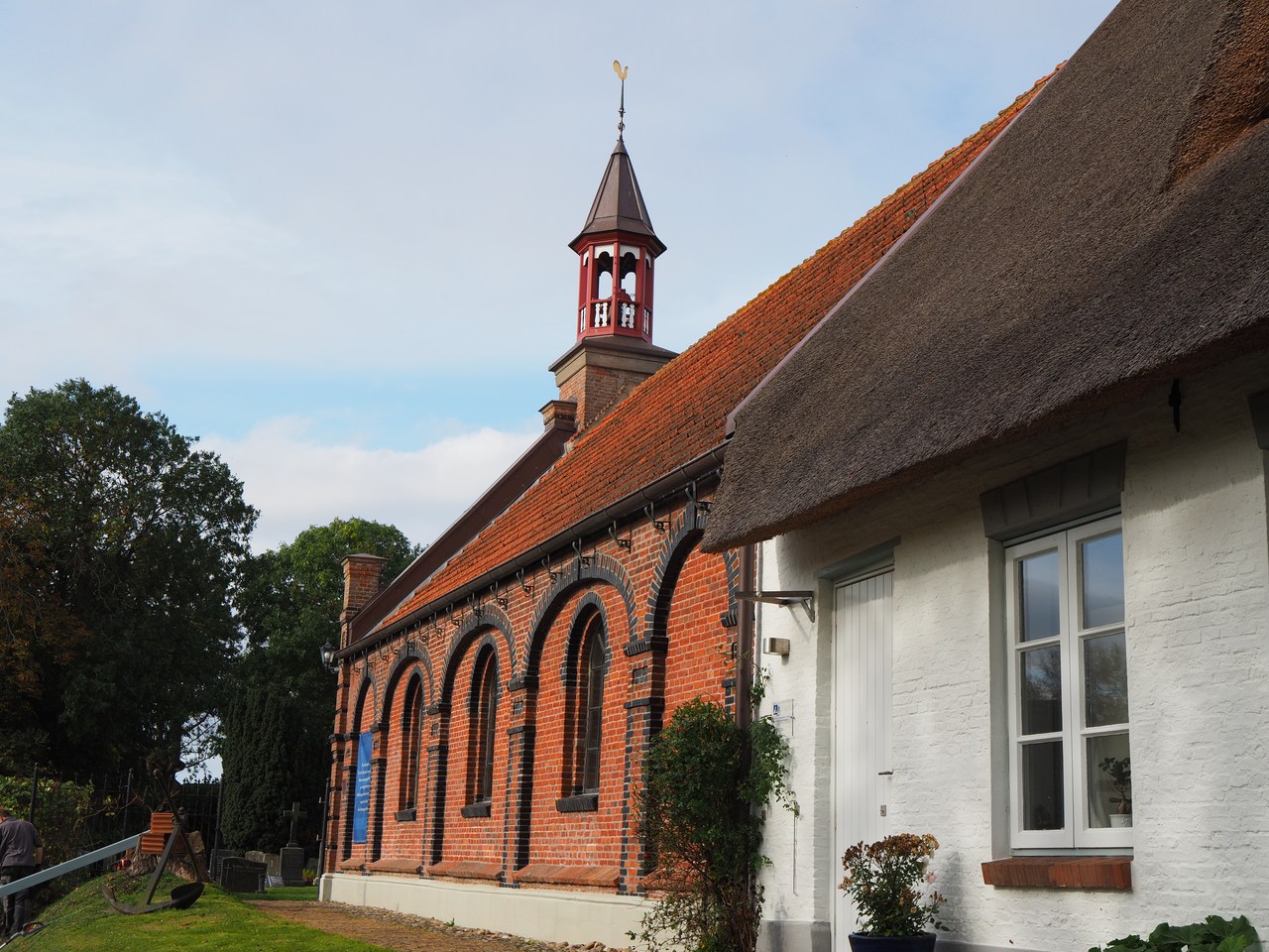
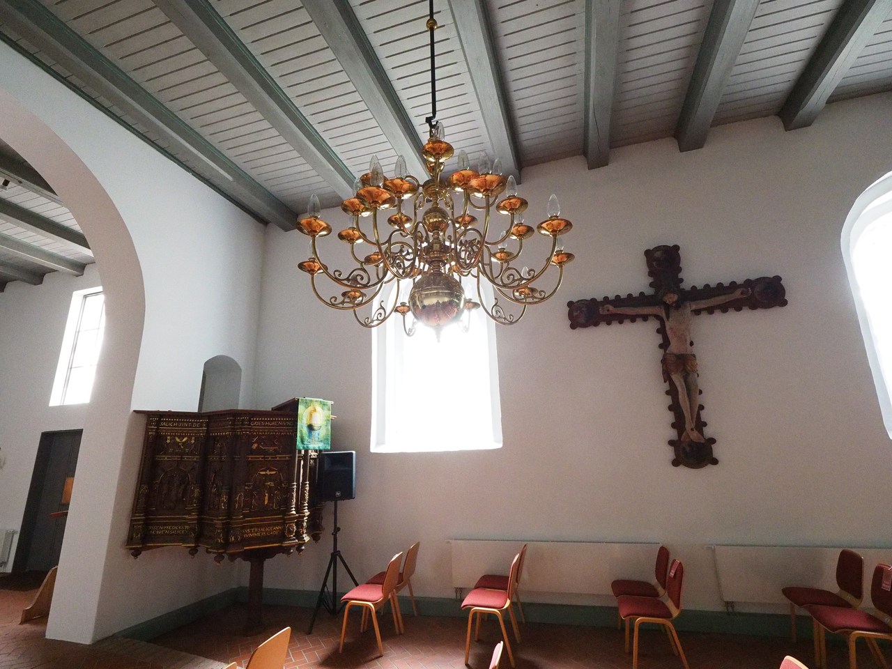
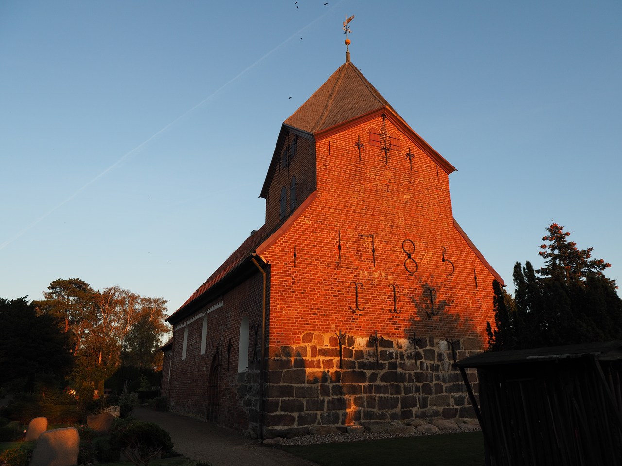
On the way to Nordstrand we stop in Schobüll to have a look inside the Kirchlein am Meer (“little church on the sea”). Now an Evangelical Lutheran church, it was originally built in the 13th century, but today's nave dates back to around 1600. The steeple was rebuilt after the original collapsed in 1780; the current one is somewhat shorter and more suitable for the coastal weather. Inside there is a notable altar, parts of which go back to the 14th century – astute observers will note that the Jesus figure on the cross wears a piece of rope around his head instead of a crown of thorns. Sailors at the time would be familiar with the idea of tying a wet rope around a delinquent's head as a very painful method of punishment. There's also an interesting frieze containing figures of the twelve apostles plus John the Baptist and Mary Magdalene; it is thought that these were originally part of the altar but had been removed in the late 17th century.
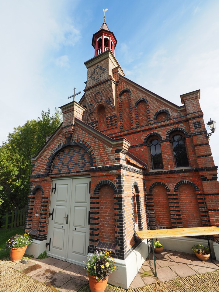
On Nordstrand we wanted to visit the Pharisäerhof, where the iconic beverage was invented (see above) but this seems to be difficult to access due to roadworks and the café there isn't operating right now in any case, so we continue to the hamlet of Süden, home to all three of the island's churches. (Technically most of Nordstrand, the peninsula, is part of a municipality also called Nordstrand, but there are lots of very small villages and hamlets.)
St. Theresa's church is unique in that it is the only Old Catholic church in the state of Schleswig-Holstein. It turns out that Nordstrand was originally settled by Dutch Catholic emigrants who obtained the privilege of building their own church. This ended up being operated by the archdiocese of Utrecht, which in the 18th century seceded from the Roman Catholic church over matters of doctrine and eventually ended up as part of the today's Old Catholic church. (Old Catholic Christians are those who don't subscribe to various ideas promulgated by the First Vatican Council in 1870, including the infallibility and supremacy of the pope. At the time they were excommunicated by the Roman Catholic church and formed their own congregations.) St. Theresa on Nordstrand belonged to the Old Catholic archdiocese of Utrecht until it joined the German Old Catholic church in 1920.
The church is colloquially also called Theresiendom because of the prominent inscription “D O M” above the entrance. Normally a Dom is an important church, often (but not necessarily) the seat of a bishop, but in this case it is short for Deo Optimo Maximo, a common Latin dedication meaning “To God, the best and biggest”. We notice that there's an organ recital in the afternoon, and when we enter the church someone is obviously practising on the organ, so we keep quiet and enjoy the music for a bit.
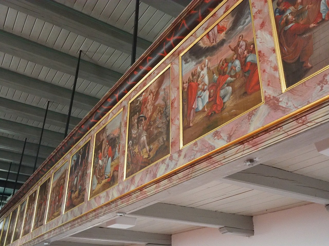
From St. Theresa's church we continue a kilometre or two down the road to the hamlet of Odenbüll and St. Vincent's church, the local Evangelical-Lutheran church. With parts dating back to the 13th century, this is one of three churches on the island of Strand that survived the 1634 flood – the other two are now on the island of Pellworm, so St. Vincent's church is the oldest building on Nordstrand. Having said that, it has been extensively rebuilt and renovated over the centuries, but much of its accoutrement is quite old.
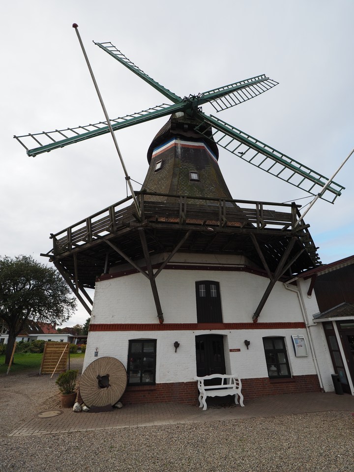
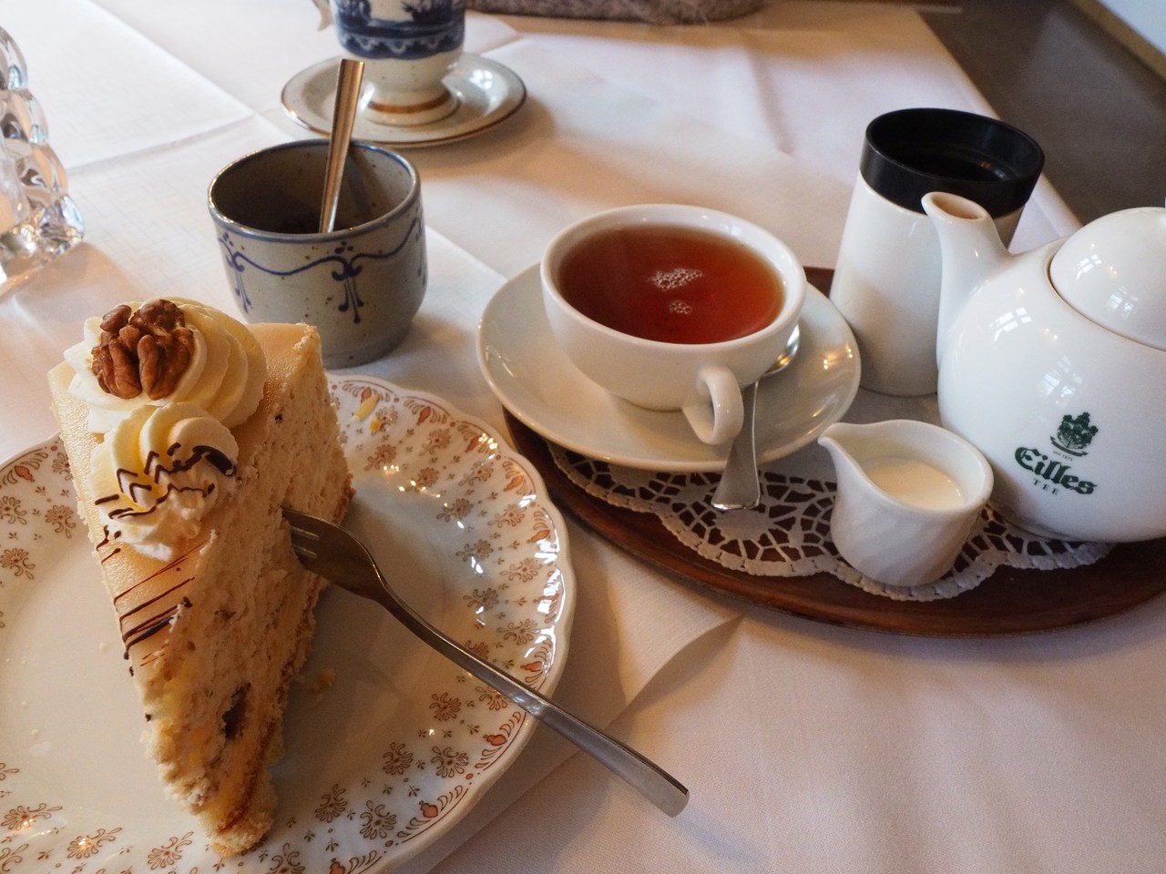
Our next stop is Fuhlehörn, on the west coast of Nordstrand. When the weather is good and the tide is high this is a bathing beach, and it is indeed still possible to rent a wicker beach chair for the day – although by the time we arrive the tide is out (i.e., kilometres of tidal mud flats) and there's a light rain that means we're taking a brief walk along the dike top, then down to the start of the mud flats, along the beach for a bit and then back to the car. It's not very inviting. Instead we prefer to continue to Süderhafen and its highly-praised “gourmet café”, the Engelmühle, built on to an old windmill. This affords us the opportunity of a delicious late lunch, or early coffee/cake break, with its impressive array of cakes baked on the premises by the resident master confectioner. Marie has a piece of Spekulatiustorte based on spiced almond biscuits, and I enjoy a slice of marzipan cake, both of which are very nice, as is my black tea and Marie's Pharisäer (at a total of two of these plus one Tote Tante, over two weeks, she's obviously really behaving herself).
After this we're going home to pack our stuff (as far as possible anyway) and make sure that the holiday flat is in reasonable order. To celebrate the end of our holiday we have made dinner reservations at the Magisterhof, a nice restaurant that is 10 minutes on foot from our flat. We're delighted to find that the rain that the weather forecast said would set in during the late afternoon hasn't actually materialised, so we manage to get there nice and dry. For starters we're sampling the fish soup and pumpkin soup, and the main dish is roast saddle of lamb with vegetables for Marie and Pannfisch (three different types of fried fish) for me. All is quite yummy! Our way home is mostly dry, too, but the street lighting leaves something to be desired as parts of the route on the combined pavement/cycleway are quite dark. My mobile phone's LED flashlight helps a bit, although it would have been nice to have the powerful head lamp that rests unused in my rucksack in the flat … But we make it back OK and take it easy for the rest of the evening, before the long drive home tomorrow.